TopoQuest Logo
Do you find TopoQuest useful?
Help keep TopoQuest running and adding new maps/features by donating!
Bitcoin:  19c7KJd3qBynnjoSw5npx9KScwjBe4ifkT
Litecoin:  LXs6TkuXGGXo1vDsWCkWVdjQX94eUKd6ui
Home View Maps Find Maps Find Places Resources & Links


Linn Grove, Indiana Topographic Map

USGS Map Title: Linn Grove, IN
USGS Map MRC: 40085F1
DRG (GeoTIFF) Download: o40085f1.tif


Neighboring USGS Topographic Map Quads:


  Uniondale, IN  
40085G2
 

  Preble, IN  
40085G1
 

  Decatur, IN  
40084G8
 

  Bluffton, IN  
40085F2
 

  Linn Grove, IN  
40085F1
 

  Berne, IN  
40084F8
 

  Petroleum, IN  
40085E2
 

  Domestic, IN  
40085E1
 

  Geneva, IN  
40084E8


Map MRC Location:

N41°
W86°
N41°
W85°
H8 H7 H6 H5 H4 H3 H2 H1
G8 G7 G6 G5 G4 G3 G2 G1
F8 F7 F6 F5 F4 F3 F2 F1
E8 E7 E6 E5 E4 E3 E2 E1
D8 D7 D6 D5 D4 D3 D2 D1
C8 C7 C6 C5 C4 C3 C2 C1
B8 B7 B6 B5 B4 B3 B2 B1
A8 A7 A6 A5 A4 A3 A2 A1
N40°
W86°
N40°
W85°

Linn Grove, IN USGS 1:24K Topographic Map Preview:
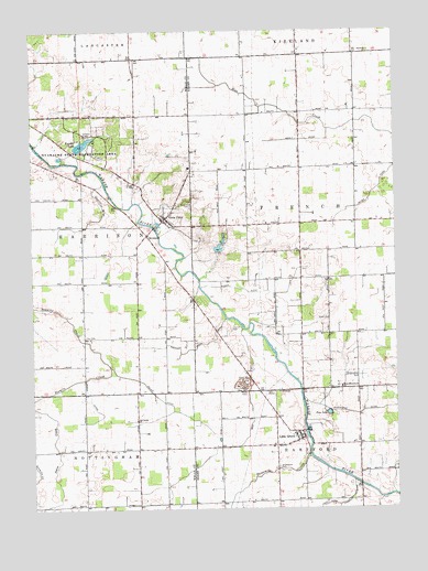
Linn Grove, IN USGS Topographic Map
Click on map above to begin viewing in our Map Viewer.

This topographic map contains these locations and features:
Feature Name Type Latitude Longitude GNIS ID View Map
B and R FarmsLocaleN40.6864°W85.0478°2628489View Map
Beibersteine CemeteryCemeteryN40.6600°W85.0133°430749View Map
Breiner Joint DitchCanalN40.6670°W85.0702°431477View Map
French CemeteryCemeteryN40.6723°W85.0566°434827View Map
Greenwood CemeteryCemeteryN40.6359°W85.0408°435465View Map
Hierly DitchCanalN40.7217°W85.0302°436127View Map
Kunkel LakeReservoirN40.7204°W85.1073°452455View Map
Linn CemeteryCemeteryN40.6700°W85.1069°437963View Map
Linn GrovePopulated PlaceN40.6450°W85.0330°437965View Map
Linn Grove QuarryMineN40.6575°W85.0536°2649535View Map
March DitchCanalN40.6506°W85.1025°438598View Map
Markley DitchCanalN40.7012°W85.1014°438631View Map
Meyer DitchCanalN40.7087°W85.0061°439064View Map
Meyer LakeReservoirN40.6931°W85.0607°448557View Map
Miller DitchCanalN40.6539°W85.0819°439203View Map
Moser CemeteryCemeteryN40.6742°W85.0233°439482View Map
Moser DitchCanalN40.6820°W85.0439°439483View Map
Old Salem ChurchChurchN40.6484°W85.0894°440592View Map
Ouabache State ParkParkN40.7228°W85.1066°440763View Map
Pine LakeLakeN40.6499°W85.0233°441157View Map
Rice DitchCanalN40.6434°W85.0519°441938View Map
RiversidePopulated PlaceN40.6964°W85.0852°442080View Map
S and G Poultry FarmLocaleN40.7058°W85.0142°2629005View Map
Saint Johns CemeteryCemeteryN40.7045°W85.0702°442567View Map
Shoemaker DitchCanalN40.6506°W85.0055°443440View Map
Solid Rock FarmsLocaleN40.6556°W85.0272°2628484View Map
South Forty FarmsLocaleN40.6861°W85.0289°2628486View Map
Sullivan DitchCanalN40.6275°W85.0055°444369View Map
Threemile CreekStreamN40.6389°W85.0302°444744View Map
Town of Vera CruzCivilN40.7015°W85.0795°2397712View Map
Township of FrenchCivilN40.6999°W85.0321°453318View Map
Tri Oaks FarmLocaleN40.7419°W85.0558°2628482View Map
Vera CruzPopulated PlaceN40.7012°W85.0791°449743View Map
West Missionary ChurchChurchN40.6567°W85.0191°445791View Map

Note: Coordinates in the location and feature list above are referenced to NAD83 datum.


Copyright (C) 2008-2024 Ryan Niemi / Sunset Dynamics ... All Rights Reserved