TopoQuest Logo
Do you find TopoQuest useful?
Help keep TopoQuest running and adding new maps/features by donating!
Bitcoin:  19c7KJd3qBynnjoSw5npx9KScwjBe4ifkT
Litecoin:  LXs6TkuXGGXo1vDsWCkWVdjQX94eUKd6ui
Home View Maps Find Maps Find Places Resources & Links


Liberty Center, Indiana Topographic Map

USGS Map Title: Liberty Center, IN
USGS Map MRC: 40085F3
DRG (GeoTIFF) Download: o40085f3.tif


Neighboring USGS Topographic Map Quads:


  Majenica, IN  
40085G4
 

  Markle, IN  
40085G3
 

  Uniondale, IN  
40085G2
 

  Warren, IN  
40085F4
 

  Liberty Center, IN  
40085F3
 

  Bluffton, IN  
40085F2
 

  Roll, IN  
40085E4
 

  Montpelier, IN  
40085E3
 

  Petroleum, IN  
40085E2


Map MRC Location:

N41°
W86°
N41°
W85°
H8 H7 H6 H5 H4 H3 H2 H1
G8 G7 G6 G5 G4 G3 G2 G1
F8 F7 F6 F5 F4 F3 F2 F1
E8 E7 E6 E5 E4 E3 E2 E1
D8 D7 D6 D5 D4 D3 D2 D1
C8 C7 C6 C5 C4 C3 C2 C1
B8 B7 B6 B5 B4 B3 B2 B1
A8 A7 A6 A5 A4 A3 A2 A1
N40°
W86°
N40°
W85°

Liberty Center, IN USGS 1:24K Topographic Map Preview:
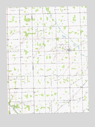
Liberty Center, IN USGS Topographic Map
Click on map above to begin viewing in our Map Viewer.

This topographic map contains these locations and features:
Feature Name Type Latitude Longitude GNIS ID View Map
Adams DitchCanalN40.6356°W85.2800°430009View Map
Batson CemeteryCemeteryN40.6334°W85.3644°430575View Map
Beaty DitchCanalN40.6634°W85.3480°430667View Map
Blanche ChapelChurchN40.6548°W85.2627°431175View Map
Boehmer ChurchChurchN40.6912°W85.3347°431281View Map
Brown Wolf DitchCanalN40.6612°W85.2700°431637View Map
BuckeyePopulated PlaceN40.6912°W85.3539°431742View Map
Carnes New Clark DitchCanalN40.6350°W85.3097°432155View Map
Clark DitchCanalN40.7067°W85.3200°432559View Map
Crosby DitchCanalN40.6250°W85.2602°433175View Map
Forman DitchCanalN40.6381°W85.2930°434677View Map
Harrold DitchCanalN40.6348°W85.3439°435810View Map
Hoover DitchCanalN40.6700°W85.3589°436424View Map
Jamison DitchCanalN40.6728°W85.2641°436935View Map
Jones CemeteryCemeteryN40.6392°W85.3730°437087View Map
Liberty CenterPopulated PlaceN40.6992°W85.2805°449685View Map
Liberty Center Township Volunteer Fire DepartmentBuildingN40.6978°W85.2788°2626219View Map
Lucky DitchCanalN40.6723°W85.3386°438392View Map
Markley DitchCanalN40.6423°W85.2597°438629View Map
Merrima DitchCanalN40.6953°W85.2997°439029View Map
Moorman DitchCanalN40.6378°W85.2650°439415View Map
Mossburg CemeteryCemeteryN40.7225°W85.3275°439502View Map
Mossburg DitchCanalN40.7225°W85.3177°439503View Map
Mounsey DitchCanalN40.6637°W85.2964°439517View Map
Mount ZionPopulated PlaceN40.6503°W85.3347°439724View Map
Neff DitchCanalN40.6895°W85.2508°439983View Map
Palmer DitchCanalN40.7050°W85.3564°440846View Map
Roush DitchCanalN40.6695°W85.2989°442361View Map
South Liberty ChurchChurchN40.6687°W85.3166°443829View Map
Spake DitchCanalN40.7023°W85.2941°443904View Map
Stevens DitchCanalN40.7198°W85.3614°444137View Map
Stites DitchCanalN40.6820°W85.2775°444176View Map
Thompson CemeteryCemeteryN40.7084°W85.3532°444704View Map
Township of LibertyCivilN40.6983°W85.2784°453566View Map
Whitelock DitchCanalN40.7439°W85.3297°445971View Map
Wyley DitchCanalN40.7325°W85.2741°446355View Map

Note: Coordinates in the location and feature list above are referenced to NAD83 datum.


Copyright (C) 2008-2025 Ryan Niemi / Sunset Dynamics ... All Rights Reserved