TopoQuest Logo
Do you find TopoQuest useful?
Help keep TopoQuest running and adding new maps/features by donating!
Bitcoin:  19c7KJd3qBynnjoSw5npx9KScwjBe4ifkT
Litecoin:  LXs6TkuXGGXo1vDsWCkWVdjQX94eUKd6ui
Home View Maps Find Maps Find Places Resources & Links


Pigeon Falls, Wisconsin Topographic Map

USGS Map Title: Pigeon Falls, WI
USGS Map MRC: 44091D2
DRG (GeoTIFF) Download: o44091d2.tif


Neighboring USGS Topographic Map Quads:


  Strum SE, WI  
44091E3
 

  Osseo, WI  
44091E2
 

  Price, WI  
44091E1
 

  Pleasantville, WI  
44091D3
 

  Pigeon Falls, WI  
44091D2
 

  Hixton, WI  
44091D1
 

  Whitehall, WI  
44091C3
 

  Blair, WI  
44091C2
 

  Taylor, WI  
44091C1


Map MRC Location:

N45°
W92°
N45°
W91°
H8 H7 H6 H5 H4 H3 H2 H1
G8 G7 G6 G5 G4 G3 G2 G1
F8 F7 F6 F5 F4 F3 F2 F1
E8 E7 E6 E5 E4 E3 E2 E1
D8 D7 D6 D5 D4 D3 D2 D1
C8 C7 C6 C5 C4 C3 C2 C1
B8 B7 B6 B5 B4 B3 B2 B1
A8 A7 A6 A5 A4 A3 A2 A1
N44°
W92°
N44°
W91°

Pigeon Falls, WI USGS 1:24K Topographic Map Preview:
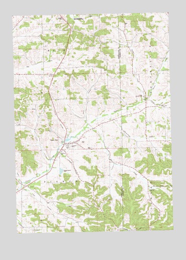
Pigeon Falls, WI USGS Topographic Map
Click on map above to begin viewing in our Map Viewer.

This topographic map contains these locations and features:
Feature Name Type Latitude Longitude GNIS ID View Map
Beaver CreekStreamN44.4497°W91.1429°1561447View Map
Big SloughStreamN44.4350°W91.1929°1561770View Map
Big Slough CemeteryCemeteryN44.3980°W91.1435°1845417View Map
Big Slough School (historical)SchoolN44.4002°W91.1443°1845418View Map
Daggett CouleeValleyN44.4044°W91.2465°1560655View Map
Daggett School (historical)SchoolN44.4016°W91.2435°1851087View Map
Eimon School (historical)SchoolN44.4875°W91.1857°1851092View Map
Evangelical CemeteryCemeteryN44.4241°W91.2060°1851096View Map
Fitch CouleeValleyN44.4012°W91.2439°1565031View Map
Fitch Coulee School (historical)SchoolN44.3813°W91.2104°1851100View Map
Fuller CouleeValleyN44.4164°W91.2231°1565363View Map
Fuller Coulee School (historical)SchoolN44.4300°W91.2310°1851102View Map
Hale CemeteryCemeteryN44.4650°W91.2193°1565970View Map
Hegge CouleeValleyN44.4215°W91.2160°1566264View Map
Huskelhus School (historical)SchoolN44.4697°W91.2010°1851115View Map
Kinning Memorial ParkParkN44.4522°W91.1471°1845473View Map
Pigeon Creek CemeteryCemeteryN44.4450°W91.1293°1571365View Map
Pigeon FallsPopulated PlaceN44.4263°W91.2104°1571367View Map
Pigeon Falls Elementary SchoolSchoolN44.4263°W91.2069°1851148View Map
Pigeon Falls Volunteer Fire DepartmentBuildingN44.4253°W91.2096°2697623View Map
Schermerhorn CreekStreamN44.4422°W91.1735°1573779View Map
Schermerhorn School (historical)SchoolN44.4266°W91.1293°1845509View Map
Steig CouleeValleyN44.4408°W91.1929°1574848View Map
Sunshine School (historical)SchoolN44.4147°W91.1752°1851184View Map
Thorson School (historical)SchoolN44.4366°W91.1832°1851185View Map
Timber CreekStreamN44.4491°W91.1438°1575460View Map
Timber Creek School (historical)SchoolN44.4839°W91.1596°1845523View Map
Tollefson Marsh State Wildlife AreaParkN44.4997°W91.2035°1851186View Map
Tomter CouleeValleyN44.4308°W91.2069°1575505View Map
Town of PigeonCivilN44.3973°W91.2224°1583921View Map
Tuff CouleeValleyN44.4128°W91.1722°1575705View Map
Village of Pigeon FallsCivilN44.4249°W91.2088°1583922View Map
YorkPopulated PlaceN44.4500°W91.1452°1577103View Map

Note: Coordinates in the location and feature list above are referenced to NAD83 datum.


Copyright (C) 2008-2025 Ryan Niemi / Sunset Dynamics ... All Rights Reserved