TopoQuest Logo
Do you find TopoQuest useful?
Help keep TopoQuest running and adding new maps/features by donating!
Bitcoin:  19c7KJd3qBynnjoSw5npx9KScwjBe4ifkT
Litecoin:  LXs6TkuXGGXo1vDsWCkWVdjQX94eUKd6ui
Home View Maps Find Maps Find Places Resources & Links


Blair, Wisconsin Topographic Map

USGS Map Title: Blair, WI
USGS Map MRC: 44091C2
DRG (GeoTIFF) Download: o44091c2.tif


Neighboring USGS Topographic Map Quads:


  Pleasantville, WI  
44091D3
 

  Pigeon Falls, WI  
44091D2
 

  Hixton, WI  
44091D1
 

  Whitehall, WI  
44091C3
 

  Blair, WI  
44091C2
 

  Taylor, WI  
44091C1
 

  Ettrick, WI  
44091B3
 

  Hegg, WI  
44091B2
 

  North Bend NE, WI  
44091B1


Map MRC Location:

N45°
W92°
N45°
W91°
H8 H7 H6 H5 H4 H3 H2 H1
G8 G7 G6 G5 G4 G3 G2 G1
F8 F7 F6 F5 F4 F3 F2 F1
E8 E7 E6 E5 E4 E3 E2 E1
D8 D7 D6 D5 D4 D3 D2 D1
C8 C7 C6 C5 C4 C3 C2 C1
B8 B7 B6 B5 B4 B3 B2 B1
A8 A7 A6 A5 A4 A3 A2 A1
N44°
W92°
N44°
W91°

Blair, WI USGS 1:24K Topographic Map Preview:
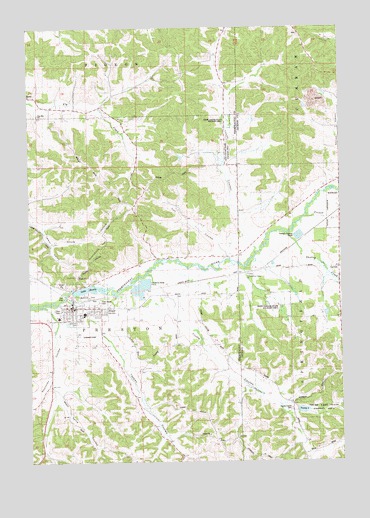
Blair, WI USGS Topographic Map
Click on map above to begin viewing in our Map Viewer.

This topographic map contains these locations and features:
Feature Name Type Latitude Longitude GNIS ID View Map
1 ReservoirReservoirN44.3750°W91.1352°1793230View Map
BlairPopulated PlaceN44.2944°W91.2352°1561910View Map
Blair - Preston Volunteer Fire DepartmentBuildingN44.2944°W91.2313°2697638View Map
Blair - Taylor Elementary SchoolSchoolN44.2929°W91.2283°2715681View Map
Blair - Taylor Middle / High SchoolSchoolN44.2912°W91.2095°1851066View Map
Blair AirportAirportN44.2868°W91.2264°1581890View Map
Blair Mill DamDamN44.3000°W91.2335°1792266View Map
Blair Police DepartmentBuildingN44.2939°W91.2336°2759917View Map
Chier Sand Company 3WC78804 DamDamN44.3750°W91.1352°1793229View Map
City of BlairCivilN44.2945°W91.2392°1582826View Map
Corness CemeteryCemeteryN44.2913°W91.2321°1851082View Map
Finn School (historical)SchoolN44.3055°W91.1263°1845444View Map
First Lutheran ChurchChurchN44.2913°W91.2332°1851099View Map
Fly Creek School (historical)SchoolN44.3522°W91.2210°1851101View Map
French CreekStreamN44.3205°W91.1393°1565309View Map
Gransberg HillSummitN44.3058°W91.2282°1565735View Map
Lake HenryReservoirN44.2997°W91.2263°1566311View Map
Lake Henry 173ReservoirN44.3000°W91.2335°1792267View Map
Memorial ParkParkN44.2980°W91.2263°1851133View Map
Pinehill Amish SchoolSchoolN44.3526°W91.2447°1560836View Map
Pleasant View School (historical)SchoolN44.3355°W91.1696°1851154View Map
Rest Haven CemeteryCemeteryN44.2952°W91.2215°1851158View Map
Reynolds CouleeValleyN44.2883°W91.2391°1572228View Map
Reynolds Coulee CreekStreamN44.2947°W91.2440°1572229View Map
Saint Ansgar Catholic ChurchChurchN44.2925°W91.2243°1851166View Map
Salva CouleeValleyN44.2700°W91.2391°1573640View Map
Shepherd School (historical)SchoolN44.3091°W91.1865°1851171View Map
Skunk HollowValleyN44.3130°W91.2403°1574250View Map
Skutley CreekStreamN44.3158°W91.1465°1574257View Map
Soset Charter SchoolSchoolN44.2929°W91.2284°2715776View Map
Sunnyside School (historical)SchoolN44.2605°W91.2015°1851182View Map
Tappen CouleeValleyN44.2872°W91.2186°1575257View Map
Tappen Coulee CreekStreamN44.2969°W91.2363°1577367View Map
Taylor PitMineN44.3494°W91.1478°2635548View Map
Trempealeau Valley ChurchChurchN44.3038°W91.1627°1845526View Map
Trump CouleeValleyN44.2944°W91.1894°1575696View Map
Trump Coulee CemeteryCemeteryN44.2650°W91.1454°1575697View Map
Trump Coulee CreekStreamN44.3038°W91.2032°1575698View Map
Trump Coulee School (historical)SchoolN44.2633°W91.1443°1845527View Map
Trump LakeReservoirN44.2644°W91.1390°1577276View Map
Trump Lake 1ReservoirN44.2650°W91.1452°1793219View Map
Trump Lake G12.224 DamDamN44.2650°W91.1452°1793218View Map
Trump Lake State Fishery AreaParkN44.2652°W91.1335°1845528View Map
Turi CouleeValleyN44.3083°W91.1707°1575720View Map
Valley View School (historical)SchoolN44.2875°W91.1918°1851193View Map
Vosse CouleeValleyN44.3149°W91.1615°1576131View Map
Vosse Coulee CreekStreamN44.3091°W91.1596°1577369View Map
Vosse Coulee State Wildlife AreaParkN44.3419°W91.1690°1851195View Map
West Taylor State Wildlife AreaParkN44.2955°W91.1485°1845534View Map
Zion CemeteryCemeteryN44.2938°W91.2388°1851210View Map
Zion Lutheran ChurchChurchN44.2938°W91.2374°1851211View Map

Note: Coordinates in the location and feature list above are referenced to NAD83 datum.


Copyright (C) 2008-2025 Ryan Niemi / Sunset Dynamics ... All Rights Reserved