TopoQuest Logo
Do you find TopoQuest useful?
Help keep TopoQuest running and adding new maps/features by donating!
Bitcoin:  19c7KJd3qBynnjoSw5npx9KScwjBe4ifkT
Litecoin:  LXs6TkuXGGXo1vDsWCkWVdjQX94eUKd6ui
Home View Maps Find Maps Find Places Resources & Links


Whitehall, Wisconsin Topographic Map

USGS Map Title: Whitehall, WI
USGS Map MRC: 44091C3
DRG (GeoTIFF) Download: o44091c3.tif


Neighboring USGS Topographic Map Quads:


  Elk Creek, WI  
44091D4
 

  Pleasantville, WI  
44091D3
 

  Pigeon Falls, WI  
44091D2
 

  Independence, WI  
44091C4
 

  Whitehall, WI  
44091C3
 

  Blair, WI  
44091C2
 

  Tamarack, WI  
44091B4
 

  Ettrick, WI  
44091B3
 

  Hegg, WI  
44091B2


Map MRC Location:

N45°
W92°
N45°
W91°
H8 H7 H6 H5 H4 H3 H2 H1
G8 G7 G6 G5 G4 G3 G2 G1
F8 F7 F6 F5 F4 F3 F2 F1
E8 E7 E6 E5 E4 E3 E2 E1
D8 D7 D6 D5 D4 D3 D2 D1
C8 C7 C6 C5 C4 C3 C2 C1
B8 B7 B6 B5 B4 B3 B2 B1
A8 A7 A6 A5 A4 A3 A2 A1
N44°
W92°
N44°
W91°

Whitehall, WI USGS 1:24K Topographic Map Preview:
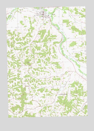
Whitehall, WI USGS Topographic Map
Click on map above to begin viewing in our Map Viewer.

This topographic map contains these locations and features:
Feature Name Type Latitude Longitude GNIS ID View Map
0.25 ReservoirReservoirN44.2600°W91.3402°1793494View Map
0.3 ReservoirReservoirN44.2683°W91.3652°1793260View Map
0.5 ReservoirReservoirN44.2683°W91.3668°1793579View Map
Assembly of God ChurchChurchN44.3672°W91.3252°1851059View Map
Brookside School (historical)SchoolN44.2933°W91.3240°1851072View Map
Carpenter CemeteryCemeteryN44.3175°W91.2724°1562730View Map
Carpenter School (historical)SchoolN44.3133°W91.2749°1851075View Map
City of WhitehallCivilN44.3703°W91.3475°1584426View Map
Dettloff Paul 3WC77816 DamDamN44.2600°W91.3402°1793493View Map
Fagernes Lutheran ChurchChurchN44.2850°W91.3418°1564795View Map
First Baptist ChurchChurchN44.3661°W91.3160°1851098View Map
Fly CreekStreamN44.3741°W91.2949°1565090View Map
Fly Creek Amish SchoolSchoolN44.3661°W91.2764°2715797View Map
Howley H860 DamDamN44.2683°W91.3652°1793259View Map
Irvin CouleeValleyN44.3663°W91.3142°1851118View Map
Irvin Coulee School (historical)SchoolN44.3305°W91.3385°1851119View Map
Irvin CreekStreamN44.3705°W91.3138°1566979View Map
Jensen DamDamN44.2683°W91.3668°1793578View Map
Lakes CouleeValleyN44.3008°W91.2704°1567771View Map
Lakes Coulee CreekStreamN44.3022°W91.2618°1567772View Map
Lakes Coulee School (historical)SchoolN44.2647°W91.3090°1851125View Map
Lakes Coulee State Public Hunting GroundsParkN44.2755°W91.2790°1567773View Map
Larkin School (historical)SchoolN44.3208°W91.2521°1851126View Map
Larkin ValleyValleyN44.3275°W91.2850°1567851View Map
Larkin Valley Amish SchoolSchoolN44.3485°W91.2569°2715642View Map
Lincoln CemeteryCemeteryN44.3641°W91.3224°1568067View Map
Old Whitehall CemeteryCemeteryN44.3727°W91.2949°1570792View Map
Peterson CouleeValleyN44.2835°W91.2928°1571267View Map
Pigeon CreekStreamN44.3663°W91.3046°1571362View Map
Reynolds Coulee School (historical)SchoolN44.2661°W91.2518°1851159View Map
Riverside SchoolSchoolN44.3388°W91.2790°1572380View Map
Saint Johns Catholic ChurchChurchN44.3627°W91.3082°1851167View Map
Square BluffSummitN44.3119°W91.3440°1574748View Map
Sunset Elementary SchoolSchoolN44.3660°W91.3270°1851183View Map
Tinnes CemeteryCemeteryN44.2936°W91.3471°1575468View Map
Town of PrestonCivilN44.2953°W91.2545°1583983View Map
Trempealeau CountyCivilN44.3040°W91.3585°1581120View Map
Trempealeau County Health Care CenterBuildingN44.3721°W91.3522°2698492View Map
Trempealeau County JailBuildingN44.3667°W91.3174°2759892View Map
Trempealeau County Sheriff's OfficeBuildingN44.3669°W91.3172°2759616View Map
Tri - County Memorial HospitalHospitalN44.3644°W91.3187°2698477View Map
Tri County Ambulance ServiceBuildingN44.3644°W91.3187°2698388View Map
Welch CouleeValleyN44.3087°W91.2779°1576411View Map
Welchs CreekStreamN44.3128°W91.2722°2760864View Map
West Lincoln School (historical)SchoolN44.3530°W91.3713°1851200View Map
WhitehallPopulated PlaceN44.3675°W91.3165°1576681View Map
Whitehall High SchoolSchoolN44.3657°W91.3301°1851204View Map
Whitehall Middle SchoolSchoolN44.3657°W91.3301°2715804View Map
Whitehall Police DepartmentBuildingN44.3666°W91.3186°2759893View Map
Whitehall Volunteer Fire DepartmentBuildingN44.3676°W91.3326°2697559View Map

Note: Coordinates in the location and feature list above are referenced to NAD83 datum.


Copyright (C) 2008-2024 Ryan Niemi / Sunset Dynamics ... All Rights Reserved