TopoQuest Logo
Do you find TopoQuest useful?
Help keep TopoQuest running and adding new maps/features by donating!
Bitcoin:  19c7KJd3qBynnjoSw5npx9KScwjBe4ifkT
Litecoin:  LXs6TkuXGGXo1vDsWCkWVdjQX94eUKd6ui
Home View Maps Find Maps Find Places Resources & Links


Pinckneyville, Mississippi Topographic Map

USGS Map Title: Pinckneyville, MS
USGS Map MRC: 31091A4
DRG (GeoTIFF) Download: o31091a4.tif


Neighboring USGS Topographic Map Quads:


  Lake Mary, MS  
31091B5
 

  Lessley, MS  
31091B4
 

  Laneheart, MS  
31091B3
 

  Fort Adams, MS  
31091A5
 

  Pinckneyville, MS  
31091A4
 

  Woodville, MS  
31091A3
 

  Angola, LA  
30091H5
 

  Weyanoke, LA  
30091H4
 

  Laurel Hill, LA  
30091H3


Map MRC Location:

N32°
W92°
N32°
W91°
H8 H7 H6 H5 H4 H3 H2 H1
G8 G7 G6 G5 G4 G3 G2 G1
F8 F7 F6 F5 F4 F3 F2 F1
E8 E7 E6 E5 E4 E3 E2 E1
D8 D7 D6 D5 D4 D3 D2 D1
C8 C7 C6 C5 C4 C3 C2 C1
B8 B7 B6 B5 B4 B3 B2 B1
A8 A7 A6 A5 A4 A3 A2 A1
N31°
W92°
N31°
W91°

Pinckneyville, MS USGS 1:24K Topographic Map Preview:
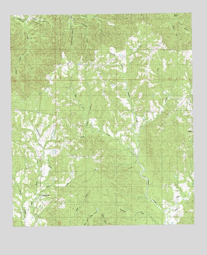
Pinckneyville, MS USGS Topographic Map
Click on map above to begin viewing in our Map Viewer.

This topographic map contains these locations and features:
Feature Name Type Latitude Longitude GNIS ID View Map
Arcole CemeteryCemeteryN31.0377°W91.4879°666354View Map
Arcole ChurchChurchN31.0343°W91.4937°666355View Map
Beasley CreekStreamN31.0518°W91.4148°666673View Map
Bells Store (historical)LocaleN31.0677°W91.4809°686148View Map
Desert CreekStreamN31.0185°W91.4829°669238View Map
DonegalPopulated PlaceN31.0560°W91.3771°691821View Map
Dunbar CreekStreamN31.0074°W91.3957°669498View Map
Dunbar Creek Oil FieldOilfieldN31.0738°W91.4237°691044View Map
Edgefield SchoolSchoolN31.0605°W91.4554°669669View Map
Fountainbleau CreekStreamN31.1163°W91.4604°670123View Map
Fountainbleau SchoolSchoolN31.0968°W91.4598°670124View Map
Grimes CemeteryCemeteryN31.0954°W91.4459°670749View Map
Highland CreekStreamN31.1185°W91.4582°671194View Map
Hooks CreekStreamN31.0391°W91.4137°671390View Map
Kaigler CreekStreamN31.0893°W91.4229°672065View Map
King Solomon ChurchChurchN31.0407°W91.4804°672164View Map
LaGrange SchoolSchoolN31.1038°W91.4001°672235View Map
Lewis BranchStreamN31.1218°W91.3879°672418View Map
Locust Hill BranchStreamN31.1221°W91.4910°672756View Map
Molden CreekStreamN31.1010°W91.4912°673726View Map
Moldon Plantation (historical)LocaleN31.1057°W91.4862°686165View Map
Mount Zion SchoolSchoolN31.0643°W91.4132°674411View Map
Pickneyville SchoolSchoolN31.0505°W91.4871°675714View Map
PinckneyvillePopulated PlaceN31.0160°W91.4809°675789View Map
Pinckneyville CreekStreamN31.0257°W91.4823°675790View Map
Primmton (historical)LocaleN31.0363°W91.3918°686172View Map
Saint James ChurchChurchN31.0116°W91.4873°677027View Map
Saint Matthews ChurchChurchN31.0643°W91.4679°677168View Map
Stockfarm SchoolSchoolN31.0274°W91.4346°678302View Map
Supervisor District 2CivilN31.1180°W91.4853°712140View Map
Tanyard BranchStreamN31.1216°W91.3879°678561View Map
Tilseys CreekStreamN31.0557°W91.4426°678765View Map
Ventress ChurchChurchN31.1060°W91.4126°679203View Map
West Fork Tilseys CreekStreamN31.0627°W91.4482°679492View Map
Woodstock CemeteryCemeteryN31.0607°W91.4793°679868View Map
Woodstock Hunting Club Lake DamDamN31.0418°W91.4668°680554View Map
Woodstock Hunting Lake DamDamN31.0418°W91.4734°680555View Map
Woodstock Plantation (historical)LocaleN31.0635°W91.4834°686185View Map
Wyman ChurchChurchN31.0121°W91.3904°679905View Map

Note: Coordinates in the location and feature list above are referenced to NAD83 datum.


Copyright (C) 2008-2025 Ryan Niemi / Sunset Dynamics ... All Rights Reserved