TopoQuest Logo
Do you find TopoQuest useful?
Help keep TopoQuest running and adding new maps/features by donating!
Bitcoin:  19c7KJd3qBynnjoSw5npx9KScwjBe4ifkT
Litecoin:  LXs6TkuXGGXo1vDsWCkWVdjQX94eUKd6ui
Home View Maps Find Maps Find Places Resources & Links


Weyanoke, Louisiana Topographic Map

USGS Map Title: Weyanoke, LA
USGS Map MRC: 30091H4
DRG (GeoTIFF) Download: o30091h4.tif


Neighboring USGS Topographic Map Quads:


  Fort Adams, MS  
31091A5
 

  Pinckneyville, MS  
31091A4
 

  Woodville, MS  
31091A3
 

  Angola, LA  
30091H5
 

  Weyanoke, LA  
30091H4
 

  Laurel Hill, LA  
30091H3
 

  Lacour, LA  
30091G5
 

  Saint Francisville, LA  
30091G4
 

  Elm Park, LA  
30091G3


Map MRC Location:

N31°
W92°
N31°
W91°
H8 H7 H6 H5 H4 H3 H2 H1
G8 G7 G6 G5 G4 G3 G2 G1
F8 F7 F6 F5 F4 F3 F2 F1
E8 E7 E6 E5 E4 E3 E2 E1
D8 D7 D6 D5 D4 D3 D2 D1
C8 C7 C6 C5 C4 C3 C2 C1
B8 B7 B6 B5 B4 B3 B2 B1
A8 A7 A6 A5 A4 A3 A2 A1
N30°
W92°
N30°
W91°

Weyanoke, LA USGS 1:24K Topographic Map Preview:
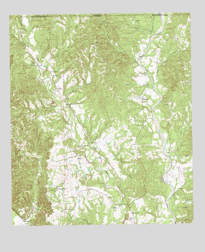
Weyanoke, LA USGS Topographic Map
Click on map above to begin viewing in our Map Viewer.

This topographic map contains these locations and features:
Feature Name Type Latitude Longitude GNIS ID View Map
Baker CreekStreamN30.9541°W91.4709°553339View Map
Bayou Sara Oil FieldOilfieldN30.9063°W91.4037°550156View Map
Bean BranchStreamN30.9571°W91.4021°532821View Map
Bell CreekStreamN30.9449°W91.4604°532914View Map
Butler PitMineN30.8942°W91.3906°2649863View Map
District DCivilN30.8863°W91.3909°2786559View Map
East Fork Baker CreekStreamN30.9737°W91.4670°534709View Map
Ellerslie PlantationLocaleN30.9143°W91.4515°534800View Map
Evans CemeteryCemeteryN30.9804°W91.4118°534853View Map
Feliciana PlantationLocaleN30.8968°W91.4671°534917View Map
Flower HillPopulated PlaceN30.8818°W91.4168°543206View Map
Gales CreekStreamN30.9571°W91.4007°535150View Map
Greater New Canaan ChurchChurchN30.8848°W91.4632°2601846View Map
Greater New Hollywood Baptist ChurchChurchN30.9354°W91.4132°2601849View Map
Greenwood CemeteryCemeteryN30.8966°W91.4707°535412View Map
Highland PlantationLocaleN30.8849°W91.4304°554711View Map
HollywoodPopulated PlaceN30.9499°W91.4090°543305View Map
Hollywood Post Office (historical)Post OfficeN30.9505°W91.4093°1631451View Map
Irondale ChurchChurchN30.9952°W91.4129°535948View Map
Jones BranchStreamN30.8868°W91.4257°536098View Map
Judas BranchStreamN30.9818°W91.4876°536128View Map
Kimball CreekStreamN30.9890°W91.4872°666105View Map
Lucy CreekStreamN30.9202°W91.4446°536776View Map
Magnolia ChurchChurchN30.9635°W91.4673°536839View Map
Mount Zion ChurchChurchN30.9218°W91.4498°537438View Map
New Canyon ChurchChurchN30.8843°W91.4634°537560View Map
New Irondale Baptist ChurchChurchN30.9646°W91.4620°2602334View Map
New Mount Zion Baptist ChurchChurchN30.9226°W91.4506°2602475View Map
PlettenbergPopulated PlaceN30.8780°W91.4923°555688View Map
Plettenburg Post OfficePost OfficeN30.8968°W91.4679°1629994View Map
RetreatPopulated PlaceN30.9721°W91.4851°555792View Map
Retreat Post Office (historical)Post OfficeN30.9735°W91.4834°1631453View Map
RosebankPopulated PlaceN30.9232°W91.4415°555837View Map
Saint Marys Episcopal ChurchChurchN30.9660°W91.4701°555919View Map
Saint Pauls ChurchChurchN30.8913°W91.4337°539039View Map
Saint Pauls ChurchChurchN30.9499°W91.4634°539040View Map
Saint Peters ChurchChurchN30.8791°W91.4171°539060View Map
Sandy CreekStreamN30.9716°W91.4123°539160View Map
Sara Field Ultralight FlightparkAirportN30.9410°W91.4728°2717357View Map
Scott CreekStreamN30.9152°W91.3912°555995View Map
Sleepy Hollow WoodsAreaN30.9863°W91.4229°550196View Map
Stockfarm CreekStreamN30.9868°W91.4009°539675View Map
Tunica Hills State Wildlife Management AreaParkN30.9243°W91.4912°1958993View Map
TurnbullPopulated PlaceN30.9546°W91.4671°541202View Map
Turnbull Post Office (historical)Post OfficeN30.9624°W91.4651°1631464View Map
Union Bethel ChurchChurchN30.9205°W91.4426°540082View Map
Ward EightCivilN30.9552°W91.4396°545284View Map
West Feliciana ParishCivilN30.8798°W91.4200°559584View Map
WeyanokePopulated PlaceN30.9468°W91.4612°541214View Map
Weyanoke Post OfficePost OfficeN30.9601°W91.4674°2759266View Map
Weyanoke Post Office (historical)Post OfficeN30.9488°W91.4634°1631466View Map
Weyanoke Volunteer Fire DepartmentBuildingN30.9384°W91.4539°2672936View Map
Williams CreekStreamN30.8824°W91.3898°540433View Map

Note: Coordinates in the location and feature list above are referenced to NAD83 datum.


Copyright (C) 2008-2025 Ryan Niemi / Sunset Dynamics ... All Rights Reserved