TopoQuest Logo
Do you find TopoQuest useful?
Help keep TopoQuest running and adding new maps/features by donating!
Bitcoin:  19c7KJd3qBynnjoSw5npx9KScwjBe4ifkT
Litecoin:  LXs6TkuXGGXo1vDsWCkWVdjQX94eUKd6ui
Home View Maps Find Maps Find Places Resources & Links


Franklinville, Pennsylvania Topographic Map

USGS Map Title: Franklinville, PA
USGS Map MRC: 40078F1
DRG (GeoTIFF) Download: o40078f1.tif


Neighboring USGS Topographic Map Quads:


  Sandy Ridge, PA  
40078G2
 

  Port Matilda, PA  
40078G1
 

  Julian, PA  
40077G8
 

  Tyrone, PA  
40078F2
 

  Franklinville, PA  
40078F1
 

  Pine Grove Mills, PA  
40077F8
 

  Spruce Creek, PA  
40078E2
 

  Alexandria, PA  
40078E1
 

  Donation, PA  
40077E8


Map MRC Location:

N41°
W79°
N41°
W78°
H8 H7 H6 H5 H4 H3 H2 H1
G8 G7 G6 G5 G4 G3 G2 G1
F8 F7 F6 F5 F4 F3 F2 F1
E8 E7 E6 E5 E4 E3 E2 E1
D8 D7 D6 D5 D4 D3 D2 D1
C8 C7 C6 C5 C4 C3 C2 C1
B8 B7 B6 B5 B4 B3 B2 B1
A8 A7 A6 A5 A4 A3 A2 A1
N40°
W79°
N40°
W78°

Franklinville, PA USGS 1:24K Topographic Map Preview:
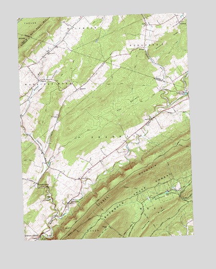
Franklinville, PA USGS Topographic Map
Click on map above to begin viewing in our Map Viewer.

This topographic map contains these locations and features:
Feature Name Type Latitude Longitude GNIS ID View Map
Beaver BranchStreamN40.7053°W78.0014°1168988View Map
Blick School (historical)SchoolN40.7245°W78.1081°1201239View Map
Brewer PathTrailN40.6528°W78.0447°1170212View Map
Center Line ChurchChurchN40.7295°W78.1031°1171439View Map
ColerainPopulated PlaceN40.6262°W78.1147°1172193View Map
Colerain Picnic AreaAreaN40.6267°W78.1114°1206547View Map
Colerain TrailTrailN40.6312°W78.0883°1172195View Map
Diamond LakeLakeN40.6495°W78.0187°1173222View Map
Double SpringSpringN40.6923°W78.0283°1202305View Map
Dry RunLocaleN40.6842°W78.1020°1201238View Map
DungarvinPopulated PlaceN40.7090°W78.0820°1173606View Map
Fowler RunStreamN40.6942°W78.0233°1175088View Map
FranklinvillePopulated PlaceN40.6465°W78.0903°1175180View Map
Franklinville CemeteryCemeteryN40.6473°W78.0955°1813202View Map
FrogtownPopulated PlaceN40.7148°W78.1097°1175288View Map
Funk CemeteryCemeteryN40.6962°W78.1242°2061747View Map
GatesburgPopulated PlaceN40.7448°W78.0050°1175485View Map
GraysvillePopulated PlaceN40.6915°W78.0278°1198829View Map
Graysville CemeteryCemeteryN40.6928°W78.0304°1813200View Map
Grazier MillLocaleN40.6651°W78.1061°1201237View Map
Halfmoon CreekStreamN40.6976°W78.0158°1192577View Map
Huntingdon FurnacePopulated PlaceN40.6570°W78.1139°1203862View Map
MarengoPopulated PlaceN40.7312°W78.0311°1180398View Map
Pennsylvania FurnacePopulated PlaceN40.7059°W78.0036°1183535View Map
Pine Hill Picnic AreaAreaN40.6398°W78.0364°1206548View Map
Pine Hill TrailTrailN40.6342°W78.0314°1183841View Map
Ross ChurchChurchN40.7439°W78.0300°1185486View Map
Round TopSummitN40.6306°W78.0636°1193225View Map
Russell Farms Airport (historical)AirportN40.7167°W78.1247°1194079View Map
Seven StarsPopulated PlaceN40.6584°W78.0817°1204616View Map
Seven Stars CemeteryCemeteryN40.6583°W78.0857°1813201View Map
Spittler CemeteryCemeteryN40.7263°W78.1085°1958433View Map
Summit TrailTrailN40.6292°W78.0581°1189055View Map
The BarrensAreaN40.6990°W78.0470°1189388View Map
Township of FranklinCivilN40.6753°W78.0612°1216508View Map
Tussey TrailTrailN40.6634°W78.0161°1189987View Map
Warriors Mark RunStreamN40.6384°W78.1011°1190609View Map
Warriors Mark RunStreamN40.6942°W78.1247°1198030View Map
Warriors Mark Volunteer Fire Company Station 22BuildingN40.7068°W78.1196°2645459View Map
Wheeler TrailTrailN40.6420°W78.0675°1191220View Map

Note: Coordinates in the location and feature list above are referenced to NAD83 datum.


Copyright (C) 2008-2024 Ryan Niemi / Sunset Dynamics ... All Rights Reserved