TopoQuest Logo
Do you find TopoQuest useful?
Help keep TopoQuest running and adding new maps/features by donating!
Bitcoin:  19c7KJd3qBynnjoSw5npx9KScwjBe4ifkT
Litecoin:  LXs6TkuXGGXo1vDsWCkWVdjQX94eUKd6ui
Home View Maps Find Maps Find Places Resources & Links


Pleasant Hill, Alabama Topographic Map

USGS Map Title: Pleasant Hill, AL
USGS Map MRC: 32086B8
DRG (GeoTIFF) Download: o32086b8.tif


Neighboring USGS Topographic Map Quads:


  Blackwell Bend, AL  
32087C1
 

  Sardis, AL  
32086C8
 

  Benton, AL  
32086C7
 

  Elm Bluff, AL  
32087B1
 

  Pleasant Hill, AL  
32086B8
 

  Collirene, AL  
32086B7
 

  Carlowville, AL  
32087A1
 

  Minter, AL  
32086A8
 

  Braggs, AL  
32086A7


Map MRC Location:

N33°
W87°
N33°
W86°
H8 H7 H6 H5 H4 H3 H2 H1
G8 G7 G6 G5 G4 G3 G2 G1
F8 F7 F6 F5 F4 F3 F2 F1
E8 E7 E6 E5 E4 E3 E2 E1
D8 D7 D6 D5 D4 D3 D2 D1
C8 C7 C6 C5 C4 C3 C2 C1
B8 B7 B6 B5 B4 B3 B2 B1
A8 A7 A6 A5 A4 A3 A2 A1
N32°
W87°
N32°
W86°

Pleasant Hill, AL USGS 1:24K Topographic Map Preview:
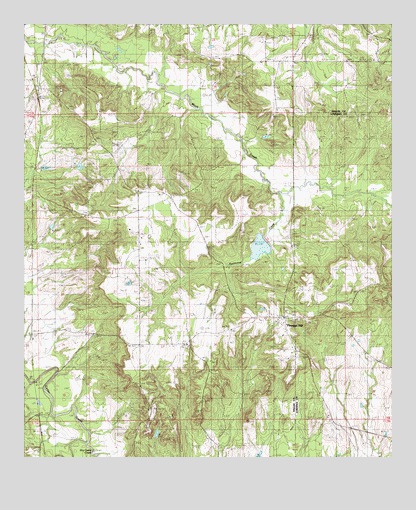
Pleasant Hill, AL USGS Topographic Map
Click on map above to begin viewing in our Map Viewer.

This topographic map contains these locations and features:
Feature Name Type Latitude Longitude GNIS ID View Map
Berlin Normal SchoolSchoolN32.2007°W86.9492°113951View Map
Bethel ChurchChurchN32.1624°W86.9111°144520View Map
Dry Cedar CreekStreamN32.1290°W86.9789°117524View Map
Good Hope ChurchChurchN32.1571°W86.9450°119118View Map
Honor BranchStreamN32.1807°W86.9311°136373View Map
Hunter SchoolSchoolN32.1790°W86.9550°151825View Map
Hurricane CreekStreamN32.2013°W86.9136°120581View Map
KingsPopulated PlaceN32.2026°W86.9972°144594View Map
Mount Arara SchoolSchoolN32.2221°W86.9092°123141View Map
Mount Ararat ChurchChurchN32.2396°W86.8811°154774View Map
Mount Lebanon CemeteryCemeteryN32.1565°W86.9447°1805700View Map
Mount Sinai ChurchChurchN32.2390°W86.9936°152510View Map
Pleasant HillPopulated PlaceN32.1654°W86.9119°155207View Map
Pleasant Hill Presbyterian ChurchChurchN32.1663°W86.9086°163432View Map
Pleasant Hill StationLocaleN32.1607°W86.9972°125017View Map
R Cullpepper DamDamN32.1251°W86.9200°130182View Map
R Cullpepper LakeReservoirN32.1252°W86.9204°130181View Map
Saint Luke ChurchChurchN32.1988°W86.9519°126141View Map
Sandy Ridge ChurchChurchN32.2010°W86.9500°144670View Map
Sinai HallLocaleN32.2182°W86.9694°126895View Map
Sinai School (historical)SchoolN32.2168°W86.9769°144683View Map
SwinkPopulated PlaceN32.1376°W86.9953°157137View Map
Underwood CemeteryCemeteryN32.1674°W86.9255°128252View Map
Wesley Chapel ChurchChurchN32.1618°W86.9105°154773View Map

Note: Coordinates in the location and feature list above are referenced to NAD83 datum.


Copyright (C) 2008-2025 Ryan Niemi / Sunset Dynamics ... All Rights Reserved