TopoQuest Logo
Do you find TopoQuest useful?
Help keep TopoQuest running and adding new maps/features by donating!
Bitcoin:  19c7KJd3qBynnjoSw5npx9KScwjBe4ifkT
Litecoin:  LXs6TkuXGGXo1vDsWCkWVdjQX94eUKd6ui
Home View Maps Find Maps Find Places Resources & Links


Collirene, Alabama Topographic Map

USGS Map Title: Collirene, AL
USGS Map MRC: 32086B7
DRG (GeoTIFF) Download: o32086b7.tif


Neighboring USGS Topographic Map Quads:


  Sardis, AL  
32086C8
 

  Benton, AL  
32086C7
 

  White Hall, AL  
32086C6
 

  Pleasant Hill, AL  
32086B8
 

  Collirene, AL  
32086B7
 

  Gordonsville, AL  
32086B6
 

  Minter, AL  
32086A8
 

  Braggs, AL  
32086A7
 

  Mount Willing, AL  
32086A6


Map MRC Location:

N33°
W87°
N33°
W86°
H8 H7 H6 H5 H4 H3 H2 H1
G8 G7 G6 G5 G4 G3 G2 G1
F8 F7 F6 F5 F4 F3 F2 F1
E8 E7 E6 E5 E4 E3 E2 E1
D8 D7 D6 D5 D4 D3 D2 D1
C8 C7 C6 C5 C4 C3 C2 C1
B8 B7 B6 B5 B4 B3 B2 B1
A8 A7 A6 A5 A4 A3 A2 A1
N32°
W87°
N32°
W86°

Collirene, AL USGS 1:24K Topographic Map Preview:
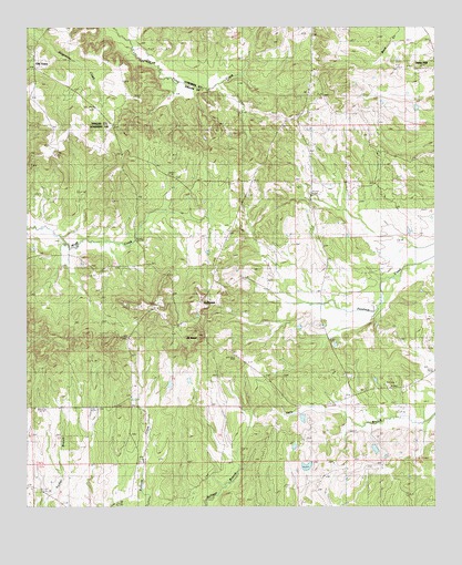
Collirene, AL USGS Topographic Map
Click on map above to begin viewing in our Map Viewer.

This topographic map contains these locations and features:
Feature Name Type Latitude Longitude GNIS ID View Map
Benton-Collirene DivisionCivilN32.2301°W86.7854°165853View Map
Bethany Baptist ChurchChurchN32.1726°W86.8322°164026View Map
Bethel Church (historical)ChurchN32.2113°W86.7866°136322View Map
Church BranchStreamN32.2004°W86.8347°136335View Map
CollirenePopulated PlaceN32.1760°W86.8236°116450View Map
Collirene Volunteer Fire DepartmentBuildingN32.2215°W86.7983°2691589View Map
Dunklin CemeteryCemeteryN32.1901°W86.8114°163490View Map
Dunklin CemeteryCemeteryN32.1904°W86.8125°117672View Map
J R Paul LakeReservoirN32.1360°W86.7894°130195View Map
J R Paul Lake DamDamN32.1351°W86.7900°130194View Map
Macedonia ChurchChurchN32.1882°W86.7828°136391View Map
Macedonia SchoolSchoolN32.1874°W86.7833°122175View Map
Mount BaberSummitN32.1626°W86.8247°123147View Map
Mount CemeteryCemeteryN32.1715°W86.8233°152412View Map
Mount Lily ChurchChurchN32.2065°W86.7655°136411View Map
Mount Lily SchoolSchoolN32.2051°W86.7658°152438View Map
Mount Teman ChurchChurchN32.2099°W86.7772°163496View Map
New Bethel ChurchChurchN32.1976°W86.8128°123718View Map
Old Bethel ChurchChurchN32.1699°W86.8308°152767View Map
Old TownPopulated PlaceN32.2390°W86.8728°124259View Map
Petronia SchoolSchoolN32.2288°W86.7891°124655View Map
Ramer Church (historical)ChurchN32.1360°W86.7722°136438View Map
Rives CemeteryCemeteryN32.1818°W86.8230°136439View Map
Shiloh Baptist ChurchChurchN32.1599°W86.7753°136454View Map
Shiloh CemeteryCemeteryN32.1590°W86.7764°1805629View Map
Shiloh SchoolSchoolN32.1590°W86.7769°126761View Map
Town Creek CemeteryCemeteryN32.2446°W86.8736°154775View Map
Union Springs ChurchChurchN32.2338°W86.8594°128350View Map
WSLA-TV (Selma)TowerN32.1496°W86.7800°161246View Map

Note: Coordinates in the location and feature list above are referenced to NAD83 datum.


Copyright (C) 2008-2024 Ryan Niemi / Sunset Dynamics ... All Rights Reserved