TopoQuest Logo
Do you find TopoQuest useful?
Help keep TopoQuest running and adding new maps/features by donating!
Bitcoin:  19c7KJd3qBynnjoSw5npx9KScwjBe4ifkT
Litecoin:  LXs6TkuXGGXo1vDsWCkWVdjQX94eUKd6ui
Home View Maps Find Maps Find Places Resources & Links


Carlowville, Alabama Topographic Map

USGS Map Title: Carlowville, AL
USGS Map MRC: 32087A1
DRG (GeoTIFF) Download: o32087a1.tif


Neighboring USGS Topographic Map Quads:


  Tasso, AL  
32087B2
 

  Elm Bluff, AL  
32087B1
 

  Pleasant Hill, AL  
32086B8
 

  Tilden, AL  
32087A2
 

  Carlowville, AL  
32087A1
 

  Minter, AL  
32086A8
 

  Rosebud, AL  
31087H2
 

  Oak Hill, AL  
31087H1
 

  Pine Apple North, AL  
31086H8


Map MRC Location:

N33°
W88°
N33°
W87°
H8 H7 H6 H5 H4 H3 H2 H1
G8 G7 G6 G5 G4 G3 G2 G1
F8 F7 F6 F5 F4 F3 F2 F1
E8 E7 E6 E5 E4 E3 E2 E1
D8 D7 D6 D5 D4 D3 D2 D1
C8 C7 C6 C5 C4 C3 C2 C1
B8 B7 B6 B5 B4 B3 B2 B1
A8 A7 A6 A5 A4 A3 A2 A1
N32°
W88°
N32°
W87°

Carlowville, AL USGS 1:24K Topographic Map Preview:
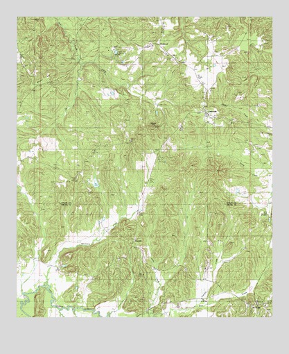
Carlowville, AL USGS Topographic Map
Click on map above to begin viewing in our Map Viewer.

This topographic map contains these locations and features:
Feature Name Type Latitude Longitude GNIS ID View Map
AckervillePopulated PlaceN32.0296°W87.0664°154959View Map
Ackerville ChurchChurchN32.0296°W87.0667°138412View Map
Alabama Sheriffs Boys RanchLocaleN32.1110°W87.0819°144516View Map
Annemanie SchoolSchoolN32.0518°W87.0392°159004View Map
Antioch ChurchChurchN32.0082°W87.0630°113136View Map
Boy's Ranch Airport (historical)AirportN32.1079°W87.0680°129418View Map
Canaan (historical)LocaleN32.1210°W87.0528°144534View Map
CarlowvillePopulated PlaceN32.0871°W87.0342°115624View Map
Carlowville ChurchChurchN32.0913°W87.0328°154772View Map
Carlowville Community CemeteryCemeteryN32.0910°W87.0339°1805697View Map
Carlowville Historic DistrictParkN32.0876°W87.0333°158260View Map
Carlowville Volunteer Fire DepartmentBuildingN32.0862°W87.0330°2691310View Map
Chambers CreekStreamN32.0129°W87.1114°115924View Map
Ebe County Line ChurchChurchN32.0629°W87.1058°117808View Map
Grays Landing (historical)LocaleN32.0904°W87.0436°137607View Map
Hopewell ChurchChurchN32.1135°W87.0108°144585View Map
Hopewell SchoolSchoolN32.1135°W87.0094°120390View Map
Hopewell School (historical)SchoolN32.1135°W87.0108°144586View Map
Institute CreekStreamN32.0054°W87.0372°120695View Map
Morgan HillSummitN32.1021°W87.1092°123046View Map
Mount Nebo ChurchChurchN32.0710°W87.0064°144626View Map
Peoples Chapel (historical)ChurchN32.1076°W87.1133°138549View Map
Pleasant ChurchChurchN32.1143°W87.0753°124932View Map
Prairie CreekStreamN32.0038°W87.1044°153057View Map
RichmondPopulated PlaceN32.1140°W87.0550°153148View Map
Saint Paul ChurchChurchN32.0051°W87.0036°158393View Map
Saint Pauls CemeteryCemeteryN32.0832°W87.0305°1805706View Map
Saint Pauls ChurchChurchN32.0838°W87.0303°144660View Map
Saint Peter ChurchChurchN32.0721°W87.0842°153293View Map
Snow HillPopulated PlaceN32.0046°W87.0072°155244View Map
Snow Hill InstituteSchoolN32.0210°W87.0330°153490View Map
Wildcat HillSummitN32.0796°W87.0578°128968View Map

Note: Coordinates in the location and feature list above are referenced to NAD83 datum.


Copyright (C) 2008-2025 Ryan Niemi / Sunset Dynamics ... All Rights Reserved