TopoQuest Logo
Do you find TopoQuest useful?
Help keep TopoQuest running and adding new maps/features by donating!
Bitcoin:  19c7KJd3qBynnjoSw5npx9KScwjBe4ifkT
Litecoin:  LXs6TkuXGGXo1vDsWCkWVdjQX94eUKd6ui
Home View Maps Find Maps Find Places Resources & Links


Pleasant Plains, Arkansas Topographic Map

USGS Map Title: Pleasant Plains, AR
USGS Map MRC: 35091E6
DRG (GeoTIFF) Download: o35091e6.tif


Neighboring USGS Topographic Map Quads:


  Concord, AR  
35091F7
 

  Jamestown, AR  
35091F6
 

  Salado, AR  
35091F5
 

  Floral, AR  
35091E7
 

  Pleasant Plains, AR  
35091E6
 

  Huff, AR  
35091E5
 

  Pangburn, AR  
35091D7
 

  Steprock, AR  
35091D6
 

  Velvet Ridge, AR  
35091D5


Map MRC Location:

N36°
W92°
N36°
W91°
H8 H7 H6 H5 H4 H3 H2 H1
G8 G7 G6 G5 G4 G3 G2 G1
F8 F7 F6 F5 F4 F3 F2 F1
E8 E7 E6 E5 E4 E3 E2 E1
D8 D7 D6 D5 D4 D3 D2 D1
C8 C7 C6 C5 C4 C3 C2 C1
B8 B7 B6 B5 B4 B3 B2 B1
A8 A7 A6 A5 A4 A3 A2 A1
N35°
W92°
N35°
W91°

Pleasant Plains, AR USGS 1:24K Topographic Map Preview:
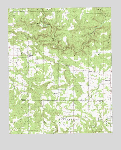
Pleasant Plains, AR USGS Topographic Map
Click on map above to begin viewing in our Map Viewer.

This topographic map contains these locations and features:
Feature Name Type Latitude Longitude GNIS ID View Map
Bear BranchStreamN35.5890°W91.6924°67981View Map
Board Shanty ChurchChurchN35.5404°W91.6904°46781View Map
Camp Crossed ArrowsLocaleN35.5929°W91.6943°47321View Map
Camp TahkodahLocaleN35.6084°W91.7038°47338View Map
Cedar GrovePopulated PlaceN35.5776°W91.7254°76559View Map
Church of ChristChurchN35.5037°W91.6729°65050View Map
Coon CreekStreamN35.5126°W91.6421°47997View Map
Dodd BranchStreamN35.6131°W91.6310°48543View Map
Fletcher BranchStreamN35.5501°W91.7451°45743View Map
Flippo ChapelChurchN35.5617°W91.6529°49137View Map
Mitchell BranchStreamN35.6095°W91.7085°52104View Map
New Bethel ChurchChurchN35.5531°W91.7399°52627View Map
Old Union CemeteryCemeteryN35.6206°W91.7426°53033View Map
Pleasant PlainsPopulated PlaceN35.5501°W91.6262°78053View Map
Pleasant Plains CemeteryCemeteryN35.5481°W91.6385°53584View Map
RooseveltPopulated PlaceN35.5165°W91.6693°58520View Map
Town of Pleasant PlainsCivilN35.5538°W91.6283°2407136View Map
Township of FairviewCivilN35.5748°W91.6449°68764View Map
Union Grove CemeteryCemeteryN35.5406°W91.6890°55807View Map
Wagon Wheel CreekStreamN35.5990°W91.7001°55941View Map
WrentonPopulated PlaceN35.6079°W91.7065°68066View Map

Note: Coordinates in the location and feature list above are referenced to NAD83 datum.


Copyright (C) 2008-2024 Ryan Niemi / Sunset Dynamics ... All Rights Reserved