TopoQuest Logo
Do you find TopoQuest useful?
Help keep TopoQuest running and adding new maps/features by donating!
Bitcoin:  19c7KJd3qBynnjoSw5npx9KScwjBe4ifkT
Litecoin:  LXs6TkuXGGXo1vDsWCkWVdjQX94eUKd6ui
Home View Maps Find Maps Find Places Resources & Links


Steprock, Arkansas Topographic Map

USGS Map Title: Steprock, AR
USGS Map MRC: 35091D6
DRG (GeoTIFF) Download: o35091d6.tif


Neighboring USGS Topographic Map Quads:


  Floral, AR  
35091E7
 

  Pleasant Plains, AR  
35091E6
 

  Huff, AR  
35091E5
 

  Pangburn, AR  
35091D7
 

  Steprock, AR  
35091D6
 

  Velvet Ridge, AR  
35091D5
 

  Letona, AR  
35091C7
 

  Judsonia, AR  
35091C6
 

  Bald Knob, AR  
35091C5


Map MRC Location:

N36°
W92°
N36°
W91°
H8 H7 H6 H5 H4 H3 H2 H1
G8 G7 G6 G5 G4 G3 G2 G1
F8 F7 F6 F5 F4 F3 F2 F1
E8 E7 E6 E5 E4 E3 E2 E1
D8 D7 D6 D5 D4 D3 D2 D1
C8 C7 C6 C5 C4 C3 C2 C1
B8 B7 B6 B5 B4 B3 B2 B1
A8 A7 A6 A5 A4 A3 A2 A1
N35°
W92°
N35°
W91°

Steprock, AR USGS 1:24K Topographic Map Preview:
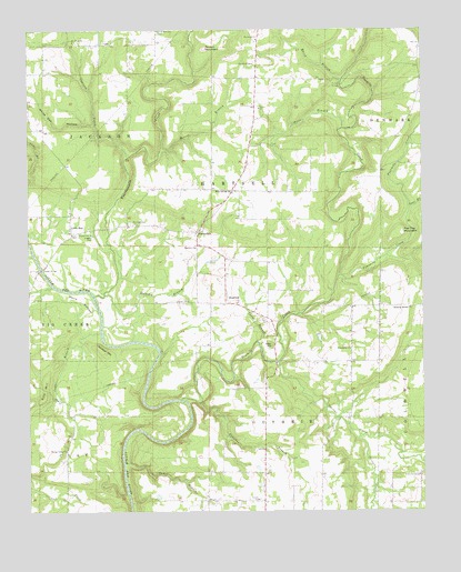
Steprock, AR USGS Topographic Map
Click on map above to begin viewing in our Map Viewer.

This topographic map contains these locations and features:
Feature Name Type Latitude Longitude GNIS ID View Map
Bare StonePopulated PlaceN35.4281°W91.6390°65036View Map
Bridges LakeReservoirN35.4200°W91.6581°79758View Map
Bridges Lake DamDamN35.4201°W91.6585°79757View Map
Cedar BranchStreamN35.4181°W91.6771°47571View Map
Cedar BranchStreamN35.4215°W91.7276°47572View Map
Cedar BranchStreamN35.3876°W91.7201°47573View Map
Chavell Lake TwoReservoirN35.3951°W91.6785°79927View Map
Chavell Lake Two DamDamN35.3951°W91.6785°79926View Map
Cypress CreekStreamN35.4670°W91.7188°48309View Map
Davenport (historical)Populated PlaceN35.4967°W91.7093°65055View Map
Dewey BridgeBridgeN35.4379°W91.7463°48498View Map
Doyleville (historical)Populated PlaceN35.4745°W91.7488°65059View Map
Dripping Springs ChurchChurchN35.4279°W91.6290°48607View Map
Fisher BridgeBridgeN35.4856°W91.6507°49070View Map
Flat Top MountainSummitN35.4476°W91.6312°57758View Map
Fourmile CreekStreamN35.4359°W91.6518°49203View Map
Fourteenmile CreekStreamN35.4312°W91.7296°81860View Map
Friendship ChurchChurchN35.4170°W91.6482°49264View Map
Hill LakeReservoirN35.3917°W91.6735°79773View Map
Hill Lake DamDamN35.3917°W91.6735°79772View Map
Holcomb BranchStreamN35.4315°W91.7260°50182View Map
Holly Grove CemeteryCemeteryN35.3848°W91.6262°50222View Map
Holly Springs ChurchChurchN35.4581°W91.6854°50252View Map
Leggett CemeteryCemeteryN35.4467°W91.7299°51058View Map
Little RedPopulated PlaceN35.4467°W91.7363°81875View Map
Lost BranchStreamN35.4534°W91.6290°51459View Map
Maddock (historical)Populated PlaceN35.4870°W91.6551°65096View Map
March BranchStreamN35.4867°W91.6507°51665View Map
Morris BranchStreamN35.4684°W91.7082°52214View Map
Mount Olive ChurchChurchN35.4973°W91.7357°52360View Map
North White County Volunteer Fire DepartmentBuildingN35.3756°W91.6755°2116872View Map
Onion CreekStreamN35.3948°W91.6454°53054View Map
Philadelphia CemeteryCemeteryN35.4501°W91.7176°53320View Map
Pine HillSummitN35.4076°W91.7454°58377View Map
Potter BranchStreamN35.4742°W91.6504°53728View Map
Pumpkin BranchStreamN35.4034°W91.6965°53842View Map
Roosevelt ChurchChurchN35.4976°W91.6776°54185View Map
Round MountainSummitN35.4954°W91.6940°58537View Map
Spring Valley ChurchChurchN35.3909°W91.7388°55129View Map
SteprockPopulated PlaceN35.4290°W91.6876°78458View Map
Steprock ChurchChurchN35.4434°W91.6971°55207View Map
Steprock Post OfficePost OfficeN35.4292°W91.6843°84981View Map
Stevens CreekStreamN35.4137°W91.6712°81898View Map
SunnydalePopulated PlaceN35.4476°W91.6960°58713View Map
Tater HillSummitN35.4179°W91.6729°58731View Map
Tenmile CreekStreamN35.4040°W91.7018°81900View Map
Township of GuthrieCivilN35.3894°W91.6727°69835View Map
Township of HartsellCivilN35.4714°W91.6821°69837View Map
Township of JacksonCivilN35.4903°W91.7499°69839View Map
Wells BottomBendN35.4284°W91.7326°56145View Map
White Oak HollowValleyN35.4754°W91.7290°56289View Map
Wildcat HillSummitN35.4162°W91.7260°58887View Map

Note: Coordinates in the location and feature list above are referenced to NAD83 datum.


Copyright (C) 2008-2025 Ryan Niemi / Sunset Dynamics ... All Rights Reserved