TopoQuest Logo
Do you find TopoQuest useful?
Help keep TopoQuest running and adding new maps/features by donating!
Bitcoin:  19c7KJd3qBynnjoSw5npx9KScwjBe4ifkT
Litecoin:  LXs6TkuXGGXo1vDsWCkWVdjQX94eUKd6ui
Home View Maps Find Maps Find Places Resources & Links


Pleasant View, Tennessee Topographic Map

USGS Map Title: Pleasant View, TN
USGS Map MRC: 36087D1
DRG (GeoTIFF) Download: o36087d1.tif


Neighboring USGS Topographic Map Quads:


  Sango, TN  
36087E2
 

  Adams, TN  
36087E1
 

  Springfield North, TN  
36086E8
 

  Henrietta, TN  
36087D2
 

  Pleasant View, TN  
36087D1
 

  Springfield South, TN  
36086D8
 

  Cheatham Dam, TN  
36087C2
 

  Ashland City, TN  
36087C1
 

  Forest Grove, TN  
36086C8


Map MRC Location:

N37°
W88°
N37°
W87°
H8 H7 H6 H5 H4 H3 H2 H1
G8 G7 G6 G5 G4 G3 G2 G1
F8 F7 F6 F5 F4 F3 F2 F1
E8 E7 E6 E5 E4 E3 E2 E1
D8 D7 D6 D5 D4 D3 D2 D1
C8 C7 C6 C5 C4 C3 C2 C1
B8 B7 B6 B5 B4 B3 B2 B1
A8 A7 A6 A5 A4 A3 A2 A1
N36°
W88°
N36°
W87°

Pleasant View, TN USGS 1:24K Topographic Map Preview:
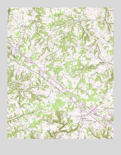
Pleasant View, TN USGS Topographic Map
Click on map above to begin viewing in our Map Viewer.

This topographic map contains these locations and features:
Feature Name Type Latitude Longitude GNIS ID View Map
Adams CemeteryCemeteryN36.4650°W87.0014°1644176View Map
Alley CemeteryCemeteryN36.4973°W87.0472°1644151View Map
Baxter CemeteryCemeteryN36.4928°W87.0422°1644166View Map
Blue Bird FieldAirportN36.4363°W87.0915°2675496View Map
Bracy CemeteryCemeteryN36.4445°W87.0344°1644180View Map
Brewer ChapelChurchN36.4434°W87.1233°1305405View Map
Brewer School (historical)SchoolN36.4428°W87.1236°1317221View Map
Brewers Chapel CemeteryCemeteryN36.4437°W87.1242°1326232View Map
City of Pleasant ViewCivilN36.3893°W87.0455°2404539View Map
Coleman School (historical)SchoolN36.4906°W87.0161°1316476View Map
Commissioner District 3CivilN36.4015°W87.0735°2464128View Map
Coopertown Division (historical)CensusN36.4634°W87.0017°1648928View Map
Darden CemeteryCemeteryN36.4803°W87.0869°1644223View Map
Darden CemeteryCemeteryN36.4689°W87.0961°1644224View Map
Dickerson CemeteryCemeteryN36.4425°W87.0125°1644228View Map
Elliott CemeteryCemeteryN36.4278°W87.0436°1644251View Map
Elliott CemeteryCemeteryN36.4809°W87.1019°1644252View Map
Elliott CemeteryCemeteryN36.4537°W87.1128°1644253View Map
Esther Jackson CemeteryCemeteryN36.4262°W87.1158°1326241View Map
Farmer CemeteryCemeteryN36.4612°W87.0019°1644258View Map
Flying W Ranch Airport (historical)AirportN36.4500°W87.0056°1301427View Map
Fox CemeteryCemeteryN36.4045°W87.1094°1284771View Map
GausePopulated PlaceN36.4367°W87.0508°1315104View Map
Gause School (historical)SchoolN36.4359°W87.0517°1316485View Map
Gower CemeteryCemeteryN36.4642°W87.1139°1644277View Map
Hallums CemeteryCemeteryN36.4173°W87.0006°1644287View Map
Head CemeteryCemeteryN36.4778°W87.0281°1644290View Map
Heads CemeteryCemeteryN36.4634°W87.0453°1644291View Map
Heads ChurchChurchN36.4625°W87.0469°1287282View Map
Honey Run CreekStreamN36.4878°W87.0389°1288206View Map
Interchange 19CrossingN36.4500°W87.0994°1310488View Map
Interchange 24CrossingN36.4020°W87.0253°1310489View Map
James CemeteryCemeteryN36.4789°W87.0339°1644320View Map
James CemeteryCemeteryN36.4745°W87.0167°1644321View Map
Knox CemeteryCemeteryN36.4114°W87.1125°1326251View Map
Lee CemeteryCemeteryN36.4200°W87.0003°1644333View Map
Lipscomb Store (historical)LocaleN36.4459°W87.1228°1317222View Map
Luter CemeteryCemeteryN36.4906°W87.0656°1644337View Map
Mill SpringSpringN36.3864°W87.0411°1650755View Map
Moore CemeteryCemeteryN36.4173°W87.0092°1644355View Map
Morris CemeteryCemeteryN36.3964°W87.1164°1317219View Map
Mount Lebanon ChurchChurchN36.3762°W87.0631°1294664View Map
Murphey CemeteryCemeteryN36.4675°W87.0072°1644367View Map
Nave CemeteryCemeteryN36.4448°W87.0156°1644368View Map
OaklawnPopulated PlaceN36.4103°W87.0881°1310753View Map
Oaklawn ChurchChurchN36.4112°W87.0878°1296191View Map
Oakwood ChurchChurchN36.4923°W87.0656°1296214View Map
Pennington CemeteryCemeteryN36.4703°W87.1083°1644385View Map
Pleasant ViewPopulated PlaceN36.3942°W87.0367°1297944View Map
Pleasant View Elementary SchoolSchoolN36.3981°W87.0350°1317223View Map
Pleasant View First Baptist ChurchChurchN36.3978°W87.0358°1644847View Map
Pleasant View Police DepartmentBuildingN36.3910°W87.0200°2766033View Map
Pleasant View Post OfficePost OfficeN36.3965°W87.0330°1650754View Map
Pleasant View United Methodist ChurchChurchN36.3937°W87.0361°1317224View Map
Pleasant View Volunteer Fire DepartmentBuildingN36.3954°W87.0376°2653666View Map
Pleasant View Volunteer Fire Department Station 3BuildingN36.4721°W87.0769°2654147View Map
Sandy SpringsPopulated PlaceN36.4478°W87.0108°1300771View Map
Shepard CemeteryCemeteryN36.4862°W87.1014°1644425View Map
StroudvillePopulated PlaceN36.4825°W87.1069°1303883View Map
Turner CemeteryCemeteryN36.4867°W87.0408°1644447View Map
TurnersvillePopulated PlaceN36.4878°W87.0400°1273091View Map
Walker CemeteryCemeteryN36.4125°W87.0106°1644449View Map
Weakleys FieldAirportN36.4063°W87.0823°2675497View Map
West Fork CreekStreamN36.4864°W87.0897°1274168View Map
Whitehead CemeteryCemeteryN36.4481°W87.0208°1644475View Map
Williams CemeteryCemeteryN36.4242°W87.0333°1644464View Map
Wilson CemeteryCemeteryN36.4298°W87.0286°1644467View Map
Winters CemeteryCemeteryN36.4389°W87.0431°1644472View Map
Woodlawn School (historical)SchoolN36.4095°W87.0986°1317220View Map

Note: Coordinates in the location and feature list above are referenced to NAD83 datum.


Copyright (C) 2008-2025 Ryan Niemi / Sunset Dynamics ... All Rights Reserved