TopoQuest Logo
Do you find TopoQuest useful?
Help keep TopoQuest running and adding new maps/features by donating!
Bitcoin:  19c7KJd3qBynnjoSw5npx9KScwjBe4ifkT
Litecoin:  LXs6TkuXGGXo1vDsWCkWVdjQX94eUKd6ui
Home View Maps Find Maps Find Places Resources & Links


Newburg, Wisconsin Topographic Map

USGS Map Title: Newburg, WI
USGS Map MRC: 43088D1
DRG (GeoTIFF) Download: o43088d1.tif


Neighboring USGS Topographic Map Quads:


  Kewaskum, WI  
43088E2
 

  Batavia, WI  
43088E1
 

  Random Lake, WI  
43087E8
 

  West Bend, WI  
43088D2
 

  Newburg, WI  
43088D1
 

  Port Washington West, WI  
43087D8
 

  Jackson, WI  
43088C2
 

  Five Corners, WI  
43088C1
 

  Cedarburg, WI  
43087C8


Map MRC Location:

N44°
W89°
N44°
W88°
H8 H7 H6 H5 H4 H3 H2 H1
G8 G7 G6 G5 G4 G3 G2 G1
F8 F7 F6 F5 F4 F3 F2 F1
E8 E7 E6 E5 E4 E3 E2 E1
D8 D7 D6 D5 D4 D3 D2 D1
C8 C7 C6 C5 C4 C3 C2 C1
B8 B7 B6 B5 B4 B3 B2 B1
A8 A7 A6 A5 A4 A3 A2 A1
N43°
W89°
N43°
W88°

Newburg, WI USGS 1:24K Topographic Map Preview:
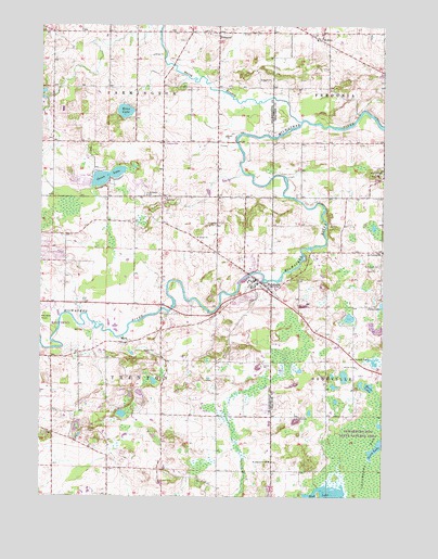
Newburg, WI USGS Topographic Map
Click on map above to begin viewing in our Map Viewer.

This topographic map contains these locations and features:
Feature Name Type Latitude Longitude GNIS ID View Map
Cedarburg Beech Woods State Natural AreaParkN43.3847°W88.0269°2093523View Map
Cedarburg BogSwampN43.3869°W88.0062°1562870View Map
Cedarburg Bog State Natural AreaParkN43.3822°W88.0106°1562871View Map
CheesevillePopulated PlaceN43.4689°W88.0806°1577413View Map
Cheeseville DairyLocaleN43.4672°W88.0783°2706500View Map
Decorah FarmLocaleN43.4119°W88.1131°2706505View Map
Donut LakeLakeN43.3941°W88.0008°2761318View Map
Erler LakeLakeN43.4771°W88.0947°1581152View Map
FillmorePopulated PlaceN43.4983°W88.0606°1564938View Map
Fillmore Fire DepartmentBuildingN43.4977°W88.0715°2697961View Map
Gough LakeLakeN43.4112°W88.0034°1565686View Map
Green LakeLakeN43.4598°W88.1011°1565816View Map
Horn LakeLakeN43.4041°W88.0054°2558888View Map
KohlerPopulated PlaceN43.4964°W88.0234°1567600View Map
Long LakeLakeN43.3888°W88.0011°1568579View Map
MyraPopulated PlaceN43.4158°W88.0956°1570081View Map
NewburgPopulated PlaceN43.4317°W88.0465°1570249View Map
Newburg DamDamN43.4350°W88.0484°1793407View Map
Newburg Fire DepartmentBuildingN43.4329°W88.0460°2697675View Map
Newburg Police DepartmentBuildingN43.4336°W88.0475°2759874View Map
Newburg Pond 243ReservoirN43.4339°W88.0493°1793408View Map
North Branch Milwaukee RiverStreamN43.4750°W88.0306°1570381View Map
Proschinger LakeLakeN43.4056°W88.0836°2761847View Map
Radtke LakeLakeN43.3968°W88.0952°2761849View Map
Riveredge Creek And Ephemeral Pond State Nature PreserveParkN43.4353°W88.0189°2093527View Map
Roeckl LakeLakeN43.3974°W88.0266°2761324View Map
Saint Augustine Catholic ChurchChurchN43.3842°W88.0412°1572850View Map
Saint Augustine CemeteryCemeteryN43.3842°W88.0406°1840957View Map
Saint Finbars CemeteryCemeteryN43.4367°W88.0009°1572920View Map
Saint Finbars SchoolSchoolN43.4403°W88.0004°1572921View Map
Saint Johns CemeteryCemeteryN43.4617°W88.0006°1573039View Map
Saint Johns Lutheran SchoolSchoolN43.4317°W88.0499°2716628View Map
Saint Peters ChurchChurchN43.4550°W88.0868°1573531View Map
Sapa Spruce Bog State Natural AreaParkN43.3942°W88.0278°2093528View Map
Town of FarmingtonCivilN43.4985°W88.1009°1583193View Map
Town of TrentonCivilN43.4100°W88.0986°1584294View Map
Trenton Police DepartmentBuildingN43.4249°W88.0900°2759875View Map
Village of NewburgCivilN43.4321°W88.0476°1583801View Map

Note: Coordinates in the location and feature list above are referenced to NAD83 datum.


Copyright (C) 2008-2025 Ryan Niemi / Sunset Dynamics ... All Rights Reserved