TopoQuest Logo
Do you find TopoQuest useful?
Help keep TopoQuest running and adding new maps/features by donating!
Bitcoin:  19c7KJd3qBynnjoSw5npx9KScwjBe4ifkT
Litecoin:  LXs6TkuXGGXo1vDsWCkWVdjQX94eUKd6ui
Home View Maps Find Maps Find Places Resources & Links


Batavia, Wisconsin Topographic Map

USGS Map Title: Batavia, WI
USGS Map MRC: 43088E1
DRG (GeoTIFF) Download: o43088e1.tif


Neighboring USGS Topographic Map Quads:


  Dundee, WI  
43088F2
 

  Cascade, WI  
43088F1
 

  Plymouth South, WI  
43087F8
 

  Kewaskum, WI  
43088E2
 

  Batavia, WI  
43088E1
 

  Random Lake, WI  
43087E8
 

  West Bend, WI  
43088D2
 

  Newburg, WI  
43088D1
 

  Port Washington West, WI  
43087D8


Map MRC Location:

N44°
W89°
N44°
W88°
H8 H7 H6 H5 H4 H3 H2 H1
G8 G7 G6 G5 G4 G3 G2 G1
F8 F7 F6 F5 F4 F3 F2 F1
E8 E7 E6 E5 E4 E3 E2 E1
D8 D7 D6 D5 D4 D3 D2 D1
C8 C7 C6 C5 C4 C3 C2 C1
B8 B7 B6 B5 B4 B3 B2 B1
A8 A7 A6 A5 A4 A3 A2 A1
N43°
W89°
N43°
W88°

Batavia, WI USGS 1:24K Topographic Map Preview:
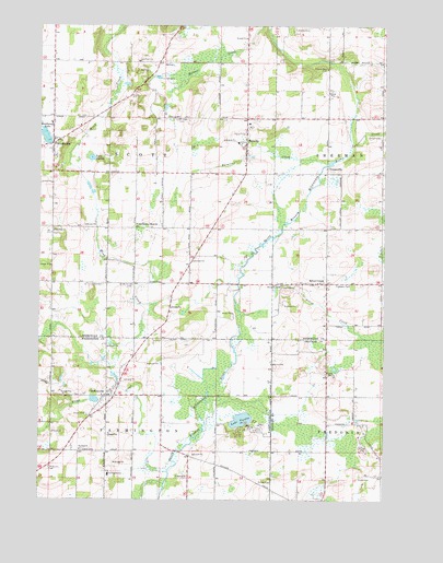
Batavia, WI USGS Topographic Map
Click on map above to begin viewing in our Map Viewer.

This topographic map contains these locations and features:
Feature Name Type Latitude Longitude GNIS ID View Map
13 ReservoirReservoirN43.5263°W88.1049°1792281View Map
BataviaPopulated PlaceN43.5944°W88.0509°1561299View Map
Batavia CreekStreamN43.5733°W88.0362°1561300View Map
Batavia Elementary SchoolSchoolN43.5942°W88.0534°1834508View Map
Batavia Volunteer Fire DepartmentBuildingN43.5912°W88.0501°2697596View Map
Batavis PondLakeN43.5904°W88.0481°2761677View Map
BeechwoodPopulated PlaceN43.5928°W88.1204°1561498View Map
Beechwood CemeteryCemeteryN43.6013°W88.1200°1833468View Map
Beechwood LakeReservoirN43.5955°W88.1230°1561499View Map
Beechwood Volunteer Fire DepartmentBuildingN43.5946°W88.1175°2697663View Map
BoltonvillePopulated PlaceN43.5272°W88.1006°1562045View Map
Boltonville 2WP1738 DamDamN43.5250°W88.1034°1792280View Map
Boltonville Volunteer Fire DepartmentBuildingN43.5281°W88.0995°2698064View Map
Camp AwanaLocaleN43.5194°W88.0454°1562578View Map
Cranberry MarshPopulated PlaceN43.5717°W88.0857°1563497View Map
Emmanuel Lutheran CemeteryCemeteryN43.5708°W88.1201°1833472View Map
Farmington Elementary SchoolSchoolN43.5064°W88.0990°1564872View Map
Firemans ParkParkN43.5567°W88.0118°1564959View Map
GoosevillePopulated PlaceN43.5872°W88.0212°1577618View Map
Gooseville 3WR 1559 DamDamN43.5883°W88.0201°1792254View Map
Gooseville CreekStreamN43.5933°W88.0120°1565669View Map
Gooseville Millpond 40ReservoirN43.5890°W88.0195°1792255View Map
Hartmann PitMineN43.5147°W88.0086°2711478View Map
Hillside School (historical)SchoolN43.5272°W88.0204°1833593View Map
Immanuel ChurchChurchN43.5708°W88.1204°1566869View Map
Lafollette School (historical)SchoolN43.6008°W88.0204°1834602View Map
Lake SixteenLakeN43.5900°W88.1064°1574220View Map
Lake TwelveLakeN43.5210°W88.0516°1575756View Map
Longfellow School (historical)SchoolN43.5717°W88.0712°1834612View Map
Mink CreekStreamN43.5564°W88.0537°1569560View Map
Pilgrims Rest CemeteryCemeteryN43.6135°W88.0211°1571403View Map
Riverside Strip (historical)AirportN43.5675°W88.0387°1582207View Map
Saint John of God Roman Catholic ChurchChurchN43.5131°W88.1106°1573085View Map
Saint Stephens Lutheran CemeteryCemeteryN43.6003°W88.0470°1833485View Map
Scott Center School (historical)SchoolN43.5864°W88.0998°1834693View Map
Scott Union CemeteryCemeteryN43.5567°W88.0915°1573849View Map
Silver CreekPopulated PlaceN43.5569°W88.0251°1574099View Map
Silver CreekStreamN43.5489°W88.0523°1574109View Map
Silver Creek Volunteer Fire DepartmentBuildingN43.5573°W88.0242°2697731View Map
Stony CreekStreamN43.5075°W88.0779°1574948View Map
Town of ScottCivilN43.5864°W88.1003°1584119View Map
Union CemeteryCemeteryN43.5222°W88.1079°1575876View Map
Winfield CemeteryCemeteryN43.6004°W88.0756°1576864View Map
Zion United Methodist CemeteryCemeteryN43.6002°W88.0476°1833489View Map

Note: Coordinates in the location and feature list above are referenced to NAD83 datum.


Copyright (C) 2008-2024 Ryan Niemi / Sunset Dynamics ... All Rights Reserved