TopoQuest Logo
Do you find TopoQuest useful?
Help keep TopoQuest running and adding new maps/features by donating!
Bitcoin:  19c7KJd3qBynnjoSw5npx9KScwjBe4ifkT
Litecoin:  LXs6TkuXGGXo1vDsWCkWVdjQX94eUKd6ui
Home View Maps Find Maps Find Places Resources & Links


Portville, New York Topographic Map

USGS Map Title: Portville, NY
USGS Map MRC: 42078A3
DRG (GeoTIFF) Download: o42078a3.tif


Neighboring USGS Topographic Map Quads:


  Hinsdale, NY  
42078B4
 

  Cuba, NY  
42078B3
 

  Friendship, NY  
42078B2
 

  Olean, NY  
42078A4
 

  Portville, NY  
42078A3
 

  Bolivar, NY  
42078A2
 

  Eldred, PA  
41078H4
 

  Bullis Mills, PA  
41078H3
 

  Shinglehouse, PA  
41078H2


Map MRC Location:

N43°
W79°
N43°
W78°
H8 H7 H6 H5 H4 H3 H2 H1
G8 G7 G6 G5 G4 G3 G2 G1
F8 F7 F6 F5 F4 F3 F2 F1
E8 E7 E6 E5 E4 E3 E2 E1
D8 D7 D6 D5 D4 D3 D2 D1
C8 C7 C6 C5 C4 C3 C2 C1
B8 B7 B6 B5 B4 B3 B2 B1
A8 A7 A6 A5 A4 A3 A2 A1
N42°
W79°
N42°
W78°

Portville, NY USGS 1:24K Topographic Map Preview:
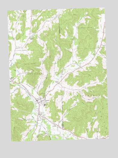
Portville, NY USGS Topographic Map
Click on map above to begin viewing in our Map Viewer.

This topographic map contains these locations and features:
Feature Name Type Latitude Longitude GNIS ID View Map
Bear ValleyValleyN42.0504°W78.2781°943324View Map
Bedford CornersPopulated PlaceN42.0545°W78.3114°943489View Map
Bells BrookStreamN42.0001°W78.3017°943629View Map
Bethel Lutheran ChurchChurchN42.0387°W78.3319°2597393View Map
Butternut BrookStreamN42.0145°W78.3278°945379View Map
CarrollPopulated PlaceN42.0065°W78.3278°972301View Map
Chestnut Hill CemeteryCemeteryN42.0429°W78.3314°946547View Map
Coon BranchStreamN42.0587°W78.3142°947371View Map
Coon HollowValleyN42.0842°W78.2591°947376View Map
Deer CreekStreamN42.0573°W78.3136°948189View Map
Deer Creek FarmLocaleN42.0553°W78.3136°2703676View Map
Dodge CreekStreamN42.0353°W78.3436°948523View Map
Doget HollowValleyN42.0887°W78.2585°948541View Map
East Portville CemeteryCemeteryN42.0135°W78.3152°2554936View Map
Faulkner's FarmLocaleN42.0486°W78.3508°2703675View Map
First Presbyterian Church of PortvilleChurchN42.0395°W78.3421°2597411View Map
Gleason HollowValleyN42.0214°W78.3470°951162View Map
Jolee Mobile Home CommunityPopulated PlaceN42.0117°W78.3148°2598232View Map
Lake View TerracePopulated PlaceN42.0992°W78.3478°972702View Map
Lillibridge CreekStreamN42.0415°W78.3470°955302View Map
Main SettlementPopulated PlaceN42.0134°W78.3142°956283View Map
Mill GrovePopulated PlaceN42.0181°W78.3408°957248View Map
Narvoo HollowValleyN42.0476°W78.2856°958273View Map
ObiPopulated PlaceN42.0865°W78.2578°972889View Map
Oswayo CreekStreamN42.0273°W78.3472°959522View Map
PortvillePopulated PlaceN42.0387°W78.3408°961005View Map
Portville Baptist Christian SchoolSchoolN42.0387°W78.3380°2597226View Map
Portville Baptist ChurchChurchN42.0387°W78.3381°2597432View Map
Portville CemeteryCemeteryN42.0771°W78.3716°961006View Map
Portville Drive-InLocaleN42.0514°W78.3525°2558464View Map
Portville Elementary SchoolSchoolN42.0331°W78.3316°2597378View Map
Portville Fire DepartmentBuildingN42.0384°W78.3400°2734678View Map
Portville Free LibraryBuildingN42.0390°W78.3404°2598257View Map
Portville Junior - Senior High SchoolSchoolN42.0346°W78.3310°2597388View Map
Portville Municipal BuildingBuildingN42.0449°W78.3236°2598466View Map
Portville Post OfficePost OfficeN42.0386°W78.3402°2598459View Map
Portville RidgeRidgeN42.0745°W78.3250°961007View Map
Portville Wastewater Treatment PlantLocaleN42.0369°W78.3419°2495999View Map
Reiss Game Farm AirportAirportN42.1168°W78.3160°978200View Map
Sacred Heart Roman Catholic ChurchChurchN42.0405°W78.3377°2597437View Map
Saint Andrews United Methodist ChurchChurchN42.0393°W78.3408°2598282View Map
Stephens LakeLakeN42.0668°W78.3648°966350View Map
Toll Gate CornerPopulated PlaceN42.0259°W78.3386°967600View Map
Town of PortvilleCivilN42.0648°W78.3473°979389View Map
Typnahda MountainSummitN42.0731°W78.3528°968103View Map
Village of PortvilleCivilN42.0367°W78.3373°2391081View Map
Wayman BranchStreamN42.0517°W78.3606°968950View Map
West Clarksville Baptist ChurchChurchN42.0888°W78.2506°2617190View Map
West Genesee CemeteryCemeteryN42.0808°W78.2636°969233View Map
Weston MillsPopulated PlaceN42.0759°W78.3725°1867424View Map
Weston Mills Census Designated PlaceCensusN42.0752°W78.3726°2390497View Map
Weston Mills Fire DepartmentBuildingN42.0601°W78.3733°2734680View Map
Westons Mills Post OfficePost OfficeN42.0605°W78.3749°2598462View Map
Wolf CreekStreamN42.0712°W78.2847°971543View Map
Wolf Creek CampLocaleN42.0962°W78.2903°971549View Map
Wolf RunStreamN42.1020°W78.3547°971583View Map

Note: Coordinates in the location and feature list above are referenced to NAD83 datum.


Copyright (C) 2008-2025 Ryan Niemi / Sunset Dynamics ... All Rights Reserved