TopoQuest Logo
Do you find TopoQuest useful?
Help keep TopoQuest running and adding new maps/features by donating!
Bitcoin:  19c7KJd3qBynnjoSw5npx9KScwjBe4ifkT
Litecoin:  LXs6TkuXGGXo1vDsWCkWVdjQX94eUKd6ui
Home View Maps Find Maps Find Places Resources & Links


Bullis Mills, Pennsylvania Topographic Map

USGS Map Title: Bullis Mills, PA
USGS Map MRC: 41078H3
DRG (GeoTIFF) Download: o41078h3.tif


Neighboring USGS Topographic Map Quads:


  Olean, NY  
42078A4
 

  Portville, NY  
42078A3
 

  Bolivar, NY  
42078A2
 

  Eldred, PA  
41078H4
 

  Bullis Mills, PA  
41078H3
 

  Shinglehouse, PA  
41078H2
 

  Smethport, PA  
41078G4
 

  Port Allegany, PA  
41078G3
 

  Roulette, PA  
41078G2


Map MRC Location:

N42°
W79°
N42°
W78°
H8 H7 H6 H5 H4 H3 H2 H1
G8 G7 G6 G5 G4 G3 G2 G1
F8 F7 F6 F5 F4 F3 F2 F1
E8 E7 E6 E5 E4 E3 E2 E1
D8 D7 D6 D5 D4 D3 D2 D1
C8 C7 C6 C5 C4 C3 C2 C1
B8 B7 B6 B5 B4 B3 B2 B1
A8 A7 A6 A5 A4 A3 A2 A1
N41°
W79°
N41°
W78°

Bullis Mills, PA USGS 1:24K Topographic Map Preview:
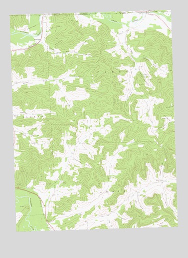
Bullis Mills, PA USGS Topographic Map
Click on map above to begin viewing in our Map Viewer.

This topographic map contains these locations and features:
Feature Name Type Latitude Longitude GNIS ID View Map
Annin CreekPopulated PlaceN41.9015°W78.2603°1202979View Map
Annin Creek School (historical)SchoolN41.9012°W78.2606°1200728View Map
Bullis MillsPopulated PlaceN41.9848°W78.3508°1170659View Map
CeresPopulated PlaceN41.9995°W78.2689°946333View Map
Ceres Post OfficePost OfficeN41.9998°W78.2686°2617855View Map
Ceres Post OfficePost OfficeN41.9998°W78.2686°2780779View Map
Champlin HollowValleyN41.9730°W78.2776°1171549View Map
Dutton HollowValleyN41.9901°W78.3458°1173667View Map
Evergreen CemeteryCemeteryN41.9876°W78.2915°1174373View Map
Finn HollowValleyN41.8840°W78.2965°1174768View Map
Fitzsimmons HollowValleyN41.9163°W78.3301°1174856View Map
Freefall Oz AirportAirportN41.9961°W78.2867°2442779View Map
Freefall Oz AirportAirportN41.9961°W78.2867°1194323View Map
George HollowValleyN41.9601°W78.2834°1175525View Map
Hakes HollowValleyN41.9320°W78.3641°1176373View Map
June HollowValleyN41.8987°W78.2622°1192699View Map
Kings RunStreamN41.9928°W78.2872°1178498View Map
Little Genesee CreekStreamN41.9892°W78.2500°1201683View Map
Little Genesee CreekStreamN41.9953°W78.2531°955541View Map
Long BranchStreamN41.8817°W78.3039°1179847View Map
Lower Kings Run SchoolSchoolN41.9765°W78.2831°1200730View Map
Lynch HollowValleyN41.9550°W78.2813°1180116View Map
McCrea RunStreamN41.9870°W78.3539°1180674View Map
Mix HollowValleyN41.9801°W78.3410°1181384View Map
Newell CreekStreamN41.8956°W78.3731°1182393View Map
Newell Creek SchoolSchoolN41.9328°W78.3072°1200729View Map
Open BrookStreamN41.8781°W78.3653°1183003View Map
Phoenix HollowValleyN41.9018°W78.2613°1183687View Map
Rock RunStreamN41.8762°W78.3589°1185286View Map
Rock Run School (historical)SchoolN41.8937°W78.3117°1200727View Map
Saint Marys ChurchChurchN41.9028°W78.3386°1186422View Map
SartwellPopulated PlaceN41.8798°W78.3497°1186985View Map
Sartwell Oil FieldOilfieldN41.9023°W78.3292°1186989View Map
Sheridan HollowValleyN41.9354°W78.2529°1187481View Map
Slack HollowValleyN41.9309°W78.3638°1187779View Map
Slippery Elm HollowValleyN41.9655°W78.2765°1187822View Map
Township of AnninCivilN41.8855°W78.2969°1216779View Map
Township of CeresCivilN41.9568°W78.2695°1216781View Map
Tubbs HollowValleyN41.8923°W78.2825°1189901View Map
Wesleyan ChurchChurchN41.9773°W78.3381°1190871View Map

Note: Coordinates in the location and feature list above are referenced to NAD83 datum.


Copyright (C) 2008-2025 Ryan Niemi / Sunset Dynamics ... All Rights Reserved