TopoQuest Logo
Do you find TopoQuest useful?
Help keep TopoQuest running and adding new maps/features by donating!
Bitcoin:  19c7KJd3qBynnjoSw5npx9KScwjBe4ifkT
Litecoin:  LXs6TkuXGGXo1vDsWCkWVdjQX94eUKd6ui
Home View Maps Find Maps Find Places Resources & Links


Powellsville, North Carolina Topographic Map

USGS Map Title: Powellsville, NC
USGS Map MRC: 36076B8
DRG (GeoTIFF) Download: o36076b8.tif


Neighboring USGS Topographic Map Quads:


  Union, NC  
36077C1
 

  Ahoskie, NC  
36076C8
 

  Harrellsville, NC  
36076C7
 

  Aulander, NC  
36077B1
 

  Powellsville, NC  
36076B8
 

  Colerain, NC  
36076B7
 

  Republican, NC  
36077A1
 

  Windsor North, NC  
36076A8
 

  Merry Hill, NC  
36076A7


Map MRC Location:

N37°
W77°
N37°
W76°
H8 H7 H6 H5 H4 H3 H2 H1
G8 G7 G6 G5 G4 G3 G2 G1
F8 F7 F6 F5 F4 F3 F2 F1
E8 E7 E6 E5 E4 E3 E2 E1
D8 D7 D6 D5 D4 D3 D2 D1
C8 C7 C6 C5 C4 C3 C2 C1
B8 B7 B6 B5 B4 B3 B2 B1
A8 A7 A6 A5 A4 A3 A2 A1
N36°
W77°
N36°
W76°

Powellsville, NC USGS 1:24K Topographic Map Preview:
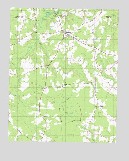
Powellsville, NC USGS Topographic Map
Click on map above to begin viewing in our Map Viewer.

This topographic map contains these locations and features:
Feature Name Type Latitude Longitude GNIS ID View Map
Beaverdam SwampStreamN36.1935°W76.9894°1025133View Map
Buzzards CrossroadsPopulated PlaceN36.1596°W76.8950°1003993View Map
CremoPopulated PlaceN36.1782°W76.9358°1003997View Map
Dragonfly FieldAirportN36.2398°W76.9727°2679111View Map
Eason SwampStreamN36.1688°W76.9894°984485View Map
Elm GrovePopulated PlaceN36.1360°W76.9077°1003995View Map
Elm Grove ChurchChurchN36.1385°W76.9066°1023509View Map
Highland Memorial CemeteryCemeteryN36.2432°W76.9444°1003957View Map
Holly GroveLocaleN36.1515°W76.9580°1006449View Map
Holly Grove ChurchChurchN36.1485°W76.9597°1003996View Map
Loosing SwampStreamN36.2188°W76.9686°997832View Map
Piney WoodLocaleN36.1743°W76.9622°1006450View Map
Piney Wood ChapelChurchN36.1752°W76.9597°1003998View Map
PowellsvillePopulated PlaceN36.2257°W76.9330°1022070View Map
Powellsville Post OfficePost OfficeN36.2259°W76.9321°2774105View Map
Powellsville Volunteer Fire DepartmentBuildingN36.2251°W76.9323°2639160View Map
Quioccosin SwampStreamN36.2188°W76.9686°997831View Map
Roundtree TempleChurchN36.2307°W76.9216°1003956View Map
Saint Marks ChurchChurchN36.1582°W76.8972°1003994View Map
Stony CreekStreamN36.2460°W76.9580°997830View Map
Stony Creek CemeteryCemeteryN36.2432°W76.9461°1003958View Map
Town of PowellsvilleCivilN36.2253°W76.9316°2407155View Map
White SchoolSchoolN36.2238°W76.9250°1004000View Map
Wildcat SwampStreamN36.1688°W76.9894°997299View Map

Note: Coordinates in the location and feature list above are referenced to NAD83 datum.


Copyright (C) 2008-2025 Ryan Niemi / Sunset Dynamics ... All Rights Reserved