TopoQuest Logo
Do you find TopoQuest useful?
Help keep TopoQuest running and adding new maps/features by donating!
Bitcoin:  19c7KJd3qBynnjoSw5npx9KScwjBe4ifkT
Litecoin:  LXs6TkuXGGXo1vDsWCkWVdjQX94eUKd6ui
Home View Maps Find Maps Find Places Resources & Links


Union, North Carolina Topographic Map

USGS Map Title: Union, NC
USGS Map MRC: 36077C1
DRG (GeoTIFF) Download: o36077c1.tif


Neighboring USGS Topographic Map Quads:


  Conway, NC  
36077D2
 

  Murfreesboro, NC  
36077D1
 

  Winton, NC  
36076D8
 

  Woodland, NC  
36077C2
 

  Union, NC  
36077C1
 

  Ahoskie, NC  
36076C8
 

  Kelford, NC  
36077B2
 

  Aulander, NC  
36077B1
 

  Powellsville, NC  
36076B8


Map MRC Location:

N37°
W78°
N37°
W77°
H8 H7 H6 H5 H4 H3 H2 H1
G8 G7 G6 G5 G4 G3 G2 G1
F8 F7 F6 F5 F4 F3 F2 F1
E8 E7 E6 E5 E4 E3 E2 E1
D8 D7 D6 D5 D4 D3 D2 D1
C8 C7 C6 C5 C4 C3 C2 C1
B8 B7 B6 B5 B4 B3 B2 B1
A8 A7 A6 A5 A4 A3 A2 A1
N36°
W78°
N36°
W77°

Union, NC USGS 1:24K Topographic Map Preview:
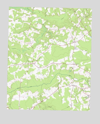
Union, NC USGS Topographic Map
Click on map above to begin viewing in our Map Viewer.

This topographic map contains these locations and features:
Feature Name Type Latitude Longitude GNIS ID View Map
Beechwood Country ClubLocaleN36.3649°W77.0083°980916View Map
Benthalls BridgeBridgeN36.3685°W77.0889°1003391View Map
Bluewater BranchStreamN36.3474°W77.0691°981641View Map
Buffalo IslandIslandN36.3574°W77.0566°1003393View Map
Chapel BranchStreamN36.3204°W77.1008°983003View Map
Cutawhiskie CreekStreamN36.3627°W77.0622°983867View Map
EarleysPopulated PlaceN36.2574°W77.0275°984477View Map
Elam Grove ChurchChurchN36.2640°W77.0666°984673View Map
Fort BranchStreamN36.2715°W77.1177°985318View Map
Fraziers CrossroadsPopulated PlaceN36.3065°W77.0250°1020361View Map
Indian CreekStreamN36.3457°W77.0700°987355View Map
Knee BranchStreamN36.2940°W77.0430°988039View Map
Knights BridgeBridgeN36.3713°W77.0261°1003394View Map
Livermans Mill (historical)LocaleN36.3543°W77.0727°1003392View Map
North Carolina State Highway Patrol Troop A District 2BuildingN36.2787°W77.0139°2130971View Map
Oak Grove ChurchChurchN36.2582°W77.0758°991399View Map
Old Tree SwampStreamN36.3621°W77.0677°991618View Map
Open Arms ChurchChurchN36.3215°W77.0700°2506207View Map
Poor TownPopulated PlaceN36.2804°W77.0252°1022031View Map
Ridgecroft SchoolSchoolN36.3542°W77.0099°993340View Map
Roanoke-Chowan Technical InstituteSchoolN36.3274°W77.0230°993424View Map
Saint JohnPopulated PlaceN36.3063°W77.0864°1022459View Map
Saint John Fire DepartmentBuildingN36.3061°W77.0890°2638484View Map
Saint Johns ChurchChurchN36.3049°W77.1122°993965View Map
Township of Saint JohnsCivilN36.3061°W77.1109°1026798View Map
Turkey CreekStreamN36.2810°W77.0725°996329View Map
UnionPopulated PlaceN36.3338°W77.0241°996416View Map
Union Baptist ChurchChurchN36.3351°W77.0240°2506291View Map
Union Rural Volunteer Fire DepartmentBuildingN36.3335°W77.0235°2639283View Map
Windsor Nursing Home School Street FacilityBuildingN36.3240°W77.0195°2505776View Map
WQDK-FM (Ahoskie)TowerN36.2796°W77.0327°1018343View Map
WRCS-AM (Ahoskie)TowerN36.2796°W77.0327°1018557View Map

Note: Coordinates in the location and feature list above are referenced to NAD83 datum.


Copyright (C) 2008-2025 Ryan Niemi / Sunset Dynamics ... All Rights Reserved