TopoQuest Logo
Do you find TopoQuest useful?
Help keep TopoQuest running and adding new maps/features by donating!
Bitcoin:  19c7KJd3qBynnjoSw5npx9KScwjBe4ifkT
Litecoin:  LXs6TkuXGGXo1vDsWCkWVdjQX94eUKd6ui
Home View Maps Find Maps Find Places Resources & Links


Merry Hill, North Carolina Topographic Map

USGS Map Title: Merry Hill, NC
USGS Map MRC: 36076A7
DRG (GeoTIFF) Download: o36076a7.tif


Neighboring USGS Topographic Map Quads:


  Powellsville, NC  
36076B8
 

  Colerain, NC  
36076B7
 

  Valhalla, NC  
36076B6
 

  Windsor North, NC  
36076A8
 

  Merry Hill, NC  
36076A7
 

  Edenhouse, NC  
36076A6
 

  Windsor South, NC  
35076H8
 

  Woodard, NC  
35076H7
 

  Westover, NC  
35076H6


Map MRC Location:

N37°
W77°
N37°
W76°
H8 H7 H6 H5 H4 H3 H2 H1
G8 G7 G6 G5 G4 G3 G2 G1
F8 F7 F6 F5 F4 F3 F2 F1
E8 E7 E6 E5 E4 E3 E2 E1
D8 D7 D6 D5 D4 D3 D2 D1
C8 C7 C6 C5 C4 C3 C2 C1
B8 B7 B6 B5 B4 B3 B2 B1
A8 A7 A6 A5 A4 A3 A2 A1
N36°
W77°
N36°
W76°

Merry Hill, NC USGS 1:24K Topographic Map Preview:
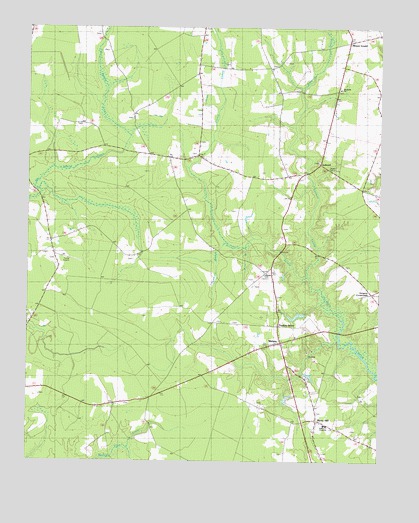
Merry Hill, NC USGS Topographic Map
Click on map above to begin viewing in our Map Viewer.

This topographic map contains these locations and features:
Feature Name Type Latitude Longitude GNIS ID View Map
AshlandPopulated PlaceN36.0860°W76.7799°1026086View Map
Bloody ForkLocaleN36.0546°W76.7902°1018712View Map
Capeharts ChurchChurchN36.0543°W76.7899°1000893View Map
Cricket SwampStreamN36.0532°W76.7752°1025269View Map
Dunmore BranchStreamN36.0629°W76.8038°1000876View Map
Eastmost SwampStreamN36.0532°W76.7752°1026022View Map
Flat SwampSwampN36.0793°W76.8727°1004842View Map
Gregory CrossroadsPopulated PlaceN36.0488°W76.7524°1026061View Map
Lawrence AcademySchoolN36.0099°W76.7691°1000877View Map
Merry - Hill Midway Volunteer Fire DepartmentBuildingN36.0357°W76.7854°2638160View Map
Merry HillPopulated PlaceN36.0118°W76.7724°1025519View Map
Merry Hill Post OfficePost OfficeN36.0114°W76.7715°2773801View Map
MidwayPopulated PlaceN36.0343°W76.7858°1025523View Map
Miller BranchStreamN36.0621°W76.7974°1000875View Map
Mount GouldPopulated PlaceN36.1196°W76.7630°1025562View Map
Riverside ChurchChurchN36.1074°W76.7641°1000894View Map
Taylors StorePopulated PlaceN36.0393°W76.7858°1026060View Map
Todds Airport (historical)AirportN36.0585°W76.8608°1000878View Map
Township of WhitesCivilN36.0809°W76.7846°1026418View Map

Note: Coordinates in the location and feature list above are referenced to NAD83 datum.


Copyright (C) 2008-2024 Ryan Niemi / Sunset Dynamics ... All Rights Reserved