TopoQuest Logo
Do you find TopoQuest useful?
Help keep TopoQuest running and adding new maps/features by donating!
Bitcoin:  19c7KJd3qBynnjoSw5npx9KScwjBe4ifkT
Litecoin:  LXs6TkuXGGXo1vDsWCkWVdjQX94eUKd6ui
Home View Maps Find Maps Find Places Resources & Links


Protem, Missouri Topographic Map

USGS Map Title: Protem, MO
USGS Map MRC: 36092E7
DRG (GeoTIFF) Download: o36092e7.tif


Neighboring USGS Topographic Map Quads:


  Hilda, MO  
36092F8
 

  Protem NE, MO  
36092F7
 

  Thornfield, MO  
36092F6
 

  Protem SW, MO  
36092E8
 

  Protem, MO  
36092E7
 

  Theodosia, MO  
36092E6
 

  Diamond City, AR  
36092D8
 

  Peel, AR  
36092D7
 

  Cotter NW, AR  
36092D6


Map MRC Location:

N37°
W93°
N37°
W92°
H8 H7 H6 H5 H4 H3 H2 H1
G8 G7 G6 G5 G4 G3 G2 G1
F8 F7 F6 F5 F4 F3 F2 F1
E8 E7 E6 E5 E4 E3 E2 E1
D8 D7 D6 D5 D4 D3 D2 D1
C8 C7 C6 C5 C4 C3 C2 C1
B8 B7 B6 B5 B4 B3 B2 B1
A8 A7 A6 A5 A4 A3 A2 A1
N36°
W93°
N36°
W92°

Protem, MO USGS 1:24K Topographic Map Preview:
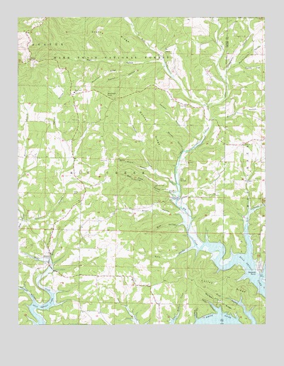
Protem, MO USGS Topographic Map
Click on map above to begin viewing in our Map Viewer.

This topographic map contains these locations and features:
Feature Name Type Latitude Longitude GNIS ID View Map
Bear Cave HollowValleyN36.5531°W92.7966°748730View Map
Big CreekStreamN36.5384°W92.7893°46524View Map
Big Creek School (historical)SchoolN36.5526°W92.7952°733654View Map
Blackjack KnobSummitN36.5934°W92.8299°748895View Map
Bonner RidgeRidgeN36.5787°W92.8068°748965View Map
Brown HollowValleyN36.5448°W92.7927°749040View Map
Cedar HollowValleyN36.5045°W92.7732°749300View Map
Coffee RidgeRidgeN36.5176°W92.7721°749399View Map
Dit CemeteryCemeteryN36.6078°W92.8046°749663View Map
East Fork Big CreekStreamN36.5878°W92.7785°749770View Map
Eslic HollowValleyN36.5317°W92.7868°749851View Map
Goetz RidgeRidgeN36.6192°W92.8268°750058View Map
Goldsbarry HollowValleyN36.6015°W92.7704°750066View Map
Gum HollowValleyN36.5409°W92.7913°750174View Map
Hampton HollowValleyN36.5570°W92.7952°750208View Map
Harris HollowValleyN36.6062°W92.7629°750241View Map
Helster School (historical)SchoolN36.5159°W92.8152°733655View Map
Henson HollowValleyN36.5751°W92.7835°750296View Map
Johnson HollowValleyN36.5090°W92.8668°750532View Map
Lick CreekStreamN36.5413°W92.7592°750709View Map
Little Buck CreekStreamN36.5031°W92.7954°51210View Map
Little Cedar HollowValleyN36.5020°W92.7846°750749View Map
Mail HollowValleyN36.6065°W92.8021°750909View Map
Mark Twain SchoolSchoolN36.5945°W92.8466°750933View Map
Merritt CemeteryCemeteryN36.5534°W92.8471°751024View Map
Moore HollowValleyN36.5634°W92.8093°751148View Map
Morris HollowValleyN36.5837°W92.7766°751161View Map
Murley HollowValleyN36.5706°W92.7913°751239View Map
NancePopulated PlaceN36.6109°W92.8002°751254View Map
Nance School (historical)SchoolN36.6103°W92.8032°733656View Map
Nolands PointCapeN36.5217°W92.7532°751325View Map
Nolands Point Seaplane BaseAirportN36.5156°W92.7502°758967View Map
OciePopulated PlaceN36.5587°W92.7591°751407View Map
Owens SpringSpringN36.5540°W92.7988°751461View Map
Patrick HollowValleyN36.6059°W92.8110°751507View Map
Pelham HollowValleyN36.5426°W92.8727°751536View Map
Pelham School (historical)SchoolN36.5751°W92.8513°733653View Map
ProtemPopulated PlaceN36.5290°W92.8588°751766View Map
Protem Fire Protection District Station 1BuildingN36.5297°W92.8593°2621028View Map
Protem Fire Protection District Station 2BuildingN36.5182°W92.7864°2620426View Map
Protem Post OfficePost OfficeN36.5288°W92.8592°2782877View Map
Racetrack RidgeRidgeN36.6026°W92.8316°751789View Map
RueterPopulated PlaceN36.6084°W92.8691°751981View Map
Salem ChurchChurchN36.5731°W92.7607°752008View Map
Schoolhouse SpringSpringN36.5512°W92.7938°752054View Map
Taber FieldAirportN36.6134°W92.7846°2679395View Map
Township of Big CreekCivilN36.5596°W92.8459°767454View Map
Tumbling CreekStreamN36.5503°W92.7949°752591View Map
Twin SpringsSpringN36.5590°W92.7932°752646View Map
Union ChurchChurchN36.5887°W92.7899°752655View Map
West Fork Big CreekStreamN36.5878°W92.7785°752813View Map
Wolf CemeteryCemeteryN36.5834°W92.8441°753966View Map
Wolfpen RidgeRidgeN36.5109°W92.7754°752963View Map
Worthington HollowValleyN36.6059°W92.7649°752982View Map

Note: Coordinates in the location and feature list above are referenced to NAD83 datum.


Copyright (C) 2008-2024 Ryan Niemi / Sunset Dynamics ... All Rights Reserved