TopoQuest Logo
Do you find TopoQuest useful?
Help keep TopoQuest running and adding new maps/features by donating!
Bitcoin:  19c7KJd3qBynnjoSw5npx9KScwjBe4ifkT
Litecoin:  LXs6TkuXGGXo1vDsWCkWVdjQX94eUKd6ui
Home View Maps Find Maps Find Places Resources & Links


Hartwell, Missouri Topographic Map

USGS Map Title: Hartwell, MO
USGS Map MRC: 38093D8
DRG (GeoTIFF) Download: o38093d8.tif


Neighboring USGS Topographic Map Quads:


  Quick City, MO  
38094E1
 

  Blairstown, MO  
38093E8
 

  Chilhowee, MO  
38093E7
 

  Creighton, MO  
38094D1
 

  Hartwell, MO  
38093D8
 

  Clinton North, MO  
38093D7
 

  Johnstown, MO  
38094C1
 

  Montrose, MO  
38093C8
 

  Clinton South, MO  
38093C7


Map MRC Location:

N39°
W94°
N39°
W93°
H8 H7 H6 H5 H4 H3 H2 H1
G8 G7 G6 G5 G4 G3 G2 G1
F8 F7 F6 F5 F4 F3 F2 F1
E8 E7 E6 E5 E4 E3 E2 E1
D8 D7 D6 D5 D4 D3 D2 D1
C8 C7 C6 C5 C4 C3 C2 C1
B8 B7 B6 B5 B4 B3 B2 B1
A8 A7 A6 A5 A4 A3 A2 A1
N38°
W94°
N38°
W93°

Hartwell, MO USGS 1:24K Topographic Map Preview:
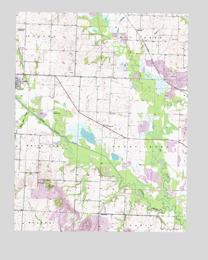
Hartwell, MO USGS Topographic Map
Click on map above to begin viewing in our Map Viewer.

This topographic map contains these locations and features:
Feature Name Type Latitude Longitude GNIS ID View Map
Big CreekStreamN38.3889°W93.8910°714155View Map
City of UrichCivilN38.4604°W93.9990°2397102View Map
Cornett School (historical)SchoolN38.4814°W93.9555°745462View Map
Enterprise School (historical)SchoolN38.4900°W93.9936°717612View Map
Fishing CreekStreamN38.3959°W93.9108°729739View Map
Ford BranchStreamN38.4670°W93.9066°718063View Map
HartwellPopulated PlaceN38.4353°W93.9347°719186View Map
Hartwell Census Designated PlaceCensusN38.4331°W93.9343°2587077View Map
Hartwell ChurchChurchN38.4431°W93.9316°719187View Map
Hartwell School (historical)SchoolN38.4430°W93.9315°745061View Map
Hickory Grove CemeteryCemeteryN38.4022°W93.9783°719456View Map
Hickory Grove School (historical)SchoolN38.4045°W93.9766°745461View Map
Holwell BranchStreamN38.4564°W93.9877°719741View Map
Honey CreekStreamN38.4457°W93.8981°719757View Map
Industry (historical)LocaleN38.4321°W93.9295°745065View Map
Kerns LakeReservoirN38.4677°W93.9611°763358View Map
Kerns Lake DamDamN38.4667°W93.9619°763357View Map
Lake George (historical)LakeN38.4627°W93.9139°739106View Map
Marvin School (historical)SchoolN38.3847°W93.9374°721945View Map
MaurinePopulated PlaceN38.4909°W93.9124°741045View Map
Mononame 107 LakeReservoirN38.3817°W93.9576°763030View Map
Morgan CemeteryCemeteryN38.4639°W93.8833°722613View Map
Nettelblad Lake DamDamN38.3815°W93.9576°763029View Map
Norris CemeteryCemeteryN38.4636°W93.9294°723426View Map
Old Channel South Grand RiverStreamN38.4317°W93.9711°723736View Map
Salem CemeteryCemeteryN38.4851°W93.8831°725925View Map
Township of Honey CreekCivilN38.4233°W93.9000°766743View Map
Urich CemeteryCemeteryN38.4789°W93.9960°728086View Map
Urich School (historical)SchoolN38.4622°W93.9988°745484View Map
Urich State Wildlife AreaParkN38.4864°W93.9472°745460View Map
Urich Volunteer Fire DepartmentBuildingN38.4647°W93.9991°2620312View Map
Victor School (historical)SchoolN38.4839°W93.8783°745463View Map
White Oak CreekStreamN38.4429°W93.9890°728748View Map
Willow BranchStreamN38.4806°W93.9191°728932View Map
Winchell (historical)LocaleN38.4234°W93.9097°745109View Map

Note: Coordinates in the location and feature list above are referenced to NAD83 datum.


Copyright (C) 2008-2025 Ryan Niemi / Sunset Dynamics ... All Rights Reserved