TopoQuest Logo
Do you find TopoQuest useful?
Help keep TopoQuest running and adding new maps/features by donating!
Bitcoin:  19c7KJd3qBynnjoSw5npx9KScwjBe4ifkT
Litecoin:  LXs6TkuXGGXo1vDsWCkWVdjQX94eUKd6ui
Home View Maps Find Maps Find Places Resources & Links


Quincy, California Topographic Map

USGS Map Title: Quincy, CA
USGS Map MRC: 39120H8
DRG (GeoTIFF) Download: o39120h8.tif


Neighboring USGS Topographic Map Quads:


  Twain, CA  
40121A1
 

  Crescent Mills, CA  
40120A8
 

  Taylorsville, CA  
40120A7
 

  Meadow Valley, CA  
39121H1
 

  Quincy, CA  
39120H8
 

  Spring Garden, CA  
39120H7
 

  Dogwood Peak, CA  
39121G1
 

  Onion Valley, CA  
39120G8
 

  Blue Nose Mountain, CA  
39120G7


Map MRC Location:

N40°
W121°
N40°
W120°
H8 H7 H6 H5 H4 H3 H2 H1
G8 G7 G6 G5 G4 G3 G2 G1
F8 F7 F6 F5 F4 F3 F2 F1
E8 E7 E6 E5 E4 E3 E2 E1
D8 D7 D6 D5 D4 D3 D2 D1
C8 C7 C6 C5 C4 C3 C2 C1
B8 B7 B6 B5 B4 B3 B2 B1
A8 A7 A6 A5 A4 A3 A2 A1
N39°
W121°
N39°
W120°

Quincy, CA USGS 1:24K Topographic Map Preview:
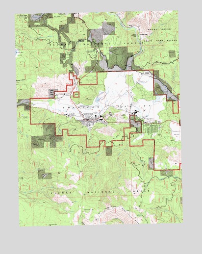
Quincy, CA USGS Topographic Map
Click on map above to begin viewing in our Map Viewer.

This topographic map contains these locations and features:
Feature Name Type Latitude Longitude GNIS ID View Map
American ValleyFlatN39.9466°W120.9269°256226View Map
Bachs Creek RidgeRidgeN39.8785°W120.9130°256403View Map
Bachs Ridge TrailTrailN39.8760°W120.9033°256404View Map
Berry CreekStreamN39.9774°W120.9013°256847View Map
Boyle RavineValleyN39.9299°W120.9452°257423View Map
California Highway Patrol QuincyBuildingN39.9372°W120.9394°2751100View Map
Cattle Spring MineMineN39.8752°W120.9783°258089View Map
Cedar MillPopulated PlaceN39.9441°W120.9233°1658242View Map
Chandler CreekStreamN39.9521°W120.8861°258195View Map
ClaremontSummitN39.8835°W120.9450°258393View Map
Claremont TrailTrailN39.8835°W120.9608°258394View Map
Clear StreamStreamN39.9552°W120.9305°258444View Map
Dublin Jack RavineValleyN39.9402°W120.9719°259591View Map
East Branch Mill CreekStreamN39.9196°W120.9175°259691View Map
East ClaremontSummitN39.8849°W120.9302°259698View Map
East Lawn CemeteryCemeteryN39.9336°W120.9102°1701352View Map
East QuincyPopulated PlaceN39.9341°W120.8980°1658463View Map
East Quincy Census Designated PlaceCensusN39.9164°W120.9189°2408033View Map
Elizabethtown FlatFlatN39.9571°W120.9563°259841View Map
Feather River Community College DistrictSchoolN39.9522°W120.9701°276514View Map
Feather River Experimental ForestForestN39.8896°W120.8894°266700View Map
Gansner CreekStreamN39.9388°W120.9600°260468View Map
Gansner FieldAirportN39.9442°W120.9516°1653843View Map
Gansner ParkParkN39.9457°W120.9516°1701361View Map
Gasner Park Picnic AreaLocaleN39.9463°W120.9550°276515View Map
Gilson CreekStreamN39.9927°W120.9188°260572View Map
Greenhorn CreekStreamN39.9682°W120.9152°260872View Map
Hungarian Placer MineMineN39.9396°W120.9938°261628View Map
Imperial MineMineN39.9824°W120.9591°261693View Map
Indian CemeteryCemeteryN39.9746°W120.9311°261715View Map
KNLF-FM (Quincy)TowerN39.9674°W120.8938°1663016View Map
KPCO-AM (Quincy)TowerN39.9482°W120.8994°1662695View Map
Little Blackhawk CreekStreamN39.9966°W120.9555°262544View Map
Middle Branch Mill CreekStreamN39.9193°W120.9175°263494View Map
Mill CreekStreamN39.9599°W120.9252°263587View Map
Newtown FlatFlatN39.9749°W120.9613°264079View Map
Newtown MineMineN39.9768°W120.9625°264080View Map
Oakland Recreation CampLocaleN39.9852°W120.9066°264299View Map
Peppard FlatFlatN39.9066°W120.8880°264644View Map
Pioneer Elementary SchoolSchoolN39.9357°W120.9052°264810View Map
Pioneer ParkParkN39.9354°W120.9141°1701384View Map
Plumas Christian SchoolSchoolN39.9374°W120.9386°1701385View Map
Plumas County CemeteryCemeteryN39.9485°W120.9427°1701387View Map
Plumas County CourthouseBuildingN39.9363°W120.9480°1701388View Map
Plumas County FairgroundsParkN39.9399°W120.9163°1701389View Map
Plumas County Law LibraryBuildingN39.9363°W120.9480°1701390View Map
PLumas County LibraryBuildingN39.9360°W120.9469°1701391View Map
Plumas County MuseumBuildingN39.9354°W120.9477°1701392View Map
Plumas County Sheriff's Office HeadquartersBuildingN39.9339°W120.9122°2751052View Map
Plumas District HospitalHospitalN39.9397°W120.9616°1701393View Map
Plumas District Hospital HeliportAirportN39.9402°W120.9602°1653845View Map
QuincyPopulated PlaceN39.9368°W120.9472°265113View Map
Quincy CemeteryCemeteryN39.9358°W120.9309°1701406View Map
Quincy Census Designated PlaceCensusN39.9310°W120.9549°2409118View Map
Quincy District Ranger OfficeLocaleN39.9327°W120.9083°276517View Map
Quincy Elementary SchoolSchoolN39.9338°W120.9455°1701407View Map
Quincy Fire Protection District Station 1 HeadquartersBuildingN39.9378°W120.9479°2621830View Map
Quincy Fire Protection District Station 2BuildingN39.9347°W120.9018°2622088View Map
Quincy Fire Protection District Station 3BuildingN39.9536°W120.8843°2622095View Map
Quincy Helitack Base HeliportAirportN39.9829°W120.9519°1653844View Map
Quincy JunctionPopulated PlaceN39.9632°W120.8983°1659450View Map
Quincy Junior-Senior High SchoolSchoolN39.9385°W120.9369°1701408View Map
Quincy Post OfficePost OfficeN39.9372°W120.9432°2783806View Map
Radio HillSummitN39.9404°W120.9286°265127View Map
Rockwell Park Recreational SiteLocaleN39.9374°W120.9133°276516View Map
SierraLocaleN39.9913°W120.9108°266157View Map
Silongkoyo (historical)Populated PlaceN39.9366°W120.9455°1701411View Map
Spanish CreekLocaleN39.9866°W120.9055°267545View Map
Taylor CreekStreamN39.9446°W120.8769°268101View Map
Tollgate CreekStreamN39.9824°W120.9069°268325View Map
West Branch Mill CreekStreamN39.9191°W120.9208°263586View Map
White CreekStreamN39.9427°W120.9780°268989View Map
Willow Creek TrailTrailN39.8852°W120.9222°269165View Map

Note: Coordinates in the location and feature list above are referenced to NAD83 datum.


Copyright (C) 2008-2024 Ryan Niemi / Sunset Dynamics ... All Rights Reserved