TopoQuest Logo
Do you find TopoQuest useful?
Help keep TopoQuest running and adding new maps/features by donating!
Bitcoin:  19c7KJd3qBynnjoSw5npx9KScwjBe4ifkT
Litecoin:  LXs6TkuXGGXo1vDsWCkWVdjQX94eUKd6ui
Home View Maps Find Maps Find Places Resources & Links


Ranger, West Virginia Topographic Map

USGS Map Title: Ranger, WV
USGS Map MRC: 38082A2
DRG (GeoTIFF) Download: o38082a2.tif


Neighboring USGS Topographic Map Quads:


  Nestlow, WV  
38082B3
 

  Branchland, WV  
38082B2
 

  Hager, WV  
38082B1
 

  Kiahsville, WV  
38082A3
 

  Ranger, WV  
38082A2
 

  Big Creek, WV  
38082A1
 

  Wilsondale, WV  
37082H3
 

  Trace, WV  
37082H2
 

  Chapmanville, WV  
37082H1


Map MRC Location:

N39°
W83°
N39°
W82°
H8 H7 H6 H5 H4 H3 H2 H1
G8 G7 G6 G5 G4 G3 G2 G1
F8 F7 F6 F5 F4 F3 F2 F1
E8 E7 E6 E5 E4 E3 E2 E1
D8 D7 D6 D5 D4 D3 D2 D1
C8 C7 C6 C5 C4 C3 C2 C1
B8 B7 B6 B5 B4 B3 B2 B1
A8 A7 A6 A5 A4 A3 A2 A1
N38°
W83°
N38°
W82°

Ranger, WV USGS 1:24K Topographic Map Preview:
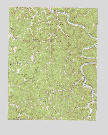
Ranger, WV USGS Topographic Map
Click on map above to begin viewing in our Map Viewer.

This topographic map contains these locations and features:
Feature Name Type Latitude Longitude GNIS ID View Map
Aarons CreekStreamN38.1104°W82.1674°1534781View Map
Aarons Creek ChurchChurchN38.1187°W82.1396°1534783View Map
Adkins CemeteryCemeteryN38.0323°W82.1287°1534820View Map
Adkins CemeteryCemeteryN38.0340°W82.1787°1534821View Map
Adkins CemeteryCemeteryN38.1176°W82.1671°1534824View Map
AtenvillePopulated PlaceN38.0482°W82.1429°1535068View Map
Atenville ChurchChurchN38.0640°W82.1596°1535069View Map
Atenville Elementary SchoolSchoolN38.0482°W82.1436°1741588View Map
Baker CemeteryCemeteryN38.1209°W82.1849°1741590View Map
Bearwallow BranchStreamN38.1220°W82.2368°1535430View Map
Beaver Pond BranchStreamN38.0801°W82.1443°1535452View Map
Bee BranchStreamN38.0870°W82.2032°1535477View Map
Bells Fishing Lake DamDamN38.0918°W82.1965°1558961View Map
Big BranchStreamN38.0162°W82.1368°1535805View Map
Big BranchStreamN38.0290°W82.1257°1535806View Map
Big Branch School (historical)SchoolN38.0137°W82.1554°1535811View Map
Big Harts CreekStreamN38.0290°W82.1304°1535848View Map
Big Laurel School (historical)SchoolN38.0623°W82.2357°1535882View Map
Big Ugly CreekStreamN38.0837°W82.1279°1535985View Map
Bolin (historical)Populated PlaceN38.1040°W82.1437°1741594View Map
Brewster CemeteryCemeteryN38.1215°W82.1404°1536325View Map
Bridge BranchStreamN38.0448°W82.1410°1536335View Map
Browning CemeteryCemeteryN38.0204°W82.1379°1536421View Map
Browns BranchStreamN38.0384°W82.1382°1536427View Map
Brumfield CemeteryCemeteryN38.0093°W82.1324°1536456View Map
Brumfield CemeteryCemeteryN38.0298°W82.1324°1536457View Map
Brumfield CemeteryCemeteryN38.0379°W82.1421°1536458View Map
Bryant ForkStreamN38.0045°W82.1887°1536534View Map
Caney BranchStreamN38.0051°W82.1318°1536997View Map
Chapman ChurchChurchN38.0259°W82.1304°1537205View Map
Coal BranchStreamN38.0101°W82.1329°1537440View Map
Coal Branch ChurchChurchN38.0087°W82.1340°1537441View Map
Coal Branch Church CemeteryCemeteryN38.0087°W82.1345°2727557View Map
Coal Branch School (historical)SchoolN38.0104°W82.1343°1537442View Map
Cove KnobSummitN38.0773°W82.2340°1554203View Map
Curry BranchStreamN38.0023°W82.1404°1537924View Map
Curry CemeteryCemeteryN38.0068°W82.1482°1537926View Map
CuzziePopulated PlaceN38.1237°W82.2213°1549651View Map
Cuzzie School (historical)SchoolN38.1234°W82.2221°1741610View Map
Dalton CemeteryCemeteryN38.0137°W82.1851°1537965View Map
Dalton ForkStreamN38.0634°W82.2382°1537967View Map
Dean CemeteryCemeteryN38.0993°W82.2093°1538094View Map
District 2CivilN38.0950°W82.1515°2727447View Map
Dry RunStreamN38.0540°W82.1454°1538371View Map
Dyer CemeteryCemeteryN38.0962°W82.2446°1538482View Map
East Fork ChurchChurchN38.0729°W82.1657°1538503View Map
East Fork Fourteenmile CreekStreamN38.1043°W82.1793°1538504View Map
Eden Park (historical)Populated PlaceN38.0584°W82.1460°1741615View Map
Fourteen (historical)Populated PlaceN38.0668°W82.1893°1741620View Map
Fourteenmile CreekStreamN38.1193°W82.1801°1539191View Map
Frances CreekStreamN38.0062°W82.2329°1539223View Map
Frye CemeteryCemeteryN38.0557°W82.1704°1539290View Map
Gartin ForkStreamN38.0320°W82.1843°1539353View Map
Gartin Knob Lookout TowerLocaleN38.0243°W82.2018°1741624View Map
Guyan ChurchChurchN38.0334°W82.1729°1539803View Map
Hamilton CreekStreamN38.0943°W82.1354°1539876View Map
Hampton CreekStreamN38.1029°W82.1443°1539893View Map
Harless BranchStreamN38.0426°W82.2163°1539958View Map
Hartland Coal Haul BridgeBridgeN38.0389°W82.1394°2647079View Map
HartsPopulated PlaceN38.0312°W82.1293°1540035View Map
Harts Census Designated PlaceCensusN38.0343°W82.1290°2389906View Map
Harts Creek BridgeBridgeN38.0296°W82.1308°2647081View Map
Harts High School (historical)SchoolN38.0214°W82.1281°1540037View Map
Harts Intermediate SchoolSchoolN38.0217°W82.1286°2489173View Map
Harts PondLakeN38.0229°W82.1299°1540038View Map
Harts Post OfficePost OfficeN38.0311°W82.1298°1741632View Map
Harts Primary School (historical)SchoolN38.0485°W82.1436°2489174View Map
Harts Volunteer Fire DepartmentBuildingN38.0300°W82.1300°2577895View Map
Harvey ForkStreamN38.0340°W82.1696°1540047View Map
Hatfield CemeteryCemeteryN38.1154°W82.1921°1540057View Map
Jones CemeteriesCemeteryN38.0537°W82.2382°1541011View Map
Lambert CemeteryCemeteryN38.0623°W82.1449°1541329View Map
Lattin (historical)Populated PlaceN38.0954°W82.1354°1741643View Map
Laurel ForkStreamN38.0326°W82.1710°1541431View Map
Lick BranchStreamN38.1115°W82.1807°1541851View Map
Lick ForkStreamN38.0537°W82.1568°1541892View Map
Lincoln Emergency Medical Services Harts SubstationBuildingN38.0629°W82.1611°2581182View Map
Little Harts ChurchChurchN38.0437°W82.1504°1542112View Map
Little Harts CreekStreamN38.0465°W82.1412°1542113View Map
Mann KnobSummitN38.0243°W82.2015°1542714View Map
Mann Knob CemeteryCemeteryN38.0265°W82.1982°1542715View Map
Mann Knob School (historical)SchoolN38.0207°W82.2001°1542716View Map
Maynard CemeteryCemeteryN38.0695°W82.1254°1542902View Map
McCoy CemeteryCemeteryN38.0898°W82.2424°1542962View Map
Montana ChurchChurchN38.0870°W82.1918°1543504View Map
Mountain Home ChurchChurchN38.0448°W82.2188°1543863View Map
Mudlick BranchStreamN38.0332°W82.1824°1543938View Map
Mullins CemeteryCemeteryN38.0395°W82.1374°1543999View Map
Murphy CemeteryCemeteryN38.1190°W82.2324°1544009View Map
Nelson CemeteryCemeteryN38.0645°W82.1293°1544088View Map
Nelson CemeteryCemeteryN38.0693°W82.1404°1544089View Map
Nelson CemeteryCemeteryN38.0723°W82.1465°1544090View Map
Nelson ForkStreamN38.0826°W82.2076°1544092View Map
New Salem ChurchChurchN38.0629°W82.2365°1544140View Map
Orchard Branch School (historical)SchoolN38.0890°W82.1915°1544437View Map
Pigpen BranchStreamN38.0382°W82.2388°1544841View Map
Plum BranchStreamN38.1240°W82.2218°1545055View Map
Pretty BranchStreamN38.0020°W82.1987°1545242View Map
RangerPopulated PlaceN38.1206°W82.1854°1545410View Map
Ranger Beam Span BridgeBridgeN38.1196°W82.1854°2647083View Map
Ranger Elementary SchoolSchoolN38.1220°W82.1910°1741667View Map
Ranger Post OfficePost OfficeN38.1207°W82.1876°1741668View Map
Road Fork School (historical)SchoolN38.0887°W82.2101°1545821View Map
Robinson CemeteryCemeteryN38.0020°W82.1410°1545861View Map
Rollem ForkStreamN38.0143°W82.2351°1546049View Map
Sandlick BranchStreamN38.0020°W82.1968°1546387View Map
Saunders CemeteryCemeteryN38.1181°W82.2043°1546451View Map
Saunders CemeteryCemeteryN38.1218°W82.1990°1546452View Map
Short Bend ForkStreamN38.0337°W82.1590°1546716View Map
Short Bend HollowValleyN38.0948°W82.1840°1546717View Map
Sias CemeteryCemeteryN38.0676°W82.2115°1546761View Map
Sias School (historical)SchoolN38.0654°W82.1904°1546763View Map
Spry CemeteryCemeteryN38.0045°W82.2088°1547284View Map
Steer ForkStreamN38.0865°W82.2043°1547373View Map
Sulphur Spring ForkStreamN38.0873°W82.1926°1547718View Map
Tomblin BranchStreamN38.0429°W82.2243°1548123View Map
Trough Fork School (historical)SchoolN38.0426°W82.2146°1548289View Map
Upper Tenmile ChurchChurchN38.1237°W82.2329°1548558View Map
Vance BranchStreamN38.0368°W82.2343°1548610View Map
Webb CemeteryCemeteryN38.0576°W82.2113°1548865View Map
West Fork Big Harts CreekStreamN38.0212°W82.1279°1548925View Map
WewantaPopulated PlaceN38.0884°W82.1926°1741691View Map
Witcher ForkStreamN38.0040°W82.2346°1549260View Map
Workman CemeteryCemeteryN38.0154°W82.2357°1549411View Map

Note: Coordinates in the location and feature list above are referenced to NAD83 datum.


Copyright (C) 2008-2025 Ryan Niemi / Sunset Dynamics ... All Rights Reserved