TopoQuest Logo
Do you find TopoQuest useful?
Help keep TopoQuest running and adding new maps/features by donating!
Bitcoin:  19c7KJd3qBynnjoSw5npx9KScwjBe4ifkT
Litecoin:  LXs6TkuXGGXo1vDsWCkWVdjQX94eUKd6ui
Home View Maps Find Maps Find Places Resources & Links


Ratcliffburg, Ohio Topographic Map

USGS Map Title: Ratcliffburg, OH
USGS Map MRC: 39082C6
DRG (GeoTIFF) Download: o39082c6.tif


Neighboring USGS Topographic Map Quads:


  Hallsville, OH  
39082D7
 

  Laurelville, OH  
39082D6
 

  South Bloomingville, OH  
39082D5
 

  Londonderry, OH  
39082C7
 

  Ratcliffburg, OH  
39082C6
 

  Allensville, OH  
39082C5
 

  Richmond Dale, OH  
39082B7
 

  Byer, OH  
39082B6
 

  Hamden, OH  
39082B5


Map MRC Location:

N40°
W83°
N40°
W82°
H8 H7 H6 H5 H4 H3 H2 H1
G8 G7 G6 G5 G4 G3 G2 G1
F8 F7 F6 F5 F4 F3 F2 F1
E8 E7 E6 E5 E4 E3 E2 E1
D8 D7 D6 D5 D4 D3 D2 D1
C8 C7 C6 C5 C4 C3 C2 C1
B8 B7 B6 B5 B4 B3 B2 B1
A8 A7 A6 A5 A4 A3 A2 A1
N39°
W83°
N39°
W82°

Ratcliffburg, OH USGS 1:24K Topographic Map Preview:
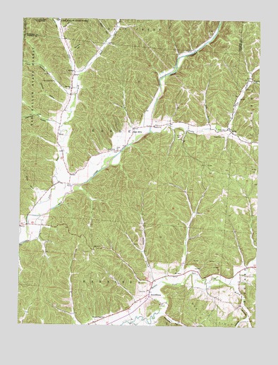
Ratcliffburg, OH USGS Topographic Map
Click on map above to begin viewing in our Map Viewer.

This topographic map contains these locations and features:
Feature Name Type Latitude Longitude GNIS ID View Map
Allen HollowValleyN39.3687°W82.7046°1037372View Map
Beech Grove School (historical)SchoolN39.3059°W82.6518°1051903View Map
Brown HollowValleyN39.3040°W82.7418°1038374View Map
Clark HollowValleyN39.3442°W82.7268°1039139View Map
Clark School (historical)SchoolN39.2509°W82.7113°1051907View Map
Conway HollowValleyN39.3395°W82.7285°1039328View Map
Cox (historical)Populated PlaceN39.2995°W82.7407°1051910View Map
Dry BranchStreamN39.3309°W82.6510°1039798View Map
Eagle Chapel (historical)ChurchN39.2962°W82.6566°1051912View Map
Eagle MillsPopulated PlaceN39.3287°W82.6921°1062742View Map
Eagle SchoolSchoolN39.3217°W82.7010°1039926View Map
East Fork Pike RunStreamN39.3520°W82.7210°1039955View Map
Headleg HollowValleyN39.2534°W82.6299°1041436View Map
High Hill School (historical)SchoolN39.3087°W82.6821°1960310View Map
JimtownPopulated PlaceN39.3534°W82.7229°1064913View Map
Kelley BranchStreamN39.2676°W82.6385°1056370View Map
Laurelville Fire Department Station 3BuildingN39.3433°W82.6809°2550323View Map
Lebanon CemeteryCemeteryN39.3317°W82.6799°1961641View Map
Lebanon ChurchChurchN39.3315°W82.6810°1042464View Map
Lipscomb HollowValleyN39.3331°W82.7343°1042611View Map
Mace HollowValleyN39.3709°W82.7288°1042863View Map
Macedonia ChurchChurchN39.3501°W82.6274°1042865View Map
McGee CemeteryCemeteryN39.3267°W82.6674°1043168View Map
Morrison HollowValleyN39.3617°W82.7243°1043499View Map
North Branch Pretty RunStreamN39.3309°W82.6427°1076525View Map
Persimmon School (historical)SchoolN39.2695°W82.6332°1051923View Map
Pike RunStreamN39.2948°W82.7441°1044438View Map
Pike Run CemeteryCemeteryN39.3467°W82.7241°1961652View Map
Pike Run ChurchChurchN39.3465°W82.7241°1044441View Map
Pilgrim ChurchChurchN39.2820°W82.7110°1044447View Map
Pine Ridge School (historical)SchoolN39.2712°W82.7154°1051924View Map
Pleasant Valley ChurchChurchN39.2534°W82.7046°1044598View Map
Ponetown HollowValleyN39.2548°W82.6729°1044679View Map
Pretty RunStreamN39.3298°W82.6821°1076687View Map
RatcliffburgPopulated PlaceN39.2628°W82.6813°1062960View Map
Saint Pauls Church (historical)ChurchN39.3628°W82.7093°1051927View Map
Salt Spring CemeteryCemeteryN39.2712°W82.6321°1045923View Map
Scott CemeteryCemeteryN39.2639°W82.6827°1046053View Map
Slagle CemeteryCemeteryN39.3299°W82.6427°1046328View Map
Slagle Farm CemeteryCemeteryN39.3281°W82.6435°1046329View Map
Stevens BranchStreamN39.2659°W82.6791°1046679View Map
Tar HollowValleyN39.3726°W82.7324°1046950View Map
Timmons School (historical)SchoolN39.3128°W82.7193°1051930View Map
Township of EagleCivilN39.3249°W82.6991°1087101View Map
Union CemeteryCemeteryN39.3214°W82.6991°1961662View Map
Union ChurchChurchN39.3215°W82.6996°1047310View Map

Note: Coordinates in the location and feature list above are referenced to NAD83 datum.


Copyright (C) 2008-2024 Ryan Niemi / Sunset Dynamics ... All Rights Reserved