TopoQuest Logo
Do you find TopoQuest useful?
Help keep TopoQuest running and adding new maps/features by donating!
Bitcoin:  19c7KJd3qBynnjoSw5npx9KScwjBe4ifkT
Litecoin:  LXs6TkuXGGXo1vDsWCkWVdjQX94eUKd6ui
Home View Maps Find Maps Find Places Resources & Links


Allensville, Ohio Topographic Map

USGS Map Title: Allensville, OH
USGS Map MRC: 39082C5
DRG (GeoTIFF) Download: o39082c5.tif


Neighboring USGS Topographic Map Quads:


  Laurelville, OH  
39082D6
 

  South Bloomingville, OH  
39082D5
 

  New Plymouth, OH  
39082D4
 

  Ratcliffburg, OH  
39082C6
 

  Allensville, OH  
39082C5
 

  Zaleski, OH  
39082C4
 

  Byer, OH  
39082B6
 

  Hamden, OH  
39082B5
 

  McArthur, OH  
39082B4


Map MRC Location:

N40°
W83°
N40°
W82°
H8 H7 H6 H5 H4 H3 H2 H1
G8 G7 G6 G5 G4 G3 G2 G1
F8 F7 F6 F5 F4 F3 F2 F1
E8 E7 E6 E5 E4 E3 E2 E1
D8 D7 D6 D5 D4 D3 D2 D1
C8 C7 C6 C5 C4 C3 C2 C1
B8 B7 B6 B5 B4 B3 B2 B1
A8 A7 A6 A5 A4 A3 A2 A1
N39°
W83°
N39°
W82°

Allensville, OH USGS 1:24K Topographic Map Preview:
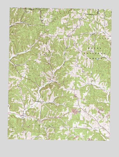
Allensville, OH USGS Topographic Map
Click on map above to begin viewing in our Map Viewer.

This topographic map contains these locations and features:
Feature Name Type Latitude Longitude GNIS ID View Map
AllensvillePopulated PlaceN39.2726°W82.6068°1075254View Map
Allensville Elementary SchoolSchoolN39.2720°W82.6085°1051900View Map
Anderson School (historical)SchoolN39.3590°W82.6196°1051901View Map
Bell CemeteryCemeteryN39.2764°W82.6068°1075341View Map
Bray HollowValleyN39.3259°W82.5579°1075441View Map
Browns School (historical)SchoolN39.3551°W82.5804°1051904View Map
Centenary CemeteryCemeteryN39.3137°W82.5517°1075549View Map
Centenary Church (historical)ChurchN39.3131°W82.5518°1051905View Map
Center School (historical)SchoolN39.3273°W82.5754°1051906View Map
Chestnut Grove CemeteryCemeteryN39.3703°W82.6054°1961636View Map
Chestnut Grove ChurchChurchN39.3709°W82.6060°1075571View Map
Curry CemeteryCemeteryN39.2978°W82.5437°1075664View Map
Curry School (historical)SchoolN39.2981°W82.5432°1960308View Map
Garrett CemeteryCemeteryN39.2987°W82.6117°1075896View Map
Garrett RidgeRidgeN39.2934°W82.6099°1961639View Map
Goosetown (historical)Populated PlaceN39.3712°W82.6054°1062147View Map
Greenbrier School (historical)SchoolN39.3040°W82.6199°1960309View Map
Locust Grove CemeteryCemeteryN39.3492°W82.5521°1961642View Map
Locust Grove RidgeRidgeN39.3345°W82.5393°1077333View Map
Low GapGapN39.3417°W82.5453°1076312View Map
Middle Fork Salt CreekStreamN39.2742°W82.6246°1077321View Map
Miller School (historical)SchoolN39.2612°W82.5082°1051919View Map
Million School (historical)SchoolN39.3567°W82.5440°1051920View Map
Mount Olive CemeteryCemeteryN39.2868°W82.5876°1961645View Map
Mount Olive ChurchChurchN39.2862°W82.5879°1076453View Map
Mount Olive Road Covered BridgeBridgeN39.2862°W82.5888°1084344View Map
Otterbein CemeteryCemeteryN39.3587°W82.5804°1961651View Map
Otterbein ChapelChurchN39.3584°W82.5827°1076582View Map
Papaw School (historical)SchoolN39.2765°W82.5363°1051922View Map
Pawpaw CemeteryCemeteryN39.2770°W82.5374°1076604View Map
Pleasant Chapel (historical)ChurchN39.2545°W82.5321°1051925View Map
Riley RunStreamN39.2706°W82.6057°1076742View Map
Riley School (historical)SchoolN39.2712°W82.5732°1051926View Map
Robb School (historical)SchoolN39.2984°W82.5046°1960311View Map
RoyalPopulated PlaceN39.3059°W82.5729°1063406View Map
Shively School (historical)SchoolN39.3259°W82.5410°1051929View Map
Spunk CemeteryCemeteryN39.3626°W82.5855°1076951View Map
StellaPopulated PlaceN39.3487°W82.5518°1076965View Map
Township of JacksonCivilN39.3292°W82.5801°1087104View Map
Vandiford School (historical)SchoolN39.3253°W82.6241°1051931View Map
Walnut Grove CemeteryCemeteryN39.3212°W82.6157°1961664View Map
Walnut Grove ChurchChurchN39.3206°W82.6157°1077134View Map
Wolf CemeteryCemeteryN39.3426°W82.6221°1077221View Map

Note: Coordinates in the location and feature list above are referenced to NAD83 datum.


Copyright (C) 2008-2025 Ryan Niemi / Sunset Dynamics ... All Rights Reserved