TopoQuest Logo
Do you find TopoQuest useful?
Help keep TopoQuest running and adding new maps/features by donating!
Bitcoin:  19c7KJd3qBynnjoSw5npx9KScwjBe4ifkT
Litecoin:  LXs6TkuXGGXo1vDsWCkWVdjQX94eUKd6ui
Home View Maps Find Maps Find Places Resources & Links


Singers Glen, Virginia Topographic Map

USGS Map Title: Singers Glen, VA
USGS Map MRC: 38078E8
DRG (GeoTIFF) Download: o38078e8.tif


Neighboring USGS Topographic Map Quads:


  Cow Knob, VA  
38079F1
 

  Fulks Run, VA  
38078F8
 

  Timberville, VA  
38078F7
 

  Rawley Springs, VA  
38079E1
 

  Singers Glen, VA  
38078E8
 

  Broadway, VA  
38078E7
 

  Briery Branch, VA  
38079D1
 

  Bridgewater, VA  
38078D8
 

  Harrisonburg, VA  
38078D7


Map MRC Location:

N39°
W79°
N39°
W78°
H8 H7 H6 H5 H4 H3 H2 H1
G8 G7 G6 G5 G4 G3 G2 G1
F8 F7 F6 F5 F4 F3 F2 F1
E8 E7 E6 E5 E4 E3 E2 E1
D8 D7 D6 D5 D4 D3 D2 D1
C8 C7 C6 C5 C4 C3 C2 C1
B8 B7 B6 B5 B4 B3 B2 B1
A8 A7 A6 A5 A4 A3 A2 A1
N38°
W79°
N38°
W78°

Singers Glen, VA USGS 1:24K Topographic Map Preview:
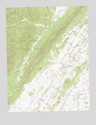
Singers Glen, VA USGS Topographic Map
Click on map above to begin viewing in our Map Viewer.

This topographic map contains these locations and features:
Feature Name Type Latitude Longitude GNIS ID View Map
Antioch ChurchChurchN38.5054°W78.8917°1481328View Map
Birch Lane DairyLocaleN38.5011°W78.9258°2675277View Map
Black Lick RunStreamN38.6110°W78.9731°1481826View Map
Broadway QuarryMineN38.6039°W78.8856°2724887View Map
Buck Lick MountainSummitN38.5976°W78.9620°1499175View Map
Buck Lick RunStreamN38.6040°W78.9542°1482117View Map
Central DistrictCivilN38.5094°W78.9792°1927141View Map
Cross Mountain RunStreamN38.6060°W78.9570°1482853View Map
Fairview ChurchChurchN38.5087°W78.9411°1483334View Map
Frog HollowValleyN38.5596°W78.8940°1483552View Map
Gospel Hill ChurchChurchN38.5485°W78.9809°1483721View Map
Green HillSummitN38.5498°W78.8906°1483798View Map
Green MountPopulated PlaceN38.5196°W78.8909°1499493View Map
Green Mount CemeteryCemeteryN38.5184°W78.9014°1483805View Map
Green Mount ChurchChurchN38.5148°W78.8925°1483806View Map
Hogpen RunStreamN38.5907°W78.9481°1484147View Map
Hopkins GapGapN38.5348°W78.9761°1484211View Map
Hopkins RidgeRidgeN38.5126°W78.9236°1484213View Map
Linville DistrictCivilN38.5683°W78.9051°1927376View Map
Little Hogpen RunStreamN38.5832°W78.9764°1484913View Map
Long RunStreamN38.5704°W78.9648°1485066View Map
Morning View ChurchChurchN38.5860°W78.9086°1485556View Map
Mount Zion ChurchChurchN38.5729°W78.8884°1485670View Map
Mountain Breeze FarmLocaleN38.5319°W78.9464°2675361View Map
Near HollowValleyN38.6018°W78.8753°1485811View Map
PalosPopulated PlaceN38.5729°W78.9653°1499836View Map
Rockingham CountyCivilN38.5120°W78.8758°1488970View Map
Round HillSummitN38.5351°W78.9098°1486786View Map
Saint Johns ChurchChurchN38.5312°W78.9334°1486856View Map
Singers GlenPopulated PlaceN38.5526°W78.9134°1500110View Map
Singers Glen Historic DistrictParkN38.5532°W78.9136°1779342View Map
Singers Glen Post OfficePost OfficeN38.5528°W78.9135°2766293View Map
Singers Glen Volunteer Fire CompanyBuildingN38.5481°W78.9195°2086023View Map
Singers Glen Volunteer Rescue SquadBuildingN38.5486°W78.9201°2086025View Map
Slate Lick BranchStreamN38.5998°W78.9378°1487299View Map
Snapp CreekStreamN38.5054°W78.9431°1487362View Map
Sparkling SpringsPopulated PlaceN38.5515°W78.9517°1500136View Map
Stony RunStreamN38.5657°W78.9711°1487634View Map
Stultz MillPopulated PlaceN38.5140°W78.9484°1500185View Map
The RidgesRidgeN38.6135°W78.9409°1487850View Map
Thompson GapGapN38.5096°W78.9245°1487883View Map
WLTK-FM (Broadway)TowerN38.5640°W78.9498°1498971View Map
WMRA-FM (Harrisonburg)TowerN38.5640°W78.9498°1498991View Map
WMRA-FM (Harrisonburg)TowerN38.5612°W78.9486°1498992View Map
Zion Hill ChurchChurchN38.5576°W78.9384°1487144View Map

Note: Coordinates in the location and feature list above are referenced to NAD83 datum.


Copyright (C) 2008-2024 Ryan Niemi / Sunset Dynamics ... All Rights Reserved