TopoQuest Logo
Do you find TopoQuest useful?
Help keep TopoQuest running and adding new maps/features by donating!
Bitcoin:  19c7KJd3qBynnjoSw5npx9KScwjBe4ifkT
Litecoin:  LXs6TkuXGGXo1vDsWCkWVdjQX94eUKd6ui
Home View Maps Find Maps Find Places Resources & Links


Phillips Butte, Montana Topographic Map

USGS Map Title: Phillips Butte, MT
USGS Map MRC: 45105C8
DRG (GeoTIFF) Download: o45105c8.tif


Neighboring USGS Topographic Map Quads:


  Yager Butte, MT  
45106D1
 

  Threemile Buttes, MT  
45105D8
 

  Sonnette, MT  
45105D7
 

  Goodspeed Butte, MT  
45106C1
 

  Phillips Butte, MT  
45105C8
 

  Hodsdon Flats, MT  
45105C7
 

  Reanus Cone, MT  
45106B1
 

  Sayle, MT  
45105B8
 

  Bloom Creek, MT  
45105B7


Map MRC Location:

N46°
W106°
N46°
W105°
H8 H7 H6 H5 H4 H3 H2 H1
G8 G7 G6 G5 G4 G3 G2 G1
F8 F7 F6 F5 F4 F3 F2 F1
E8 E7 E6 E5 E4 E3 E2 E1
D8 D7 D6 D5 D4 D3 D2 D1
C8 C7 C6 C5 C4 C3 C2 C1
B8 B7 B6 B5 B4 B3 B2 B1
A8 A7 A6 A5 A4 A3 A2 A1
N45°
W106°
N45°
W105°

Phillips Butte, MT USGS 1:24K Topographic Map Preview:
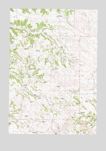
Phillips Butte, MT USGS Topographic Map
Click on map above to begin viewing in our Map Viewer.

This topographic map contains these locations and features:
Feature Name Type Latitude Longitude GNIS ID View Map
Anderson ReservoirReservoirN45.2858°W105.9269°779039View Map
Basin ReservoirReservoirN45.3330°W105.9627°779425View Map
Canyon ReservoirReservoirN45.3340°W105.9950°780920View Map
Canyon SpringSpringN45.3420°W105.9972°780921View Map
Coal Hollow SpringSpringN45.3208°W105.9981°781453View Map
Coal Mine SpringSpringN45.3224°W105.9494°781457View Map
Crowfoot ReservoirReservoirN45.2978°W105.9328°781936View Map
Deadman SpringSpringN45.2905°W105.8753°782159View Map
Elk Creek Reservoir Number OneReservoirN45.3678°W105.9271°783075View Map
Elk Creek SpringSpringN45.3561°W105.9987°783079View Map
Halfway ReservoirReservoirN45.2988°W105.9799°784476View Map
Lyon Creek Divide ReservoirReservoirN45.3147°W105.9727°786742View Map
Lyon Creek SpringSpringN45.3018°W105.9508°786743View Map
Mason Prong SpringSpringN45.2672°W105.9117°786916View Map
Mason ReservoirReservoirN45.2598°W105.8809°786917View Map
May SpringsSpringN45.2608°W105.9997°786958View Map
Mud Turtle ReservoirReservoirN45.2815°W105.9696°799863View Map
Mud Turtle SpringSpringN45.2820°W105.9700°787819View Map
North Fork Elk CreekStreamN45.3522°W105.9547°788153View Map
North Fork Taylor Creek WellWellN45.2725°W105.9978°788260View Map
Phillips ButteSummitN45.2678°W105.9764°788816View Map
Pierce ReservoirReservoirN45.2857°W105.9550°788846View Map
Pierce SpringSpringN45.2887°W105.9618°788847View Map
Red Shale SpringSpringN45.3092°W105.9845°789489View Map
Rock SpringSpringN45.3348°W105.9794°789713View Map
Rocky Crossing ReservoirReservoirN45.2516°W105.9598°789728View Map
Sand Rock ReservoirReservoirN45.3069°W105.9739°790005View Map
Schwind SpringSpringN45.3480°W105.9754°790147View Map
Skull SpringsSpringN45.2714°W105.8964°790610View Map
Slough Grass ReservoirReservoirN45.2625°W105.9539°790691View Map
Snell SpringSpringN45.3369°W105.9307°790766View Map
South Fork Elk CreekStreamN45.3522°W105.9547°790958View Map
Two Trough SpringSpringN45.3157°W105.9358°792566View Map
Willow SpringSpringN45.2830°W105.8883°793377View Map

Note: Coordinates in the location and feature list above are referenced to NAD83 datum.


Copyright (C) 2008-2025 Ryan Niemi / Sunset Dynamics ... All Rights Reserved