TopoQuest Logo
Do you find TopoQuest useful?
Help keep TopoQuest running and adding new maps/features by donating!
Bitcoin:  19c7KJd3qBynnjoSw5npx9KScwjBe4ifkT
Litecoin:  LXs6TkuXGGXo1vDsWCkWVdjQX94eUKd6ui
Home View Maps Find Maps Find Places Resources & Links


Reed Mountain, Arkansas Topographic Map

USGS Map Title: Reed Mountain, AR
USGS Map MRC: 34093E5
DRG (GeoTIFF) Download: o34093e5.tif


Neighboring USGS Topographic Map Quads:


  Sims, AR  
34093F6
 

  Story, AR  
34093F5
 

  Fannie, AR  
34093F4
 

  Mount Ida, AR  
34093E6
 

  Reed Mountain, AR  
34093E5
 

  McGraw Mountain, AR  
34093E4
 

  Norman, AR  
34093D6
 

  Caddo Gap, AR  
34093D5
 

  Bonnerdale, AR  
34093D4


Map MRC Location:

N35°
W94°
N35°
W93°
H8 H7 H6 H5 H4 H3 H2 H1
G8 G7 G6 G5 G4 G3 G2 G1
F8 F7 F6 F5 F4 F3 F2 F1
E8 E7 E6 E5 E4 E3 E2 E1
D8 D7 D6 D5 D4 D3 D2 D1
C8 C7 C6 C5 C4 C3 C2 C1
B8 B7 B6 B5 B4 B3 B2 B1
A8 A7 A6 A5 A4 A3 A2 A1
N34°
W94°
N34°
W93°

Reed Mountain, AR USGS 1:24K Topographic Map Preview:
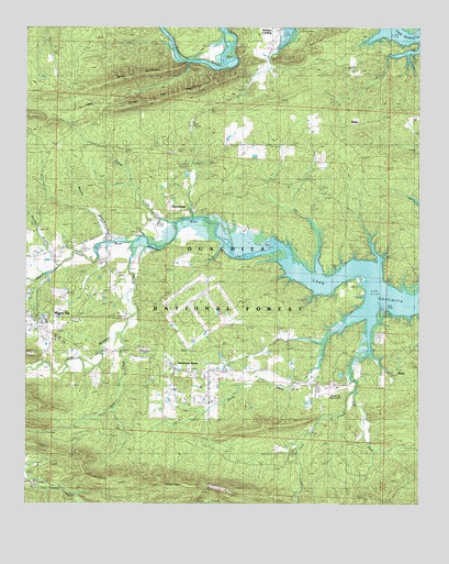
Reed Mountain, AR USGS Topographic Map
Click on map above to begin viewing in our Map Viewer.

This topographic map contains these locations and features:
Feature Name Type Latitude Longitude GNIS ID View Map
All Saints Catholic ChurchChurchN34.5504°W93.6249°63440View Map
Alley CemeteryCemeteryN34.5181°W93.5332°63441View Map
Barnes BranchStreamN34.5615°W93.6152°76235View Map
Bearce AirportAirportN34.5297°W93.5307°74602View Map
Big Fir CemeteryCemeteryN34.6051°W93.5055°63450View Map
Big Fir School (historical)SchoolN34.6054°W93.5046°63451View Map
Blish CemeteryCemeteryN34.5345°W93.5194°70722View Map
Blue Bell School (historical)SchoolN34.6134°W93.5524°63457View Map
Buddys LandingPopulated PlaceN34.6243°W93.5432°70908View Map
East Fork Twin CreekStreamN34.5298°W93.5207°71512View Map
Elnora School (historical)SchoolN34.5456°W93.5110°63478View Map
Gardner MountainRidgeN34.5026°W93.5924°71728View Map
Hovel CreekStreamN34.5737°W93.5774°72094View Map
Hurricane GrovePopulated PlaceN34.5357°W93.5777°74604View Map
Hurricane Grove Primitive Baptist ChurchChurchN34.5343°W93.5780°63510View Map
Hurricane Grove School (historical)SchoolN34.5348°W93.5769°63511View Map
James CemeteryCemeteryN34.5690°W93.5216°63516View Map
Jones CemeteryCemeteryN34.5701°W93.5921°77385View Map
Lake Ouachita Baptist ChurchChurchN34.5318°W93.5252°63522View Map
Little Fir CemeteryCemeteryN34.6051°W93.5046°72390View Map
McKinney CemeteryCemeteryN34.5706°W93.5463°72606View Map
Mount Ida Elementary SchoolSchoolN34.5516°W93.6154°2039277View Map
Music CemeteryCemeteryN34.5940°W93.6082°63564View Map
Ouachita Seed OrchardLocaleN34.5504°W93.5699°74605View Map
Piney CemeteryCemeteryN34.6195°W93.6149°63593View Map
Piney Grove School (historical)SchoolN34.6154°W93.6163°63594View Map
Reed MountainRidgeN34.6062°W93.5816°73269View Map
Rogers CreekStreamN34.5451°W93.5952°78209View Map
RubiePopulated PlaceN34.5987°W93.5246°74607View Map
RublePopulated PlaceN34.6001°W93.5207°63614View Map
Shady CreekStreamN34.5470°W93.5238°73518View Map
Shady Grove School (historical)SchoolN34.5354°W93.5607°63620View Map
SilverPopulated PlaceN34.5348°W93.5102°78366View Map
South Fork Ouachita RiverStreamN34.5645°W93.5524°73651View Map
South Fork Volunteer Fire DepartmentBuildingN34.5304°W93.5281°2117139View Map
Stanley CemeteryCemeteryN34.5418°W93.6185°78445View Map
Sweet Home School (historical)SchoolN34.5765°W93.5780°63631View Map
SweethomePopulated PlaceN34.5765°W93.5796°63632View Map
Sweethome CemeteryCemeteryN34.5754°W93.5821°63633View Map
Sweethome ChurchChurchN34.5751°W93.5819°78515View Map
Township of CenterCivilN34.5386°W93.5007°68885View Map
Township of Mount IdaCivilN34.5815°W93.6019°1954011View Map
Twin CreekStreamN34.5476°W93.5157°73924View Map
Twin Creek Recreation SiteLocaleN34.5506°W93.5116°74603View Map
Twin Creek Use AreaParkN34.5504°W93.5099°63638View Map
Washita Missionary Baptist ChurchChurchN34.6054°W93.5610°63645View Map
Whittington CemeteryCemeteryN34.5676°W93.6119°63649View Map
Whittington CemeteryCemeteryN34.5684°W93.6119°74140View Map
Whittington-Hiram CemeteryCemeteryN34.5629°W93.6024°63650View Map
Wolf MountainSummitN34.6112°W93.5957°74191View Map
Womble Ranger StationLocaleN34.5426°W93.6146°74608View Map
Womble Work CenterLocaleN34.5440°W93.6155°74609View Map
Woods BranchStreamN34.5684°W93.5985°78804View Map
Woodville School (historical)SchoolN34.5590°W93.5107°63653View Map

Note: Coordinates in the location and feature list above are referenced to NAD83 datum.


Copyright (C) 2008-2025 Ryan Niemi / Sunset Dynamics ... All Rights Reserved