TopoQuest Logo
Do you find TopoQuest useful?
Help keep TopoQuest running and adding new maps/features by donating!
Bitcoin:  19c7KJd3qBynnjoSw5npx9KScwjBe4ifkT
Litecoin:  LXs6TkuXGGXo1vDsWCkWVdjQX94eUKd6ui
Home View Maps Find Maps Find Places Resources & Links


Reform SW, Alabama Topographic Map

USGS Map Title: Reform SW, AL
USGS Map MRC: 33088C2
DRG (GeoTIFF) Download: o33088c2.tif


Neighboring USGS Topographic Map Quads:


  New Hope, MS  
33088D3
 

  Ethelsville, AL  
33088D2
 

  Reform, AL  
33088D1
 

  Forreston, MS  
33088C3
 

  Reform SW, AL  
33088C2
 

  Carrollton, AL  
33088C1
 

  Pickensville, AL  
33088B3
 

  Aliceville North, AL  
33088B2
 

  Cunningham, AL  
33088B1


Map MRC Location:

N34°
W89°
N34°
W88°
H8 H7 H6 H5 H4 H3 H2 H1
G8 G7 G6 G5 G4 G3 G2 G1
F8 F7 F6 F5 F4 F3 F2 F1
E8 E7 E6 E5 E4 E3 E2 E1
D8 D7 D6 D5 D4 D3 D2 D1
C8 C7 C6 C5 C4 C3 C2 C1
B8 B7 B6 B5 B4 B3 B2 B1
A8 A7 A6 A5 A4 A3 A2 A1
N33°
W89°
N33°
W88°

Reform SW, AL USGS 1:24K Topographic Map Preview:
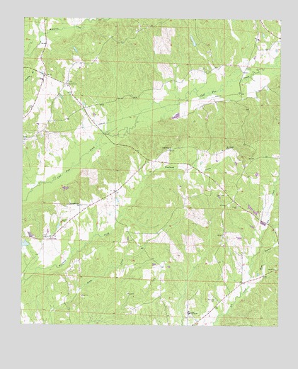
Reform SW, AL USGS Topographic Map
Click on map above to begin viewing in our Map Viewer.

This topographic map contains these locations and features:
Feature Name Type Latitude Longitude GNIS ID View Map
Allen School (historical)SchoolN33.3221°W88.1681°135456View Map
ArcherPopulated PlaceN33.2973°W88.2217°135463View Map
Big Creek CemeteryCemeteryN33.2607°W88.1556°114269View Map
Big Creek Missionary Baptist Church (historical)ChurchN33.2604°W88.1545°138729View Map
Big Creek SchoolSchoolN33.2560°W88.1592°135471View Map
Brooks CemeteryCemeteryN33.2509°W88.1792°135475View Map
Bunk BranchStreamN33.2662°W88.1395°115204View Map
C W Ladow CenterSchoolN33.2551°W88.1681°135477View Map
Carrollton DivisionCivilN33.2740°W88.1564°165923View Map
Cross Roads ChurchChurchN33.3221°W88.1784°116894View Map
Crossroads CemeteryCemeteryN33.3215°W88.1789°138735View Map
Lintons Bridge (historical)BridgeN33.3460°W88.1556°135560View Map
Mount Moriah School (historical)SchoolN33.3673°W88.1639°135576View Map
Mount Pleasant ChurchChurchN33.3226°W88.1509°152498View Map
Mount Pleasant ChurchChurchN33.2865°W88.1503°135578View Map
New Jerusalem ChurchChurchN33.2846°W88.1534°135586View Map
Pine GrovePopulated PlaceN33.3473°W88.2306°135608View Map
Pine Grove ChurchChurchN33.3473°W88.2284°158373View Map
Pine Grove ChurchChurchN33.3485°W88.2289°124796View Map
Shepherd DamDamN33.3635°W88.1667°131480View Map
Shepherds LakeReservoirN33.3660°W88.1676°131479View Map
Shiloh Unity ChurchChurchN33.2854°W88.1525°158376View Map
Spring Hill Baptist ChurchChurchN33.2996°W88.2225°158930View Map
Spring Hill CemeteryCemeteryN33.2987°W88.2222°138761View Map
Spring Hill ChurchChurchN33.2857°W88.2395°127258View Map
Spring Hill Church CemeteryCemeteryN33.2868°W88.2397°135626View Map
Woolbank Creek Gas FieldOilfieldN33.3335°W88.1875°154956View Map
Zion Possum Bend CemeteryCemeteryN33.3582°W88.1478°2662876View Map

Note: Coordinates in the location and feature list above are referenced to NAD83 datum.


Copyright (C) 2008-2025 Ryan Niemi / Sunset Dynamics ... All Rights Reserved