TopoQuest Logo
Do you find TopoQuest useful?
Help keep TopoQuest running and adding new maps/features by donating!
Bitcoin:  19c7KJd3qBynnjoSw5npx9KScwjBe4ifkT
Litecoin:  LXs6TkuXGGXo1vDsWCkWVdjQX94eUKd6ui
Home View Maps Find Maps Find Places Resources & Links


Cunningham, Alabama Topographic Map

USGS Map Title: Cunningham, AL
USGS Map MRC: 33088B1
DRG (GeoTIFF) Download: o33088b1.tif


Neighboring USGS Topographic Map Quads:


  Reform SW, AL  
33088C2
 

  Carrollton, AL  
33088C1
 

  Gordo, AL  
33087C8
 

  Aliceville North, AL  
33088B2
 

  Cunningham, AL  
33088B1
 

  Kirk, AL  
33087B8
 

  Aliceville South, AL  
33088A2
 

  Pleasant Ridge, AL  
33088A1
 

  Mantua, AL  
33087A8


Map MRC Location:

N34°
W89°
N34°
W88°
H8 H7 H6 H5 H4 H3 H2 H1
G8 G7 G6 G5 G4 G3 G2 G1
F8 F7 F6 F5 F4 F3 F2 F1
E8 E7 E6 E5 E4 E3 E2 E1
D8 D7 D6 D5 D4 D3 D2 D1
C8 C7 C6 C5 C4 C3 C2 C1
B8 B7 B6 B5 B4 B3 B2 B1
A8 A7 A6 A5 A4 A3 A2 A1
N33°
W89°
N33°
W88°

Cunningham, AL USGS 1:24K Topographic Map Preview:
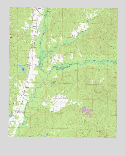
Cunningham, AL USGS Topographic Map
Click on map above to begin viewing in our Map Viewer.

This topographic map contains these locations and features:
Feature Name Type Latitude Longitude GNIS ID View Map
Aliceville DivisionCivilN33.1427°W88.1033°1935003View Map
Bear CreekStreamN33.1860°W88.0797°154440View Map
BeasleyPopulated PlaceN33.2121°W88.1000°156041View Map
Bells (historical)LocaleN33.2307°W88.0945°135464View Map
Bonners Mill (historical)LocaleN33.1935°W88.0547°135473View Map
CunninghamPopulated PlaceN33.1740°W88.1075°116965View Map
DillburgPopulated PlaceN33.1937°W88.1014°156271View Map
Good Hope ChurchChurchN33.1257°W88.0995°119110View Map
HickoryPopulated PlaceN33.1629°W88.0631°156470View Map
Hickory (historical)LocaleN33.1585°W88.0806°135542View Map
Hopewell Hill CemeteryCemeteryN33.1882°W88.0003°135544View Map
Hugh Pate DamDamN33.1868°W88.1067°131286View Map
Knox BranchStreamN33.1471°W88.1067°121278View Map
Little Lubbub CreekStreamN33.1904°W88.0872°152100View Map
Lois SpringPopulated PlaceN33.2307°W88.0939°156627View Map
Monkey BranchStreamN33.2010°W88.0000°122952View Map
Monkey CreekStreamN33.1982°W88.0225°122953View Map
Mount Calvary ChurchChurchN33.2240°W88.1245°123152View Map
Mount Pleasant Church (historical)ChurchN33.1873°W88.0020°135579View Map
Mount Sinai ChurchChurchN33.2201°W88.1242°123386View Map
New Salem ChurchChurchN33.1676°W88.0584°135587View Map
OlneyPopulated PlaceN33.1412°W88.0386°156837View Map
P M Johnston Dam Number OneDamN33.1535°W88.0417°131247View Map
P M Johnston Dam Number TwoDamN33.1451°W88.0300°131243View Map
P M Johnston Lake Number OneReservoirN33.1517°W88.0351°131246View Map
P M Johnston Lake Number TwoReservoirN33.1463°W88.0306°131242View Map
Pates LakeReservoirN33.1903°W88.1088°124478View Map
Puckett BranchStreamN33.2426°W88.0831°125351View Map
Seneca CreekStreamN33.1540°W88.1053°154494View Map
Sneads CreekStreamN33.1993°W88.0050°153488View Map
StevensPopulated PlaceN33.1279°W88.1200°135629View Map
Stevens SpurLocaleN33.1485°W88.1150°153570View Map
Unity CemeteryCemeteryN33.1668°W88.0603°135638View Map
WAQT-FM (Carrollton)TowerN33.2179°W88.0967°161177View Map
Windles LakeReservoirN33.1784°W88.0748°129111View Map
Windles Lake DamDamN33.1785°W88.0750°131272View Map
WRAG-AM (Carrollton)TowerN33.2179°W88.0967°160997View Map

Note: Coordinates in the location and feature list above are referenced to NAD83 datum.


Copyright (C) 2008-2025 Ryan Niemi / Sunset Dynamics ... All Rights Reserved