TopoQuest Logo
Do you find TopoQuest useful?
Help keep TopoQuest running and adding new maps/features by donating!
Bitcoin:  19c7KJd3qBynnjoSw5npx9KScwjBe4ifkT
Litecoin:  LXs6TkuXGGXo1vDsWCkWVdjQX94eUKd6ui
Home View Maps Find Maps Find Places Resources & Links


Carrollton, Alabama Topographic Map

USGS Map Title: Carrollton, AL
USGS Map MRC: 33088C1
DRG (GeoTIFF) Download: o33088c1.tif


Neighboring USGS Topographic Map Quads:


  Ethelsville, AL  
33088D2
 

  Reform, AL  
33088D1
 

  Palmetto, AL  
33087D8
 

  Reform SW, AL  
33088C2
 

  Carrollton, AL  
33088C1
 

  Gordo, AL  
33087C8
 

  Aliceville North, AL  
33088B2
 

  Cunningham, AL  
33088B1
 

  Kirk, AL  
33087B8


Map MRC Location:

N34°
W89°
N34°
W88°
H8 H7 H6 H5 H4 H3 H2 H1
G8 G7 G6 G5 G4 G3 G2 G1
F8 F7 F6 F5 F4 F3 F2 F1
E8 E7 E6 E5 E4 E3 E2 E1
D8 D7 D6 D5 D4 D3 D2 D1
C8 C7 C6 C5 C4 C3 C2 C1
B8 B7 B6 B5 B4 B3 B2 B1
A8 A7 A6 A5 A4 A3 A2 A1
N33°
W89°
N33°
W88°

Carrollton, AL USGS 1:24K Topographic Map Preview:
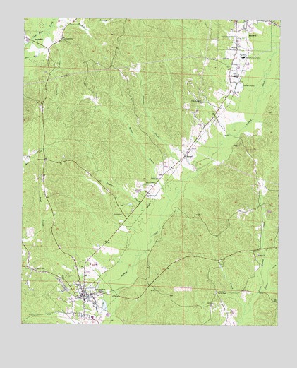
Carrollton, AL USGS Topographic Map
Click on map above to begin viewing in our Map Viewer.

This topographic map contains these locations and features:
Feature Name Type Latitude Longitude GNIS ID View Map
Anna BranchStreamN33.3718°W88.1100°113088View Map
Bastic CreekStreamN33.2643°W88.0086°113556View Map
Beards MillPopulated PlaceN33.3657°W88.1197°156040View Map
Bethel BranchStreamN33.3010°W88.0528°114010View Map
Bethel CemeteryCemeteryN33.3098°W88.0581°114020View Map
CarlossPopulated PlaceN33.2946°W88.0756°135478View Map
CarrolltonPopulated PlaceN33.2618°W88.0950°135481View Map
Carrollton Baptist ChurchChurchN33.2629°W88.0964°157447View Map
Carrollton CemeteryCemeteryN33.2668°W88.0992°138733View Map
Carrollton High SchoolSchoolN33.2601°W88.0939°135482View Map
Carrollton Junior High School (historical)SchoolN33.2573°W88.0897°154436View Map
Carrollton Methodist ChurchChurchN33.2626°W88.0934°157448View Map
Carrollton Police DepartmentBuildingN33.2619°W88.0951°2751823View Map
Carrollton Post OfficePost OfficeN33.2621°W88.0957°166926View Map
Carrollton Volunteer Fire DepartmentBuildingN33.2584°W88.0934°2682680View Map
Cockrell CemeteryCemeteryN33.2954°W88.0759°116340View Map
Community CemeteryCemeteryN33.2640°W88.1209°158368View Map
Faith ChurchChurchN33.2807°W88.0095°135516View Map
Graham CemeteryCemeteryN33.3707°W88.0159°158606View Map
Hebron Baptist ChurchChurchN33.3171°W88.1139°119927View Map
Hebron Church CemeteryCemeteryN33.3159°W88.1142°135538View Map
Huckeby BranchStreamN33.3743°W88.1106°120499View Map
Infant Baptist ChurchChurchN33.2618°W88.0878°157449View Map
Johnsons BranchStreamN33.3087°W88.0470°120964View Map
Kilpatrick LakeReservoirN33.2539°W88.0827°131353View Map
Marvin Chapel ChurchChurchN33.2637°W88.0292°152240View Map
Mastons Mill (historical)LocaleN33.2632°W88.0856°135568View Map
Mill BranchStreamN33.2548°W88.0167°122740View Map
Mill Branch School (historical)SchoolN33.2654°W88.0192°135573View Map
New Providence CemeteryCemeteryN33.3076°W88.0647°123893View Map
New Providence ChurchChurchN33.3026°W88.0636°123899View Map
Old Sardis CemeteryCemeteryN33.3557°W88.0247°138755View Map
OwensPopulated PlaceN33.3085°W88.0597°135663View Map
Parson DamDamN33.2551°W88.0834°131352View Map
Pickens AcademySchoolN33.2523°W88.0911°135600View Map
Pickens CountyCivilN33.2809°W88.0887°161580View Map
Pickens County CourthouseBuildingN33.2618°W88.0950°135601View Map
Pickens County Medical CenterHospitalN33.2745°W88.0887°158372View Map
Pickens County Sheriff's OfficeBuildingN33.2602°W88.0959°2751884View Map
Poplar Springs CemeteryCemeteryN33.3415°W88.0386°158616View Map
Poplar Springs ChurchChurchN33.3421°W88.0386°125172View Map
Reform Temple ChurchChurchN33.3385°W88.0311°135615View Map
Salem ChurchChurchN33.2682°W88.1067°135618View Map
Salem ChurchChurchN33.2693°W88.1209°135619View Map
ShepherdLocaleN33.3529°W88.0250°135621View Map
StanselPopulated PlaceN33.3196°W88.0456°157102View Map
Stansel ChurchChurchN33.3190°W88.0459°135627View Map
Stratton BranchStreamN33.2860°W88.0620°127455View Map
Town of CarrolltonCivilN33.2619°W88.0951°2405384View Map
Union Hill CemeteryCemeteryN33.3673°W88.1070°138764View Map
Union Hill Freewill Baptist ChurchChurchN33.3668°W88.1059°153791View Map
Windle CemeteryCemeteryN33.2504°W88.0381°158985View Map

Note: Coordinates in the location and feature list above are referenced to NAD83 datum.


Copyright (C) 2008-2025 Ryan Niemi / Sunset Dynamics ... All Rights Reserved