TopoQuest Logo
Do you find TopoQuest useful?
Help keep TopoQuest running and adding new maps/features by donating!
Bitcoin:  19c7KJd3qBynnjoSw5npx9KScwjBe4ifkT
Litecoin:  LXs6TkuXGGXo1vDsWCkWVdjQX94eUKd6ui
Home View Maps Find Maps Find Places Resources & Links


Reform, Alabama Topographic Map

USGS Map Title: Reform, AL
USGS Map MRC: 33088D1
DRG (GeoTIFF) Download: o33088d1.tif


Neighboring USGS Topographic Map Quads:


  Fernbank, AL  
33088E2
 

  Millport, AL  
33088E1
 

  Kennedy, AL  
33087E8
 

  Ethelsville, AL  
33088D2
 

  Reform, AL  
33088D1
 

  Palmetto, AL  
33087D8
 

  Reform SW, AL  
33088C2
 

  Carrollton, AL  
33088C1
 

  Gordo, AL  
33087C8


Map MRC Location:

N34°
W89°
N34°
W88°
H8 H7 H6 H5 H4 H3 H2 H1
G8 G7 G6 G5 G4 G3 G2 G1
F8 F7 F6 F5 F4 F3 F2 F1
E8 E7 E6 E5 E4 E3 E2 E1
D8 D7 D6 D5 D4 D3 D2 D1
C8 C7 C6 C5 C4 C3 C2 C1
B8 B7 B6 B5 B4 B3 B2 B1
A8 A7 A6 A5 A4 A3 A2 A1
N33°
W89°
N33°
W88°

Reform, AL USGS 1:24K Topographic Map Preview:
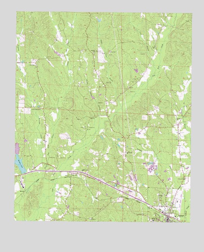
Reform, AL USGS Topographic Map
Click on map above to begin viewing in our Map Viewer.

This topographic map contains these locations and features:
Feature Name Type Latitude Longitude GNIS ID View Map
Antioch CemeteryCemeteryN33.4421°W88.1078°135460View Map
Antioch Cumberland Presbyterian ChurchChurchN33.4423°W88.1072°113182View Map
Arbor Springs CemeteryCemeteryN33.4168°W88.0456°138726View Map
Arbor Springs ChurchChurchN33.4168°W88.0453°113198View Map
Arnold CemeteryCemeteryN33.4248°W88.0853°113232View Map
Baird CemeteryCemeteryN33.4373°W88.0722°158774View Map
Beard CemeteryCemeteryN33.4009°W88.1197°113691View Map
BethlehemPopulated PlaceN33.4751°W88.0709°138728View Map
Bethlehem Baptist ChurchChurchN33.4765°W88.0709°114134View Map
Bethlehem Church CemeteryCemeteryN33.4757°W88.0700°135468View Map
Bethlehem Volunteer Fire DepartmentBuildingN33.4762°W88.0697°2683481View Map
Board Tree BranchStreamN33.4437°W88.0500°114626View Map
Board Tree Branch Gas FieldOilfieldN33.4801°W88.0528°154943View Map
Buncomb CreekStreamN33.4037°W88.1050°115203View Map
Carden CemeteryCemeteryN33.4132°W88.0964°115613View Map
Chicken Swamp BranchStreamN33.4312°W88.0659°116037View Map
Christian Hope ChurchChurchN33.4048°W88.0767°116098View Map
Church of GodChurchN33.3796°W88.0367°116140View Map
Coal FirePopulated PlaceN33.4040°W88.0847°154447View Map
Coal Fire CemeteryCemeteryN33.4040°W88.0806°158602View Map
Coal Fire ChurchChurchN33.4029°W88.0811°135496View Map
Coal Fire Creek Gas FieldOilfieldN33.4823°W88.0006°154944View Map
Cocks BranchStreamN33.4609°W88.0289°116342View Map
David DamDamN33.4951°W88.0650°131574View Map
Davis LakeReservoirN33.4950°W88.0663°131573View Map
Ewart Doughty DamDamN33.4085°W88.0267°131518View Map
Ewart Doughty LakeReservoirN33.4080°W88.0275°131519View Map
Friendship ChurchChurchN33.4359°W88.0103°118694View Map
Funderburk CemeteryCemeteryN33.4050°W88.0984°2663496View Map
Hamilton CemeteryCemeteryN33.4668°W88.0181°135534View Map
Hopewell CemeteryCemeteryN33.3915°W88.0189°120360View Map
Hopewell High SchoolSchoolN33.3762°W88.0259°120388View Map
John McShan Number 1 DamDamN33.4018°W88.1167°131513View Map
John McShan Number 2 DamDamN33.4101°W88.1217°131522View Map
Keasley School (historical)SchoolN33.4543°W88.1047°135553View Map
Langdon BranchStreamN33.3857°W88.0011°121382View Map
Liberty CemeteryCemeteryN33.3771°W88.0706°158607View Map
Liberty ChurchChurchN33.3762°W88.0703°121550View Map
Little Coal Fire CreekStreamN33.3968°W88.0961°121738View Map
McShan LakeReservoirN33.4089°W88.1213°152290View Map
McShan Lake Number TwoReservoirN33.4089°W88.1213°131523View Map
MelrosePopulated PlaceN33.3929°W88.1178°156697View Map
North Pickens AirportAirportN33.3823°W88.0082°129463View Map
Phoenix CemeteryCemeteryN33.4771°W88.0689°124695View Map
Rawles Mill (historical)LocaleN33.4348°W88.0561°135613View Map
ReformPopulated PlaceN33.3785°W88.0153°125544View Map
Reform DivisionCivilN33.4223°W88.0215°165927View Map
Reform Police DepartmentBuildingN33.3769°W88.0162°2752036View Map
Reform Post OfficePost OfficeN33.3779°W88.0110°167744View Map
Reform Volunteer Fire DepartmentBuildingN33.3768°W88.0179°2682850View Map
Rocky Ridge CemeteryCemeteryN33.4671°W88.1095°158618View Map
Rocky Ridge ChurchChurchN33.4682°W88.1106°125879View Map
Shady Grove CemeteryCemeteryN33.4015°W88.0042°126589View Map
Town of ReformCivilN33.3788°W88.0173°2407194View Map
William Latham DamDamN33.4001°W88.0417°131511View Map
William Latham LakeReservoirN33.4014°W88.0424°131510View Map

Note: Coordinates in the location and feature list above are referenced to NAD83 datum.


Copyright (C) 2008-2025 Ryan Niemi / Sunset Dynamics ... All Rights Reserved