TopoQuest Logo
Do you find TopoQuest useful?
Help keep TopoQuest running and adding new maps/features by donating!
Bitcoin:  19c7KJd3qBynnjoSw5npx9KScwjBe4ifkT
Litecoin:  LXs6TkuXGGXo1vDsWCkWVdjQX94eUKd6ui
Home View Maps Find Maps Find Places Resources & Links


Richfield, Pennsylvania Topographic Map

USGS Map Title: Richfield, PA
USGS Map MRC: 40077F1
DRG (GeoTIFF) Download: o40077f1.tif


Neighboring USGS Topographic Map Quads:


  Beavertown, PA  
40077G2
 

  Middleburg, PA  
40077G1
 

  Freeburg, PA  
40076G8
 

  Beaver Springs, PA  
40077F2
 

  Richfield, PA  
40077F1
 

  Dalmatia, PA  
40076F8
 

  Millerstown, PA  
40077E2
 

  Reward, PA  
40077E1
 

  Millersburg, PA  
40076E8


Map MRC Location:

N41°
W78°
N41°
W77°
H8 H7 H6 H5 H4 H3 H2 H1
G8 G7 G6 G5 G4 G3 G2 G1
F8 F7 F6 F5 F4 F3 F2 F1
E8 E7 E6 E5 E4 E3 E2 E1
D8 D7 D6 D5 D4 D3 D2 D1
C8 C7 C6 C5 C4 C3 C2 C1
B8 B7 B6 B5 B4 B3 B2 B1
A8 A7 A6 A5 A4 A3 A2 A1
N40°
W78°
N40°
W77°

Richfield, PA USGS 1:24K Topographic Map Preview:
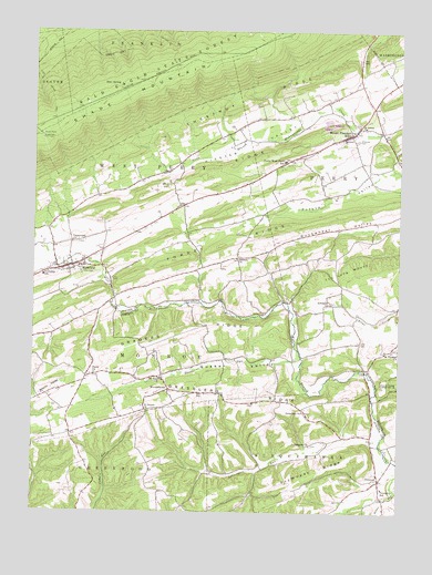
Richfield, PA USGS Topographic Map
Click on map above to begin viewing in our Map Viewer.

This topographic map contains these locations and features:
Feature Name Type Latitude Longitude GNIS ID View Map
Arbogast ChurchChurchN40.6793°W77.0230°1168366View Map
Bear SpringSpringN40.7356°W77.0955°1168939View Map
Beavertown Fire TowerTowerN40.7226°W77.1222°1213136View Map
Chestnut RidgeRidgeN40.7318°W77.0539°1171743View Map
Crossroads ChurchChurchN40.6954°W77.1114°1172767View Map
Daniels ChurchChurchN40.6912°W77.0550°1198634View Map
Dresslers ChurchChurchN40.6512°W77.0322°1173473View Map
Dresslers RidgeRidgeN40.6554°W77.0516°1173474View Map
East Boyer TrailTrailN40.7320°W77.1186°1173726View Map
Emanuel CemeteryCemeteryN40.7220°W77.0136°1174201View Map
Emanuel ChurchChurchN40.7220°W77.0189°1174204View Map
Faith ChurchChurchN40.6609°W77.1036°1174564View Map
Forrey RidgeRidgeN40.6987°W77.0425°1175003View Map
Fremont Fire Department Station 100BuildingN40.7244°W77.0151°2653303View Map
Frymoyer Airport (historical)AirportN40.6306°W77.0103°1194051View Map
Frymoyer RidgeRidgeN40.6365°W77.0266°1175319View Map
Graders RidgeRidgeN40.6723°W77.0703°1175914View Map
Hiester ValleyValleyN40.7342°W77.0115°1176995View Map
Jansen Vineyards AirportAirportN40.6523°W77.0534°2443662View Map
KnousetownPopulated PlaceN40.6567°W77.0780°1178618View Map
Leiningers ChurchChurchN40.6426°W77.0297°1179172View Map
Leiningers RunStreamN40.6426°W77.0061°1179173View Map
Lime RidgeRidgeN40.7070°W77.0878°1179349View Map
Mount Pleasant MillPopulated PlaceN40.7240°W77.0064°1202029View Map
Mount Pleasant MillsPopulated PlaceN40.7231°W77.0158°1181828View Map
Mount Pleasant Mills Census Designated PlaceCensusN40.7229°W77.0214°2389516View Map
Mount Pleasant Mills Post OfficePost OfficeN40.7253°W77.0142°2772851View Map
Mount Pleasant Mills Post Office (historical)Post OfficeN40.7231°W77.0164°1214317View Map
Mount Zion ChurchChurchN40.6595°W77.0811°1181924View Map
OrientalPopulated PlaceN40.6334°W77.0061°1183043View Map
Perry-West Perry SchoolSchoolN40.7162°W77.0389°1183605View Map
Pine Swamp Evangelical Methodist Church CemeteryCemeteryN40.6858°W77.0981°1183762View Map
Potato ValleyValleyN40.7144°W77.0014°1184328View Map
Quaker RunStreamN40.6637°W77.0333°1184524View Map
Quaker ValleyValleyN40.6642°W77.0357°1184527View Map
RichfieldPopulated PlaceN40.6887°W77.1128°1185007View Map
Richfield Census Designated PlaceCensusN40.6869°W77.1141°2584501View Map
Richfield Census Designated PlaceCensusN40.6869°W77.1141°2389749View Map
Richfield Post OfficePost OfficeN40.6893°W77.1106°2772943View Map
Saint Johns ChurchChurchN40.7256°W77.0133°1186138View Map
Saint Peters ChurchChurchN40.6512°W77.0855°1186665View Map
Saint Thomas ChurchChurchN40.6670°W77.0019°1186753View Map
StrouptownPopulated PlaceN40.6934°W77.0336°1197133View Map
The Long WoodsWoodsN40.6887°W77.0161°1189422View Map
Township of MonroeCivilN40.6631°W77.1213°1216585View Map
Township of PerryCivilN40.6995°W77.0076°1217036View Map
Township of SusquehannaCivilN40.6310°W77.0158°1216587View Map
Township of West PerryCivilN40.7027°W77.1224°1217041View Map

Note: Coordinates in the location and feature list above are referenced to NAD83 datum.


Copyright (C) 2008-2024 Ryan Niemi / Sunset Dynamics ... All Rights Reserved