TopoQuest Logo
Do you find TopoQuest useful?
Help keep TopoQuest running and adding new maps/features by donating!
Bitcoin:  19c7KJd3qBynnjoSw5npx9KScwjBe4ifkT
Litecoin:  LXs6TkuXGGXo1vDsWCkWVdjQX94eUKd6ui
Home View Maps Find Maps Find Places Resources & Links


Richfield, Utah Topographic Map

USGS Map Title: Richfield, UT
USGS Map MRC: 38112G1
DRG (GeoTIFF) Download: o38112g1.tif


Neighboring USGS Topographic Map Quads:


  Mount Catherine, UT  
38112H2
 

  Beehive Peak, UT  
38112H1
 

  Aurora, UT  
38111H8
 

  White Pine Peak, UT  
38112G2
 

  Richfield, UT  
38112G1
 

  Sigurd, UT  
38111G8
 

  Elsinore, UT  
38112F2
 

  Annabella, UT  
38112F1
 

  Water Creek Canyon, UT  
38111F8


Map MRC Location:

N39°
W113°
N39°
W112°
H8 H7 H6 H5 H4 H3 H2 H1
G8 G7 G6 G5 G4 G3 G2 G1
F8 F7 F6 F5 F4 F3 F2 F1
E8 E7 E6 E5 E4 E3 E2 E1
D8 D7 D6 D5 D4 D3 D2 D1
C8 C7 C6 C5 C4 C3 C2 C1
B8 B7 B6 B5 B4 B3 B2 B1
A8 A7 A6 A5 A4 A3 A2 A1
N38°
W113°
N38°
W112°

Richfield, UT USGS 1:24K Topographic Map Preview:
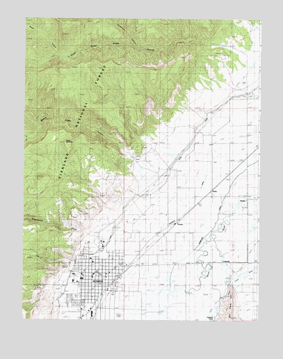
Richfield, UT USGS Topographic Map
Click on map above to begin viewing in our Map Viewer.

This topographic map contains these locations and features:
Feature Name Type Latitude Longitude GNIS ID View Map
Ashman Elementary SchoolSchoolN38.7690°W112.0875°1448091View Map
Assembly of God ChurchChurchN38.7697°W112.0791°1455591View Map
City of RichfieldCivilN38.7628°W112.0926°2410935View Map
Cottonwood CreekStreamN38.7822°W112.0799°1440014View Map
First Baptist ChurchChurchN38.7752°W112.0849°1455600View Map
Good Shepherd Lutheran ChurchChurchN38.7680°W112.0849°1455604View Map
GramsePopulated PlaceN38.7905°W112.0430°1441400View Map
KemaPopulated PlaceN38.8039°W112.0249°1442300View Map
KKWZ-FM (Richfield)TowerN38.7630°W112.0791°1455779View Map
KOA CampgroundLocaleN38.7600°W112.0941°1448553View Map
KSVC-AM (Richfield)TowerN38.7611°W112.0771°1455731View Map
Newts CanyonValleyN38.8608°W112.1083°1443816View Map
North Fork Willow CreekStreamN38.8250°W112.1235°1448747View Map
North Fork Willow Creek CanyonValleyN38.8250°W112.1230°1443948View Map
Pahvant Elementary SchoolSchoolN38.7754°W112.0897°1444160View Map
Park Crest Village CenterLocaleN38.7761°W112.0846°1455449View Map
PrattsvillePopulated PlaceN38.7741°W112.0146°1444631View Map
Prattsville CanalCanalN38.7616°W112.0235°1444632View Map
RichfieldPopulated PlaceN38.7725°W112.0841°1444889View Map
Richfield CanalCanalN38.7866°W112.0530°1444890View Map
Richfield City CemeteryCemeteryN38.7783°W112.0888°1448911View Map
Richfield City Police DepartmentBuildingN38.7683°W112.0837°2730397View Map
Richfield High SchoolSchoolN38.7672°W112.0943°1448905View Map
Richfield Post OfficePost OfficeN38.7693°W112.0851°1455477View Map
Richfield Volunteer Fire DepartmentBuildingN38.7697°W112.0835°2768475View Map
Richfield Volunteer Fire DepartmentBuildingN38.7648°W112.0844°2627203View Map
Saint Elizabeth Catholic ChurchChurchN38.7755°W112.0774°1455608View Map
Sevier County AmbulanceBuildingN38.7813°W112.0860°2665427View Map
Sevier County FairgroundLocaleN38.7633°W112.0771°1454964View Map
Sevier County JailBuildingN38.7736°W112.0695°2769024View Map
Sevier County Sheriff's OfficeBuildingN38.7734°W112.0691°2730335View Map
Sevier Valley CanalCanalN38.7930°W112.0710°1445452View Map
Sevier Valley Hospital HeliportAirportN38.7841°W112.0838°1448992View Map
Sevier Valley Medical CenterHospitalN38.7826°W112.0835°1448991View Map
South Cedar Ridge CanyonValleyN38.8639°W112.0174°1445805View Map
South Fork Willow CreekStreamN38.8250°W112.1235°1449031View Map
South Fork Willow Creek CanyonValleyN38.8250°W112.1235°1445888View Map
State CanalCanalN38.8372°W112.0249°1446104View Map
Strawberry CanyonValleyN38.8641°W112.0669°1446178View Map
Table MountainSummitN38.8241°W112.1030°1446316View Map
The Church of Jesus Christ of Latter Day SaintsChurchN38.7816°W112.0844°1455660View Map
The Church of Jesus Christ of Latter Day SaintsChurchN38.7686°W112.0780°1455661View Map
The Church of Jesus Christ of Latter Day SaintsChurchN38.7544°W112.0938°1455662View Map
The Church of Jesus Christ of Latter Day SaintsChurchN38.7741°W112.0880°1455663View Map
The Church of Jesus Christ of Latter Day SaintsChurchN38.7702°W112.0924°1455664View Map
The Church of Jesus Christ of Latter Day SaintsChurchN38.7677°W112.0883°1455665View Map
The Church of Jesus Christ of Latter Day SaintsChurchN38.7664°W112.0852°1455676View Map
Trinity Baptist ChurchChurchN38.7739°W112.0827°1455612View Map
United States Forest Service Fire Station Fishlake National ForestBuildingN38.7811°W112.0830°2768485View Map
Utah Highway Patrol Section 10 Richfield OfficeBuildingN38.7739°W112.0683°2730473View Map
Valley Community Presbyterian ChurchChurchN38.7650°W112.0838°1455614View Map
VenicePopulated PlaceN38.8002°W112.0063°1446921View Map
Willow CreekStreamN38.8027°W112.0566°1449200View Map
Willow Creek CanyonValleyN38.8166°W112.0688°1447414View Map

Note: Coordinates in the location and feature list above are referenced to NAD83 datum.


Copyright (C) 2008-2025 Ryan Niemi / Sunset Dynamics ... All Rights Reserved