TopoQuest Logo
Do you find TopoQuest useful?
Help keep TopoQuest running and adding new maps/features by donating!
Bitcoin:  19c7KJd3qBynnjoSw5npx9KScwjBe4ifkT
Litecoin:  LXs6TkuXGGXo1vDsWCkWVdjQX94eUKd6ui
Home View Maps Find Maps Find Places Resources & Links


Sigurd, Utah Topographic Map

USGS Map Title: Sigurd, UT
USGS Map MRC: 38111G8
DRG (GeoTIFF) Download: o38111g8.tif


Neighboring USGS Topographic Map Quads:


  Beehive Peak, UT  
38112H1
 

  Aurora, UT  
38111H8
 

  Salina, UT  
38111H7
 

  Richfield, UT  
38112G1
 

  Sigurd, UT  
38111G8
 

  Rex Reservoir, UT  
38111G7
 

  Annabella, UT  
38112F1
 

  Water Creek Canyon, UT  
38111F8
 

  Boobe Hole Reservoir, UT  
38111F7


Map MRC Location:

N39°
W112°
N39°
W111°
H8 H7 H6 H5 H4 H3 H2 H1
G8 G7 G6 G5 G4 G3 G2 G1
F8 F7 F6 F5 F4 F3 F2 F1
E8 E7 E6 E5 E4 E3 E2 E1
D8 D7 D6 D5 D4 D3 D2 D1
C8 C7 C6 C5 C4 C3 C2 C1
B8 B7 B6 B5 B4 B3 B2 B1
A8 A7 A6 A5 A4 A3 A2 A1
N38°
W112°
N38°
W111°

Sigurd, UT USGS 1:24K Topographic Map Preview:
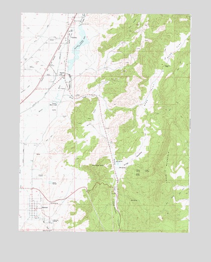
Sigurd, UT USGS Topographic Map
Click on map above to begin viewing in our Map Viewer.

This topographic map contains these locations and features:
Feature Name Type Latitude Longitude GNIS ID View Map
Black KnollSummitN38.8227°W111.9727°1438853View Map
Brine CreekStreamN38.8283°W111.9735°1439121View Map
Carter SpringSpringN38.7831°W111.9147°1439501View Map
Cedar MountainSummitN38.7850°W111.8930°1439580View Map
Cove RiverStreamN38.8030°W111.9958°1440073View Map
GlenwoodPopulated PlaceN38.7633°W111.9902°1441332View Map
Glenwood CemeteryCemeteryN38.7819°W111.9871°1441333View Map
Glenwood Fish HatcheryLocaleN38.7561°W111.9774°1455295View Map
Glenwood Pioneer CemeteryCemeteryN38.7570°W111.9883°2769402View Map
Glenwood Post OfficePost OfficeN38.7630°W111.9881°2769039View Map
Glenwood SpringSpringN38.7560°W111.9755°1441335View Map
Indian SpringsSpringN38.7779°W111.9760°1442032View Map
Kings MeadowFlatN38.7922°W111.9160°1442329View Map
Kings Meadow CanyonValleyN38.7811°W111.9271°1442330View Map
Mill CreekStreamN38.7739°W111.9988°1443426View Map
Mud SpringSpringN38.7869°W111.9268°1443690View Map
North SpringSpringN38.7852°W111.9080°1443977View Map
Parcell SpringSpringN38.7660°W111.9776°1444199View Map
Peterson CreekStreamN38.8133°W111.9460°1444305View Map
Rainbow HillsSummitN38.7875°W111.9413°1444716View Map
Rock SpringSpringN38.7905°W111.9294°1445092View Map
Rocky Ford DamDamN38.8681°W111.9567°1447742View Map
Rocky Ford ReservoirReservoirN38.8562°W111.9577°1447741View Map
Ross SpringSpringN38.7683°W111.9127°1445147View Map
Sage FlatFlatN38.8414°W111.8971°1445238View Map
Sage Flat DivideGapN38.8455°W111.8944°1445241View Map
SigurdPopulated PlaceN38.8405°W111.9677°1445583View Map
Sigurd CemeteryCemeteryN38.8394°W111.9817°1445584View Map
Sigurd Fire DepartmentBuildingN38.8391°W111.9672°2627135View Map
Sigurd Post OfficePost OfficeN38.8391°W111.9678°2769040View Map
Sigurd SubstationLocaleN38.8433°W111.9941°1454523View Map
The Church of Jesus Christ of Latter Day SaintsChurchN38.8389°W111.9696°1455673View Map
The Church of Jesus Christ of Latter Day SaintsChurchN38.7633°W111.9863°1449462View Map
The TwistSummitN38.8727°W111.9149°1446512View Map
Town of GlenwoodCivilN38.7625°W111.9881°2412688View Map
Town of SigurdCivilN38.8358°W111.9686°2413282View Map
Venice CanalCanalN38.7930°W111.9969°1446922View Map
Venice CemeteryCemeteryN38.7994°W111.9877°1449143View Map
VermillionPopulated PlaceN38.8608°W111.9652°1446926View Map
Vermillion CanalCanalN38.8258°W111.9841°1446927View Map
Vermillion CemeteryCemeteryN38.8605°W111.9775°1446931View Map
Willow SpringSpringN38.7852°W111.9144°1447435View Map

Note: Coordinates in the location and feature list above are referenced to NAD83 datum.


Copyright (C) 2008-2025 Ryan Niemi / Sunset Dynamics ... All Rights Reserved