TopoQuest Logo
Do you find TopoQuest useful?
Help keep TopoQuest running and adding new maps/features by donating!
Bitcoin:  19c7KJd3qBynnjoSw5npx9KScwjBe4ifkT
Litecoin:  LXs6TkuXGGXo1vDsWCkWVdjQX94eUKd6ui
Home View Maps Find Maps Find Places Resources & Links


Aurora, Utah Topographic Map

USGS Map Title: Aurora, UT
USGS Map MRC: 38111H8
DRG (GeoTIFF) Download: o38111h8.tif


Neighboring USGS Topographic Map Quads:


  Scipio Lake, UT  
39112A1
 

  Redmond Canyon, UT  
39111A8
 

  Redmond, UT  
39111A7
 

  Beehive Peak, UT  
38112H1
 

  Aurora, UT  
38111H8
 

  Salina, UT  
38111H7
 

  Richfield, UT  
38112G1
 

  Sigurd, UT  
38111G8
 

  Rex Reservoir, UT  
38111G7


Map MRC Location:

N39°
W112°
N39°
W111°
H8 H7 H6 H5 H4 H3 H2 H1
G8 G7 G6 G5 G4 G3 G2 G1
F8 F7 F6 F5 F4 F3 F2 F1
E8 E7 E6 E5 E4 E3 E2 E1
D8 D7 D6 D5 D4 D3 D2 D1
C8 C7 C6 C5 C4 C3 C2 C1
B8 B7 B6 B5 B4 B3 B2 B1
A8 A7 A6 A5 A4 A3 A2 A1
N38°
W112°
N38°
W111°

Aurora, UT USGS 1:24K Topographic Map Preview:
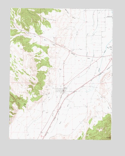
Aurora, UT USGS Topographic Map
Click on map above to begin viewing in our Map Viewer.

This topographic map contains these locations and features:
Feature Name Type Latitude Longitude GNIS ID View Map
AuroraPopulated PlaceN38.9222°W111.9341°1438307View Map
Aurora CemeteryCemeteryN38.9263°W111.9377°1448096View Map
Aurora Fire DepartmentBuildingN38.9244°W111.9379°2627213View Map
Aurora Post OfficePost OfficeN38.9210°W111.9371°1455171View Map
Bald Knoll CanyonValleyN38.9886°W111.9105°1438351View Map
Carter PeakSummitN38.8769°W111.8760°1439500View Map
City of AuroraCivilN38.9202°W111.9340°2409760View Map
Denmark WashValleyN38.9552°W111.8869°1440410View Map
Denmark Wash DamDamN38.9733°W111.9708°1447743View Map
Dry Red CanyonValleyN38.8911°W111.9605°1440681View Map
Johnson FeedlotLocaleN38.9000°W111.9516°2576423View Map
Little DitchCanalN38.9925°W111.8933°1442703View Map
Lost CreekStreamN38.9250°W111.8974°1442967View Map
Mud SpringSpringN38.9091°W111.9832°1443693View Map
Rocky Ford CanalCanalN38.9566°W111.8977°1445115View Map
Salina CreekStreamN38.9639°W111.8821°1445272View Map
The Church of Jesus Christ of Latter Day SaintsChurchN38.9219°W111.9341°1449347View Map

Note: Coordinates in the location and feature list above are referenced to NAD83 datum.


Copyright (C) 2008-2025 Ryan Niemi / Sunset Dynamics ... All Rights Reserved