TopoQuest Logo
Do you find TopoQuest useful?
Help keep TopoQuest running and adding new maps/features by donating!
Bitcoin:  19c7KJd3qBynnjoSw5npx9KScwjBe4ifkT
Litecoin:  LXs6TkuXGGXo1vDsWCkWVdjQX94eUKd6ui
Home View Maps Find Maps Find Places Resources & Links


Richland, Oregon Topographic Map

USGS Map Title: Richland, OR
USGS Map MRC: 44117G2
DRG (GeoTIFF) Download: o44117g2.tif


Neighboring USGS Topographic Map Quads:


  Sparta Butte, OR  
44117H3
 

  Jimtown, OR  
44117H2
 

  Halfway, OR  
44117H1
 

  Sparta, OR  
44117G3
 

  Richland, OR  
44117G2
 

  Posy Valley, OR  
44117G1
 

  Little Lookout Mountain, OR  
44117F3
 

  Daly Creek, OR  
44117F2
 

  Sturgill Creek, ID  
44117F1


Map MRC Location:

N45°
W118°
N45°
W117°
H8 H7 H6 H5 H4 H3 H2 H1
G8 G7 G6 G5 G4 G3 G2 G1
F8 F7 F6 F5 F4 F3 F2 F1
E8 E7 E6 E5 E4 E3 E2 E1
D8 D7 D6 D5 D4 D3 D2 D1
C8 C7 C6 C5 C4 C3 C2 C1
B8 B7 B6 B5 B4 B3 B2 B1
A8 A7 A6 A5 A4 A3 A2 A1
N44°
W118°
N44°
W117°

Richland, OR USGS 1:24K Topographic Map Preview:
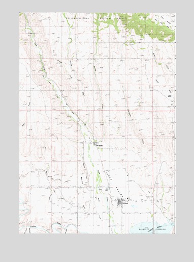
Richland, OR USGS Topographic Map
Click on map above to begin viewing in our Map Viewer.

This topographic map contains these locations and features:
Feature Name Type Latitude Longitude GNIS ID View Map
Baker County Library Richland Branch LibraryBuildingN44.7702°W117.1633°2700374View Map
Barnard CreekStreamN44.8107°W117.2007°1137530View Map
Box CanyonValleyN44.7535°W117.2443°1138531View Map
China SpringSpringN44.8282°W117.1285°1139692View Map
City of RichlandCivilN44.7678°W117.1686°2410936View Map
Coin CreekStreamN44.7513°W117.2441°1153073View Map
Corral GulchValleyN44.8732°W117.1880°1140151View Map
Cundiff SloughStreamN44.7554°W117.1263°1158581View Map
Dry Barnard CreekStreamN44.8304°W117.1982°1153067View Map
Dry GulchValleyN44.7546°W117.2163°1141332View Map
Dry Gulch DitchCanalN44.8135°W117.2113°1141337View Map
Eagle Valley CemeteryCemeteryN44.7521°W117.1677°1153056View Map
Eagle Valley Rural Fire Protection DistrictBuildingN44.7694°W117.1677°2576710View Map
Fawn GulchValleyN44.8665°W117.2441°1161771View Map
Guyer GulchValleyN44.7679°W117.2455°1116460View Map
Harry M Hewitt Memorial ParkParkN44.7582°W117.1274°1161773View Map
Hewitt / Holcomb Parks Boat RampLocaleN44.7557°W117.1315°2698983View Map
Hewitt / Holcomb Parks Boat Ramp 2LocaleN44.7564°W117.1273°2698984View Map
Howell DitchCanalN44.7707°W117.1927°1158582View Map
I N Young DitchCanalN44.7888°W117.1843°1158580View Map
Immigrant GulchValleyN44.7554°W117.1288°1144000View Map
Mill PondLakeN44.7751°W117.1785°1146254View Map
New BridgePopulated PlaceN44.8004°W117.1899°1146799View Map
New Bridge Post Office (historical)Post OfficeN44.8004°W117.1899°1165699View Map
Newt Young DitchCanalN44.7879°W117.1643°1146816View Map
Pleasant RidgeRidgeN44.7666°W117.2343°1161772View Map
Posy Valley DitchCanalN44.8690°W117.1385°1147926View Map
RichlandPopulated PlaceN44.7690°W117.1685°1148423View Map
Richland City HallBuildingN44.7694°W117.1677°2700421View Map
Richland Elementary School (historical)SchoolN44.7701°W117.1635°1161774View Map
Richland Post OfficePost OfficeN44.7690°W117.1700°1165852View Map
Richland Public Works Department OfficeBuildingN44.7694°W117.1677°2700420View Map
Richland Wastewater Treatment PondsLocaleN44.7659°W117.1590°2697194View Map
Rock GulchValleyN44.7524°W117.2130°1148612View Map
Skull CreekStreamN44.8729°W117.2457°1149629View Map
Spring Creek DitchCanalN44.8402°W117.2107°1161770View Map
Summit CreekStreamN44.7949°W117.1949°1150615View Map
Tekpé GulchValleyN44.7972°W117.1760°1130928View Map
Three CanyonValleyN44.7518°W117.2405°1639336View Map
Tobin DitchCanalN44.8196°W117.2074°1151291View Map
Town GulchValleyN44.8732°W117.2457°1151357View Map
Waterbury DitchCanalN44.7985°W117.1999°1151942View Map
Waterbury GulchValleyN44.7513°W117.1988°1151943View Map

Note: Coordinates in the location and feature list above are referenced to NAD83 datum.


Copyright (C) 2008-2025 Ryan Niemi / Sunset Dynamics ... All Rights Reserved