TopoQuest Logo
Do you find TopoQuest useful?
Help keep TopoQuest running and adding new maps/features by donating!
Bitcoin:  19c7KJd3qBynnjoSw5npx9KScwjBe4ifkT
Litecoin:  LXs6TkuXGGXo1vDsWCkWVdjQX94eUKd6ui
Home View Maps Find Maps Find Places Resources & Links


Posy Valley, Oregon Topographic Map

USGS Map Title: Posy Valley, OR
USGS Map MRC: 44117G1
DRG (GeoTIFF) Download: o44117g1.tif


Neighboring USGS Topographic Map Quads:


  Jimtown, OR  
44117H2
 

  Halfway, OR  
44117H1
 

  McLain Gulch, OR  
44116H8
 

  Richland, OR  
44117G2
 

  Posy Valley, OR  
44117G1
 

  Brownlee Dam, OR  
44116G8
 

  Daly Creek, OR  
44117F2
 

  Sturgill Creek, ID  
44117F1
 

  Neil Gulch, ID  
44116F8


Map MRC Location:

N45°
W118°
N45°
W117°
H8 H7 H6 H5 H4 H3 H2 H1
G8 G7 G6 G5 G4 G3 G2 G1
F8 F7 F6 F5 F4 F3 F2 F1
E8 E7 E6 E5 E4 E3 E2 E1
D8 D7 D6 D5 D4 D3 D2 D1
C8 C7 C6 C5 C4 C3 C2 C1
B8 B7 B6 B5 B4 B3 B2 B1
A8 A7 A6 A5 A4 A3 A2 A1
N44°
W118°
N44°
W117°

Posy Valley, OR USGS 1:24K Topographic Map Preview:
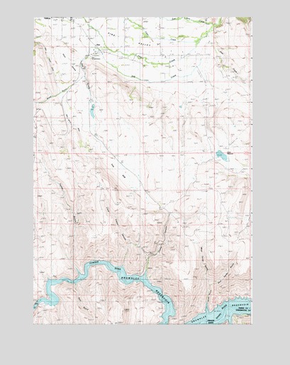
Posy Valley, OR USGS Topographic Map
Click on map above to begin viewing in our Map Viewer.

This topographic map contains these locations and features:
Feature Name Type Latitude Longitude GNIS ID View Map
Baker County FairgroundsLocaleN44.8746°W117.1035°1637981View Map
Baker County Panhandle Rodeo ArenaLocaleN44.8746°W117.1030°2700429View Map
Clear CreekStreamN44.8657°W117.0304°1139788View Map
Cottonwood CreekStreamN44.7552°W117.0152°379838View Map
Crow ReservoirReservoirN44.8188°W117.0179°1129557View Map
Deer CreekStreamN44.8679°W117.0263°1119826View Map
Deer GulchValleyN44.8527°W117.0260°1129554View Map
Densley ReservoirReservoirN44.7819°W117.0170°1116465View Map
Dry CreekStreamN44.8718°W117.0207°1141305View Map
East Pine CreekStreamN44.8738°W117.0410°1141635View Map
East Tarter GulchValleyN44.7657°W117.0243°1133425View Map
F M Crow DamDamN44.8206°W117.0191°1131283View Map
Foster GulchValleyN44.7688°W117.0977°1142342View Map
Gulch ReservoirReservoirN44.7803°W117.0045°1116464View Map
Hewitt / Holcomb Parks Boat Ramp 3LocaleN44.7595°W117.1228°2698985View Map
Hewitt / Holcomb Parks MarinaHarborN44.7572°W117.1247°2699007View Map
Laird DamDamN44.8402°W117.0913°1133580View Map
Laird ReservoirReservoirN44.8367°W117.0914°1129558View Map
Lee CreekStreamN44.8749°W117.1185°1144910View Map
Little Timber CanyonValleyN44.7718°W117.0749°1123297View Map
McMullen DitchCanalN44.8513°W117.0649°1129555View Map
PinePopulated PlaceN44.8613°W117.0891°1136628View Map
Pine Post Office (historical)Post OfficeN44.8613°W117.0891°1165787View Map
Pine Ranger StationBuildingN44.8582°W117.0924°1121517View Map
Pine ValleyValleyN44.8604°W117.0271°1147737View Map
Pine Valley AirportAirportN44.8601°W117.0895°2646050View Map
Posy ValleyValleyN44.8557°W117.1013°1125601View Map
Road GulchValleyN44.8502°W117.0971°1148508View Map
RobinettePopulated PlaceN44.7527°W117.0304°1126115View Map
Robinette Post Office (historical)Post OfficeN44.7527°W117.0304°1165866View Map
Ruth GulchValleyN44.7668°W117.1016°1148867View Map
Sag CreekStreamN44.8552°W117.0332°1126432View Map
Tarter GulchValleyN44.7596°W117.0257°1126116View Map
Tarter SpringSpringN44.7874°W117.0177°1116458View Map
The SagFlatN44.8115°W117.0743°1127997View Map
Timber CanyonValleyN44.7677°W117.0630°1128101View Map
Timber Canyon SpringSpringN44.7957°W117.0300°1129556View Map
Timber Canyon WaterholeReservoirN44.7763°W117.0399°1130929View Map
West Tarter GulchValleyN44.7657°W117.0243°1133426View Map

Note: Coordinates in the location and feature list above are referenced to NAD83 datum.


Copyright (C) 2008-2025 Ryan Niemi / Sunset Dynamics ... All Rights Reserved