TopoQuest Logo
Do you find TopoQuest useful?
Help keep TopoQuest running and adding new maps/features by donating!
Bitcoin:  19c7KJd3qBynnjoSw5npx9KScwjBe4ifkT
Litecoin:  LXs6TkuXGGXo1vDsWCkWVdjQX94eUKd6ui
Home View Maps Find Maps Find Places Resources & Links


Rochester Mills, Pennsylvania Topographic Map

USGS Map Title: Rochester Mills, PA
USGS Map MRC: 40078G8
DRG (GeoTIFF) Download: o40078g8.tif


Neighboring USGS Topographic Map Quads:


  Valier, PA  
40079H1
 

  Punxsutawney, PA  
40078H8
 

  McGees Mills, PA  
40078H7
 

  Marion Center, PA  
40079G1
 

  Rochester Mills, PA  
40078G8
 

  Burnside, PA  
40078G7
 

  Clymer, PA  
40079F1
 

  Commodore, PA  
40078F8
 

  Barnesboro, PA  
40078F7


Map MRC Location:

N41°
W79°
N41°
W78°
H8 H7 H6 H5 H4 H3 H2 H1
G8 G7 G6 G5 G4 G3 G2 G1
F8 F7 F6 F5 F4 F3 F2 F1
E8 E7 E6 E5 E4 E3 E2 E1
D8 D7 D6 D5 D4 D3 D2 D1
C8 C7 C6 C5 C4 C3 C2 C1
B8 B7 B6 B5 B4 B3 B2 B1
A8 A7 A6 A5 A4 A3 A2 A1
N40°
W79°
N40°
W78°

Rochester Mills, PA USGS 1:24K Topographic Map Preview:
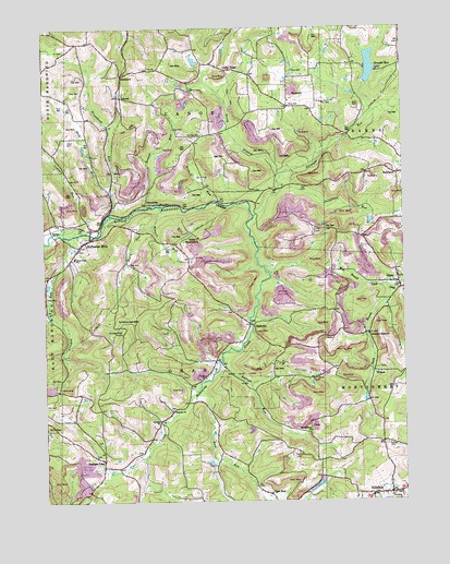
Rochester Mills, PA USGS Topographic Map
Click on map above to begin viewing in our Map Viewer.

This topographic map contains these locations and features:
Feature Name Type Latitude Longitude GNIS ID View Map
Antioch ChurchChurchN40.7715°W78.9603°1168339View Map
Barrett RunStreamN40.8276°W78.9595°1168765View Map
Beech RunStreamN40.8226°W78.9617°1169108View Map
Brewer RunStreamN40.8273°W78.9648°1170213View Map
Brinkell School (historical)SchoolN40.7945°W78.8873°1201160View Map
Broadhead RunStreamN40.8256°W78.9767°1170298View Map
Calvary ChurchChurchN40.7826°W78.9436°1192230View Map
Canoe Grant SchoolSchoolN40.8140°W78.9892°1171171View Map
Canoe RidgePopulated PlaceN40.8637°W78.9359°1171174View Map
Crawford SchoolSchoolN40.8267°W78.9784°1201155View Map
Crawford SchoolSchoolN40.8465°W78.9848°1201157View Map
Crooked RunStreamN40.8198°W78.9923°1172726View Map
Deckers PointPopulated PlaceN40.7612°W78.9798°1173049View Map
Doty RoundtopSummitN40.8178°W78.9478°1209297View Map
East RunPopulated PlaceN40.7520°W78.9228°1173864View Map
East RunStreamN40.7798°W78.9464°1173865View Map
EnterprisePopulated PlaceN40.8284°W78.9636°1203522View Map
Fairview CemeteryCemeteryN40.7630°W78.9120°1174491View Map
Fairview ChurchChurchN40.8467°W78.9445°1190979View Map
Fairview SchoolSchoolN40.8334°W78.9439°1201156View Map
Frye CemeteryCemeteryN40.8216°W78.9025°1175315View Map
Gaston SchoolSchoolN40.8626°W78.9145°1201161View Map
GipsyPopulated PlaceN40.8073°W78.8764°1192512View Map
Gipsy Post OfficePost OfficeN40.8075°W78.8767°2773148View Map
Gorman SummitSummitN40.8109°W78.9003°1212900View Map
Gorman SummitPopulated PlaceN40.7942°W78.8867°1203699View Map
Hartman School (historical)SchoolN40.7556°W78.9381°1201154View Map
Hemlock Lake County ParkParkN40.8667°W78.8873°1214205View Map
Henry SchoolSchoolN40.8659°W78.9439°1201158View Map
Hess RunStreamN40.8337°W78.9764°1176913View Map
HillsdalePopulated PlaceN40.7517°W78.8850°1177107View Map
Hillsdale ChurchChurchN40.7501°W78.8886°1177109View Map
Hillsdale Post OfficePost OfficeN40.7524°W78.8798°2779737View Map
Kinter HillSummitN40.7942°W78.9753°1178527View Map
Leasure RunStreamN40.8206°W78.9948°1179092View Map
LocustPopulated PlaceN40.8565°W78.9725°1204046View Map
Montgomery ChurchChurchN40.7687°W78.9073°1181456View Map
NashvillePopulated PlaceN40.7967°W78.9270°1204258View Map
North Branch Straight RunStreamN40.8351°W78.9175°1182552View Map
Pine ChurchChurchN40.8642°W78.9631°1183764View Map
Pine RunStreamN40.7806°W78.9275°1202644View Map
Pinevale ChurchChurchN40.7737°W78.9556°1183931View Map
Rairigh RunStreamN40.7870°W78.9381°1184610View Map
Rishell RunStreamN40.8290°W78.9398°1185105View Map
RobertsvilleLocaleN40.8301°W78.9248°1206872View Map
Rochester MillsPopulated PlaceN40.8187°W78.9856°1185242View Map
Rochester Mills Post OfficePost OfficeN40.8188°W78.9860°2772948View Map
RoseboroPopulated PlaceN40.8626°W78.9717°1204542View Map
Rowley CemeteryCemeteryN40.7652°W78.8814°1185580View Map
Ruffener SchoolSchoolN40.7517°W78.9109°1201159View Map
Salsgiver RunStreamN40.8306°W78.9184°1186875View Map
SavanPopulated PlaceN40.8217°W78.9973°1204585View Map
SmithportPopulated PlaceN40.8359°W78.8764°1193384View Map
South Branch Cush CreekStreamN40.8057°W78.8788°1202632View Map
State Game Lands Number 262ParkN40.7834°W78.9331°1208332View Map
Straight RunStreamN40.8251°W78.9267°1188843View Map
Straight Run DamDamN40.8617°W78.8864°1195118View Map
Straight Run LakeReservoirN40.8647°W78.8859°1195117View Map
Township of CanoeCivilN40.8655°W78.9473°1216537View Map
Township of GrantCivilN40.7827°W78.9488°1216543View Map
WilgusPopulated PlaceN40.7840°W78.8856°1191434View Map

Note: Coordinates in the location and feature list above are referenced to NAD83 datum.


Copyright (C) 2008-2024 Ryan Niemi / Sunset Dynamics ... All Rights Reserved