TopoQuest Logo
Do you find TopoQuest useful?
Help keep TopoQuest running and adding new maps/features by donating!
Bitcoin:  19c7KJd3qBynnjoSw5npx9KScwjBe4ifkT
Litecoin:  LXs6TkuXGGXo1vDsWCkWVdjQX94eUKd6ui
Home View Maps Find Maps Find Places Resources & Links


Barnesboro, Pennsylvania Topographic Map

USGS Map Title: Barnesboro, PA
USGS Map MRC: 40078F7
DRG (GeoTIFF) Download: o40078f7.tif


Neighboring USGS Topographic Map Quads:


  Rochester Mills, PA  
40078G8
 

  Burnside, PA  
40078G7
 

  Westover, PA  
40078G6
 

  Commodore, PA  
40078F8
 

  Barnesboro, PA  
40078F7
 

  Hastings, PA  
40078F6
 

  Strongstown, PA  
40078E8
 

  Colver, PA  
40078E7
 

  Carrolltown, PA  
40078E6


Map MRC Location:

N41°
W79°
N41°
W78°
H8 H7 H6 H5 H4 H3 H2 H1
G8 G7 G6 G5 G4 G3 G2 G1
F8 F7 F6 F5 F4 F3 F2 F1
E8 E7 E6 E5 E4 E3 E2 E1
D8 D7 D6 D5 D4 D3 D2 D1
C8 C7 C6 C5 C4 C3 C2 C1
B8 B7 B6 B5 B4 B3 B2 B1
A8 A7 A6 A5 A4 A3 A2 A1
N40°
W79°
N40°
W78°

Barnesboro, PA USGS 1:24K Topographic Map Preview:
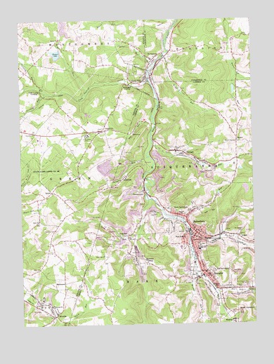
Barnesboro, PA USGS Topographic Map
Click on map above to begin viewing in our Map Viewer.

This topographic map contains these locations and features:
Feature Name Type Latitude Longitude GNIS ID View Map
AllportPopulated PlaceN40.6612°W78.7578°1168212View Map
AlverdaPopulated PlaceN40.6303°W78.8570°1168240View Map
Alverda Post OfficePost OfficeN40.6319°W78.8643°2772572View Map
BarnesboroPopulated PlaceN40.6626°W78.7800°1168741View Map
BeringerLocaleN40.7037°W78.8306°1200999View Map
Borough of Barnesboro (historical)CivilN40.6653°W78.7803°1215009View Map
Borough of Cherry TreeCivilN40.7252°W78.8084°1215284View Map
Borough of Northern CambriaCivilN40.6561°W78.7785°2086609View Map
Borough of Spangler (historical)CivilN40.6470°W78.7803°1215036View Map
Browns RunStreamN40.6470°W78.7811°1170402View Map
Calvary ChurchChurchN40.7431°W78.7511°1170941View Map
Cherry TreePopulated PlaceN40.7265°W78.8067°1171677View Map
Cherry Tree Post OfficePost OfficeN40.7215°W78.8011°2779709View Map
Cherry Tree ReservoirReservoirN40.7234°W78.8148°1195002View Map
Cherry Tree Volunteer Fire Department Station 520BuildingN40.7259°W78.8043°2645660View Map
Cush CushionLocaleN40.7290°W78.8706°1212084View Map
Cush Cushion CreekStreamN40.7256°W78.8050°1172863View Map
Cush Cushion CrossingPopulated PlaceN40.7212°W78.8631°1203383View Map
Douglas RunStreamN40.6940°W78.8059°1173422View Map
EmeighPopulated PlaceN40.6948°W78.7870°1174212View Map
Emeigh Post OfficePost OfficeN40.6962°W78.7916°2780012View Map
Emeigh RunStreamN40.6992°W78.8034°1174213View Map
Fox RunStreamN40.6381°W78.7700°1175109View Map
Garmans MillsLocaleN40.6842°W78.8081°1200998View Map
GarmantownPopulated PlaceN40.6798°W78.8081°1175456View Map
GrantLocaleN40.7276°W78.8023°1200997View Map
Grass Hill CemeteryCemeteryN40.6699°W78.8056°1175980View Map
GreenwichPopulated PlaceN40.6856°W78.8186°1176179View Map
GripLocaleN40.6592°W78.8381°1201028View Map
Hazelet ChurchChurchN40.7420°W78.8531°1176713View Map
Hazelet RunStreamN40.7206°W78.8378°1176714View Map
Health Ride Plus Transportation ServiceBuildingN40.6707°W78.7866°2719631View Map
Holy Cross SchoolSchoolN40.6467°W78.7747°1177260View Map
Hope Fire Company Station 50BuildingN40.6633°W78.7810°2645076View Map
Isenberg RunStreamN40.7203°W78.8611°1177878View Map
Kilns RunStreamN40.7317°W78.8009°1178455View Map
Kings RunStreamN40.7356°W78.7964°1178496View Map
Living Waters CampLocaleN40.7028°W78.8384°1179726View Map
Long RunPopulated PlaceN40.6615°W78.8214°1179878View Map
Long RunStreamN40.6603°W78.8136°1179885View Map
MarstellerPopulated PlaceN40.6506°W78.8081°1180484View Map
MartintownPopulated PlaceN40.6423°W78.8517°1204113View Map
McDowell CemeteryCemeteryN40.6639°W78.8559°1180696View Map
Mckeage DamDamN40.7234°W78.8148°1195001View Map
McKeages CrossingPopulated PlaceN40.7234°W78.8153°1204134View Map
Med - Van Transport AmbulanceBuildingN40.6647°W78.7834°2719637View Map
Miners HospitalHospitalN40.6459°W78.7742°1181321View Map
Moss CreekStreamN40.6762°W78.8039°1181622View Map
Moss CreekLocaleN40.6537°W78.8139°1213444View Map
Mount Carmel CemeteryCemeteryN40.6637°W78.7563°1181663View Map
Nebo CemeteryCemeteryN40.6484°W78.8652°1182200View Map
North BarnesboroPopulated PlaceN40.6701°W78.7906°1182516View Map
Northern CambriaPopulated PlaceN40.6592°W78.7817°1848159View Map
Northern Cambria Borough Police DepartmentBuildingN40.6637°W78.7827°2780484View Map
Northern Cambria High SchoolSchoolN40.6559°W78.7786°1182668View Map
Northern Cambria Post OfficePost OfficeN40.6631°W78.7801°2779743View Map
Painters RunStreamN40.7231°W78.8661°1183213View Map
Peg RunStreamN40.7101°W78.8028°1183444View Map
Pine Grove ChurchChurchN40.7034°W78.8670°1183812View Map
Pioneer LakeReservoirN40.7363°W78.8550°1183957View Map
Pioneer Lake DamDamN40.7384°W78.8548°1195009View Map
Pleasant View ChurchChurchN40.7001°W78.7586°1184090View Map
Porter RunStreamN40.6676°W78.7875°1184295View Map
Roosevelt SchoolSchoolN40.6701°W78.7881°1185433View Map
Saint Johns SchoolSchoolN40.6581°W78.7797°1186179View Map
Saint Marys CemeteryCemeteryN40.6403°W78.7564°1186389View Map
Saint Patricks CemeteryCemeteryN40.6412°W78.7522°1186533View Map
Saint Patricks SchoolSchoolN40.6403°W78.7697°1193268View Map
Saint Stanislas SchoolSchoolN40.6590°W78.7828°1186717View Map
Salem ChurchChurchN40.6678°W78.8656°1186838View Map
ShazenPopulated PlaceN40.7015°W78.7578°1187415View Map
SpanglerPopulated PlaceN40.6428°W78.7728°1188146View Map
Spangler Fire Company Station 58BuildingN40.6431°W78.7729°2645827View Map
Spangler Post OfficePost OfficeN40.6423°W78.7727°2779648View Map
SprucePopulated PlaceN40.6798°W78.8581°1188321View Map
State Game Lands Number 185ParkN40.6873°W78.8611°1188474View Map
StifflertownPopulated PlaceN40.7337°W78.8020°1188665View Map
Township of SusquehannaCivilN40.6856°W78.7617°1216096View Map
UniontownPopulated PlaceN40.7048°W78.8306°1190187View Map
Veterans Memorial Ambulance Service Station 68BuildingN40.6686°W78.7856°2719630View Map
Walnut RunStreamN40.6626°W78.7836°1190552View Map
WatkinsPopulated PlaceN40.6262°W78.7611°1190687View Map
West BranchPopulated PlaceN40.6615°W78.7859°1190885View Map
Wood Ridge ChurchChurchN40.6537°W78.8300°1191718View Map

Note: Coordinates in the location and feature list above are referenced to NAD83 datum.


Copyright (C) 2008-2024 Ryan Niemi / Sunset Dynamics ... All Rights Reserved