TopoQuest Logo
Do you find TopoQuest useful?
Help keep TopoQuest running and adding new maps/features by donating!
Bitcoin:  19c7KJd3qBynnjoSw5npx9KScwjBe4ifkT
Litecoin:  LXs6TkuXGGXo1vDsWCkWVdjQX94eUKd6ui
Home View Maps Find Maps Find Places Resources & Links


Rosedale, West Virginia Topographic Map

USGS Map Title: Rosedale, WV
USGS Map MRC: 38080F8
DRG (GeoTIFF) Download: o38080f8.tif


Neighboring USGS Topographic Map Quads:


  Millstone, WV  
38081G1
 

  Normantown, WV  
38080G8
 

  Cedarville, WV  
38080G7
 

  Chloe, WV  
38081F1
 

  Rosedale, WV  
38080F8
 

  Gassaway, WV  
38080F7
 

  Ivydale, WV  
38081E1
 

  Strange Creek, WV  
38080E8
 

  Herold, WV  
38080E7


Map MRC Location:

N39°
W81°
N39°
W80°
H8 H7 H6 H5 H4 H3 H2 H1
G8 G7 G6 G5 G4 G3 G2 G1
F8 F7 F6 F5 F4 F3 F2 F1
E8 E7 E6 E5 E4 E3 E2 E1
D8 D7 D6 D5 D4 D3 D2 D1
C8 C7 C6 C5 C4 C3 C2 C1
B8 B7 B6 B5 B4 B3 B2 B1
A8 A7 A6 A5 A4 A3 A2 A1
N38°
W81°
N38°
W80°

Rosedale, WV USGS 1:24K Topographic Map Preview:
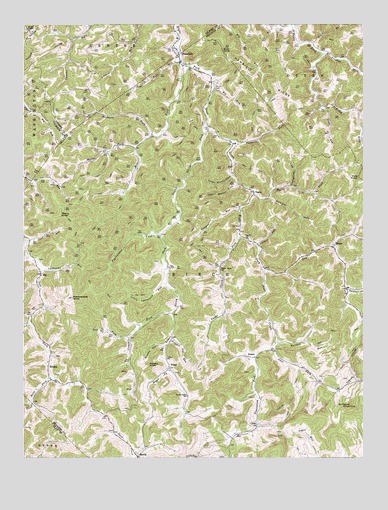
Rosedale, WV USGS Topographic Map
Click on map above to begin viewing in our Map Viewer.

This topographic map contains these locations and features:
Feature Name Type Latitude Longitude GNIS ID View Map
Anthony ForkStreamN38.7182°W80.9529°1534970View Map
Barn RunStreamN38.7390°W80.9423°1535253View Map
Bee RunStreamN38.7318°W80.9304°1535496View Map
Bills ForkStreamN38.6479°W80.9898°1536006View Map
Boar KnobSummitN38.7426°W80.9271°1536154View Map
Boggs ForkStreamN38.6509°W80.9462°1536195View Map
Bourn CemeteryCemeteryN38.7329°W80.9293°1536251View Map
Brushy HollowValleyN38.6570°W80.9490°1536515View Map
Burns ForkStreamN38.7151°W80.9587°1536754View Map
Charity ChurchChurchN38.6882°W80.9179°1537210View Map
ClemPopulated PlaceN38.6343°W80.9143°1549631View Map
Coolspring RunStreamN38.7032°W80.9009°1537612View Map
Coon RunStreamN38.6873°W80.9987°1537636View Map
Corbett RunStreamN38.6865°W80.9143°1537679View Map
Cowskin ForkStreamN38.6665°W80.9457°1537752View Map
DessiePopulated PlaceN38.6540°W80.9148°1549653View Map
DingyPopulated PlaceN38.6518°W80.9468°1554307View Map
Dry ForkStreamN38.6793°W80.9112°1538354View Map
Earl Miller CemeteryCemeteryN38.7404°W80.9859°2586291View Map
Eli Taylor KnobSummitN38.6398°W80.8795°1538593View Map
ElmiraPopulated PlaceN38.6515°W80.9909°1554395View Map
Elmira Baptist Church CemeteryCemeteryN38.6545°W80.9884°2586227View Map
Frame ForkStreamN38.6734°W80.8801°1539218View Map
Frozen ChapelChurchN38.7487°W80.9984°1539282View Map
GipPopulated PlaceN38.6779°W80.9940°1549703View Map
Hamric RidgeRidgeN38.7315°W80.9143°1539894View Map
Joes ForkStreamN38.6570°W80.9084°1540933View Map
Little Lynncamp RunStreamN38.6751°W80.9479°1542168View Map
Long RunStreamN38.7259°W80.8884°1542400View Map
Lower Keener LickStreamN38.7065°W80.9232°1542547View Map
Lower Sleith ForkStreamN38.7209°W80.9332°1542573View Map
Lower Sleith School (historical)SchoolN38.6426°W80.9398°1542574View Map
Lynncamp RunStreamN38.6787°W80.9934°1542648View Map
Mark (historical)Populated PlaceN38.7257°W80.8776°1727281View Map
Mill ForkStreamN38.7379°W80.9393°1543339View Map
Mollohan CemeteryCemeteryN38.6301°W80.9825°2586224View Map
Mudlick ForkStreamN38.7173°W80.8757°1543951View Map
Pawpaw RunStreamN38.6970°W80.9204°1544645View Map
Pigeonroost ForkStreamN38.6893°W80.9493°1544829View Map
Pine KnobSummitN38.7059°W80.8765°1555356View Map
Plantation ForkStreamN38.6537°W80.9148°1544972View Map
Potato KnobSummitN38.6520°W80.9543°1555400View Map
Rattlesnake KnobSummitN38.6709°W80.9823°1545424View Map
Road RunStreamN38.7437°W80.8937°1545831View Map
RosedalePopulated PlaceN38.7393°W80.9429°1546077View Map
Rosedale Post OfficePost OfficeN38.7422°W80.9431°1689728View Map
Slab ForkStreamN38.6595°W80.9615°1546885View Map
Sleith (historical)Populated PlaceN38.6793°W80.9465°1727293View Map
Straight ForkStreamN38.7001°W80.9098°1547555View Map
TaguePopulated PlaceN38.7018°W80.9154°1549950View Map
Tague ForkStreamN38.7009°W80.9151°1547873View Map
Teeny KnobSummitN38.6951°W80.9865°1555791View Map
Trigger Gut ForkStreamN38.6590°W80.9454°1548265View Map
Triplett ForkStreamN38.7415°W80.8893°1548279View Map
Twomile ForkStreamN38.7159°W80.9215°1548438View Map
Unity ChurchChurchN38.6534°W80.9473°1548497View Map
Upper Keener LickStreamN38.7037°W80.9220°1548527View Map
Upper Sleith ChurchChurchN38.6793°W80.9276°1548553View Map
Upper Sleith ForkStreamN38.6887°W80.9204°1548554View Map
WilsiePopulated PlaceN38.6857°W80.8859°1555996View Map
Wilsie Post OfficePost OfficeN38.6873°W80.8854°1727300View Map
Wolfpen RunStreamN38.6584°W80.9073°1549335View Map

Note: Coordinates in the location and feature list above are referenced to NAD83 datum.


Copyright (C) 2008-2025 Ryan Niemi / Sunset Dynamics ... All Rights Reserved