TopoQuest Logo
Do you find TopoQuest useful?
Help keep TopoQuest running and adding new maps/features by donating!
Bitcoin:  19c7KJd3qBynnjoSw5npx9KScwjBe4ifkT
Litecoin:  LXs6TkuXGGXo1vDsWCkWVdjQX94eUKd6ui
Home View Maps Find Maps Find Places Resources & Links


Wittenberg, Wisconsin Topographic Map

USGS Map Title: Wittenberg, WI
USGS Map MRC: 44089G2
DRG (GeoTIFF) Download: o44089g2.tif


Neighboring USGS Topographic Map Quads:


  Hatley, WI  
44089H3
 

  Birnamwood, WI  
44089H2
 

  Regina, WI  
44089H1
 

  Mission Lake, WI  
44089G3
 

  Wittenberg, WI  
44089G2
 

  Shepley, WI  
44089G1
 

  Rosholt, WI  
44089F3
 

  Tigerton NW, WI  
44089F2
 

  Tigerton, WI  
44089F1


Map MRC Location:

N45°
W90°
N45°
W89°
H8 H7 H6 H5 H4 H3 H2 H1
G8 G7 G6 G5 G4 G3 G2 G1
F8 F7 F6 F5 F4 F3 F2 F1
E8 E7 E6 E5 E4 E3 E2 E1
D8 D7 D6 D5 D4 D3 D2 D1
C8 C7 C6 C5 C4 C3 C2 C1
B8 B7 B6 B5 B4 B3 B2 B1
A8 A7 A6 A5 A4 A3 A2 A1
N44°
W90°
N44°
W89°

Wittenberg, WI USGS 1:24K Topographic Map Preview:
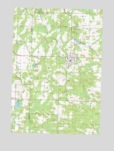
Wittenberg, WI USGS Topographic Map
Click on map above to begin viewing in our Map Viewer.

This topographic map contains these locations and features:
Feature Name Type Latitude Longitude GNIS ID View Map
ElandPopulated PlaceN44.8705°W89.2151°1564486View Map
Eland CemeteryCemeteryN44.8711°W89.2379°1564487View Map
Eland PondLakeN44.8701°W89.2120°2784229View Map
ElderonPopulated PlaceN44.7839°W89.2448°1564498View Map
Elderon County ParkParkN44.7828°W89.2407°1844100View Map
Elderon Elementary SchoolSchoolN44.7824°W89.2436°1844101View Map
Forest Home CemeteryCemeteryN44.7980°W89.1723°1565128View Map
Hidden Valley School (historical)SchoolN44.8478°W89.1334°1876634View Map
Holy Family CemeteryCemeteryN44.8033°W89.1729°1566600View Map
Homme Home for BoysLocaleN44.8394°W89.1640°1566645View Map
Homme PondReservoirN44.8434°W89.1612°1566646View Map
John Stacy Memorial CemeteryCemeteryN44.8556°W89.1628°1876631View Map
Kingdom HallBuildingN44.8050°W89.2440°1844172View Map
Larsen CreekStreamN44.7578°W89.1623°1567856View Map
Lilly LakeLakeN44.7775°W89.2405°1568039View Map
Norrie BrookStreamN44.8680°W89.2173°1570340View Map
Norrie Brook AirportAirportN44.8746°W89.2308°2444149View Map
Packard CreekStreamN44.8697°W89.1698°1570985View Map
Railroad CreekStreamN44.8677°W89.2168°1572031View Map
Spranger CreekStreamN44.7947°W89.1959°1574580View Map
Sunnyside School (historical)SchoolN44.8055°W89.1976°1876645View Map
Town of WittenbergCivilN44.8116°W89.1632°1584467View Map
Village of ElandCivilN44.8670°W89.2089°1583140View Map
Village of ElderonCivilN44.7840°W89.2478°1583143View Map
Village of WittenbergCivilN44.8272°W89.1668°1584466View Map
Visions Junior / Senior High SchoolSchoolN44.8406°W89.1633°2713172View Map
Wayside School (historical)SchoolN44.8341°W89.1946°1876646View Map
Wilson LakeLakeN44.8173°W89.2197°1576816View Map
WittenbergPopulated PlaceN44.8272°W89.1696°1576924View Map
Wittenberg - Birnamwood High SchoolSchoolN44.8286°W89.1801°2713312View Map
Wittenberg 1885c235 DamDamN44.8416°W89.1568°1791770View Map
Wittenberg Elementary SchoolSchoolN44.8251°W89.1729°2713178View Map
Wittenberg Fire DepartmentBuildingN44.8233°W89.1702°2696821View Map

Note: Coordinates in the location and feature list above are referenced to NAD83 datum.


Copyright (C) 2008-2025 Ryan Niemi / Sunset Dynamics ... All Rights Reserved