TopoQuest Logo
Do you find TopoQuest useful?
Help keep TopoQuest running and adding new maps/features by donating!
Bitcoin:  19c7KJd3qBynnjoSw5npx9KScwjBe4ifkT
Litecoin:  LXs6TkuXGGXo1vDsWCkWVdjQX94eUKd6ui
Home View Maps Find Maps Find Places Resources & Links


Round Bluff, Wisconsin Topographic Map

USGS Map Title: Round Bluff, WI
USGS Map MRC: 43089G8
DRG (GeoTIFF) Download: o43089g8.tif


Neighboring USGS Topographic Map Quads:


  Kelly, WI  
43090H1
 

  Dellwood, WI  
43089H8
 

  Adams, WI  
43089H7
 

  Mauston, WI  
43090G1
 

  Round Bluff, WI  
43089G8
 

  Easton, WI  
43089G7
 

  Potato Hill, WI  
43090F1
 

  Lyndon Station, WI  
43089F8
 

  Wisconsin Dells North, WI  
43089F7


Map MRC Location:

N44°
W90°
N44°
W89°
H8 H7 H6 H5 H4 H3 H2 H1
G8 G7 G6 G5 G4 G3 G2 G1
F8 F7 F6 F5 F4 F3 F2 F1
E8 E7 E6 E5 E4 E3 E2 E1
D8 D7 D6 D5 D4 D3 D2 D1
C8 C7 C6 C5 C4 C3 C2 C1
B8 B7 B6 B5 B4 B3 B2 B1
A8 A7 A6 A5 A4 A3 A2 A1
N43°
W90°
N43°
W89°

Round Bluff, WI USGS 1:24K Topographic Map Preview:
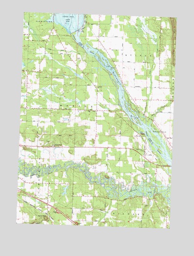
Round Bluff, WI USGS Topographic Map
Click on map above to begin viewing in our Map Viewer.

This topographic map contains these locations and features:
Feature Name Type Latitude Longitude GNIS ID View Map
Castle RockPillarN43.8050°W89.8993°1562790View Map
Castle Rock 2WP724 DamDamN43.8655°W89.9553°1792927View Map
Duck CreekStreamN43.8161°W89.8993°1564143View Map
Hamm DamDamN43.8366°W89.9518°1792632View Map
Oak School (historical)SchoolN43.7989°W89.9385°1570688View Map
Pokorney 3WR273 DamDamN43.7750°W89.9235°1792471View Map
Quincy BluffCliffN43.8739°W89.8804°1572003View Map
Round BluffCliffN43.7541°W89.9765°1572630View Map
Saint Johns ChurchChurchN43.8436°W89.9235°1573089View Map
Saint Michaels CemeteryCemeteryN43.8325°W89.9382°1834338View Map
Saint Michaels Church (historical)ChurchN43.8316°W89.9385°1573381View Map
Sevenmile CreekStreamN43.7811°W89.9985°1573914View Map
Town of MarionCivilN43.8154°W89.9428°1583656View Map
Township CemeteryCemeteryN43.7961°W89.8993°2027223View Map
White CreekStreamN43.8103°W89.8946°1576636View Map
Woodside RanchLocaleN43.7966°W89.9723°1577028View Map

Note: Coordinates in the location and feature list above are referenced to NAD83 datum.


Copyright (C) 2008-2024 Ryan Niemi / Sunset Dynamics ... All Rights Reserved