TopoQuest Logo
Do you find TopoQuest useful?
Help keep TopoQuest running and adding new maps/features by donating!
Bitcoin:  19c7KJd3qBynnjoSw5npx9KScwjBe4ifkT
Litecoin:  LXs6TkuXGGXo1vDsWCkWVdjQX94eUKd6ui
Home View Maps Find Maps Find Places Resources & Links


Adams, Wisconsin Topographic Map

USGS Map Title: Adams, WI
USGS Map MRC: 43089H7
DRG (GeoTIFF) Download: o43089h7.tif


Neighboring USGS Topographic Map Quads:


  Arkdale, WI  
44089A8
 

  Roche A Cri, WI  
44089A7
 

  Coloma SW, WI  
44089A6
 

  Dellwood, WI  
43089H8
 

  Adams, WI  
43089H7
 

  Grand Marsh, WI  
43089H6
 

  Round Bluff, WI  
43089G8
 

  Easton, WI  
43089G7
 

  Brooks, WI  
43089G6


Map MRC Location:

N44°
W90°
N44°
W89°
H8 H7 H6 H5 H4 H3 H2 H1
G8 G7 G6 G5 G4 G3 G2 G1
F8 F7 F6 F5 F4 F3 F2 F1
E8 E7 E6 E5 E4 E3 E2 E1
D8 D7 D6 D5 D4 D3 D2 D1
C8 C7 C6 C5 C4 C3 C2 C1
B8 B7 B6 B5 B4 B3 B2 B1
A8 A7 A6 A5 A4 A3 A2 A1
N43°
W90°
N43°
W89°

Adams, WI USGS 1:24K Topographic Map Preview:
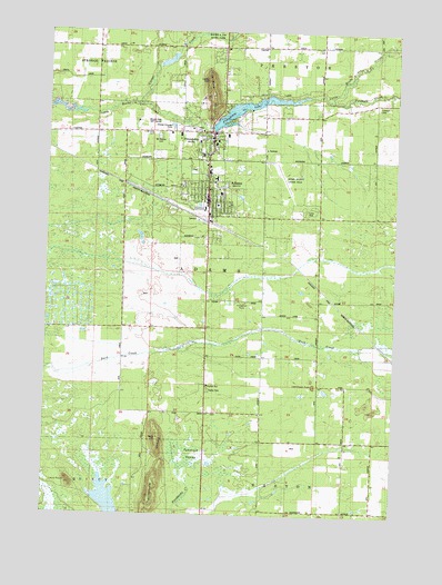
Adams, WI USGS Topographic Map
Click on map above to begin viewing in our Map Viewer.

This topographic map contains these locations and features:
Feature Name Type Latitude Longitude GNIS ID View Map
3 ReservoirReservoirN43.8790°W89.8521°1793199View Map
50 ReservoirReservoirN43.9924°W89.8324°1792542View Map
AdamsPopulated PlaceN43.9561°W89.8182°1560681View Map
Adams - Friendship Elementary SchoolSchoolN43.9649°W89.8104°1837586View Map
Adams - Friendship High SchoolSchoolN43.9658°W89.8024°1837573View Map
Adams - Friendship Middle SchoolSchoolN43.9638°W89.8168°2715697View Map
Adams Center (historical)Populated PlaceN43.9161°W89.7973°1837568View Map
Adams CountyCivilN43.9695°W89.7704°1581060View Map
Adams County CourthouseBuildingN43.9702°W89.8160°1837569View Map
Adams County Fire DistrictBuildingN43.9580°W89.8181°2697845View Map
Adams County JailBuildingN43.9716°W89.8153°2759841View Map
Adams County Legion FieldAirportN43.9612°W89.7880°1581986View Map
Adams County LibraryBuildingN43.9575°W89.8182°1837570View Map
Adams County Sheriff's OfficeBuildingN43.9716°W89.8153°2759701View Map
Adams Elementary SchoolSchoolN43.9552°W89.8143°1837572View Map
Adams Police DepartmentBuildingN43.9581°W89.8179°2759413View Map
Adams Wastewater Treatment PlantLocaleN43.9758°W89.8311°2358189View Map
Carter CreekStreamN43.9814°W89.8440°1562749View Map
City of AdamsCivilN43.9554°W89.8169°1582653View Map
First Baptist Church of AdamsChurchN43.9611°W89.8198°1837584View Map
Fordham CreekStreamN43.9819°W89.7732°1565105View Map
FriendshipPopulated PlaceN43.9705°W89.8168°1565329View Map
Friendship 2WP745 DamDamN43.9747°W89.8162°1791778View Map
Friendship LakeReservoirN43.9799°W89.8079°1565333View Map
Friendship MoundSummitN43.9839°W89.8171°1565334View Map
Friendship Volunteer Fire DepartmentBuildingN43.9734°W89.8231°2697826View Map
Houghton RockPillarN43.9297°W89.8043°1566759View Map
Immanuel Evangelical Lutheran ChurchChurchN43.9611°W89.8154°1837588View Map
Kingdom HallChurchN43.9086°W89.8165°1837589View Map
Lighthouse RockPillarN43.9091°W89.7785°1568031View Map
Lone RockPillarN43.8822°W89.8660°1568510View Map
Mound View Golf CourseLocaleN43.9769°W89.8379°1837591View Map
Moundview Memorial Hospital and ClinicsHospitalN43.9746°W89.8215°1837571View Map
Mount Repose CemeteryCemeteryN43.9733°W89.8360°1569844View Map
Rattlesnake MoundSummitN43.8855°W89.8343°1572099View Map
Saint Joseph Catholic ChurchChurchN43.9591°W89.8173°1837601View Map
Saint Leo's CemeteryCemeteryN43.9735°W89.8371°1573216View Map
Splitek 3WR299 DamDamN43.9916°W89.8368°1792541View Map
Tamarack SwampSwampN43.8886°W89.8240°1575247View Map
Town of AdamsCivilN43.9362°W89.8066°1582654View Map
Trinity Congregational ChurchChurchN43.9589°W89.8160°1837606View Map
Trinity Lutheran ChurchChurchN43.9577°W89.8160°1837607View Map
Village of FriendshipCivilN43.9720°W89.8203°1583248View Map

Note: Coordinates in the location and feature list above are referenced to NAD83 datum.


Copyright (C) 2008-2024 Ryan Niemi / Sunset Dynamics ... All Rights Reserved