TopoQuest Logo
Do you find TopoQuest useful?
Help keep TopoQuest running and adding new maps/features by donating!
Bitcoin:  19c7KJd3qBynnjoSw5npx9KScwjBe4ifkT
Litecoin:  LXs6TkuXGGXo1vDsWCkWVdjQX94eUKd6ui
Home View Maps Find Maps Find Places Resources & Links


Round Lake, Mississippi Topographic Map

USGS Map Title: Round Lake, MS
USGS Map MRC: 34090A7
DRG (GeoTIFF) Download: o34090a7.tif


Neighboring USGS Topographic Map Quads:


  Mellwood, AR  
34090B8
 

  Rena Lara, MS  
34090B7
 

  Sherard, MS  
34090B6
 

  Laconia, AR  
34090A8
 

  Round Lake, MS  
34090A7
 

  Duncan, MS  
34090A6
 

  Gunnison, MS  
33090H8
 

  Shelby, MS  
33090H7
 

  Mound Bayou, MS  
33090H6


Map MRC Location:

N35°
W91°
N35°
W90°
H8 H7 H6 H5 H4 H3 H2 H1
G8 G7 G6 G5 G4 G3 G2 G1
F8 F7 F6 F5 F4 F3 F2 F1
E8 E7 E6 E5 E4 E3 E2 E1
D8 D7 D6 D5 D4 D3 D2 D1
C8 C7 C6 C5 C4 C3 C2 C1
B8 B7 B6 B5 B4 B3 B2 B1
A8 A7 A6 A5 A4 A3 A2 A1
N34°
W91°
N34°
W90°

Round Lake, MS USGS 1:24K Topographic Map Preview:
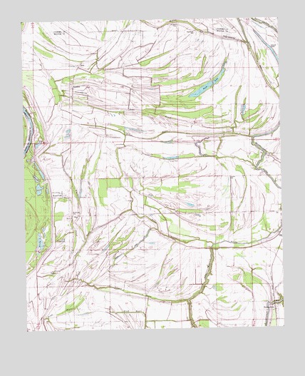
Round Lake, MS USGS Topographic Map
Click on map above to begin viewing in our Map Viewer.

This topographic map contains these locations and features:
Feature Name Type Latitude Longitude GNIS ID View Map
Bethlehem ChurchChurchN34.0326°W90.8257°667020View Map
Booker CemeteryCemeteryN34.0676°W90.8040°687962View Map
Booker School (historical)SchoolN34.0679°W90.8048°687963View Map
Brook BayouStreamN34.0048°W90.8682°667589View Map
Buck LakeLakeN34.0963°W90.7879°690864View Map
Burken Church (historical)ChurchN34.0907°W90.8554°687964View Map
Calvery ChurchChurchN34.0704°W90.8157°667947View Map
Cessions RevetmentLeveeN34.0857°W90.8707°668291View Map
DeesonPopulated PlaceN34.0232°W90.8595°669211View Map
DixiePopulated PlaceN34.1076°W90.8459°669294View Map
Edward BayouStreamN34.0115°W90.7957°669680View Map
EldridgePopulated PlaceN34.1115°W90.8412°691836View Map
Eldridge Church (historical)ChurchN34.1123°W90.8401°687978View Map
FrancisPopulated PlaceN34.0818°W90.8548°670155View Map
Hooper ChapelChurchN34.0690°W90.8115°671392View Map
HushpuckenaPopulated PlaceN34.0048°W90.7532°671639View Map
Island LakeLakeN34.1103°W90.7519°671730View Map
Jacob ChurchChurchN34.0318°W90.7959°671794View Map
Jerusalem CemeteryCemeteryN34.1212°W90.7982°671850View Map
Jerusalem ChurchChurchN34.1198°W90.7904°687986View Map
Johnson Kemper ChurchChurchN34.0554°W90.8570°690865View Map
Jones BayouStreamN34.0771°W90.7632°671957View Map
King Solomon Church (historical)ChurchN34.1051°W90.7601°687989View Map
King Solomon School (historical)SchoolN34.1054°W90.7604°687990View Map
McNeil SloughStreamN34.1151°W90.7654°673419View Map
Midway ChurchChurchN34.0459°W90.8515°667945View Map
Moon LakeStreamN34.0207°W90.8504°673766View Map
Mount Hope ChurchChurchN34.1209°W90.8276°674032View Map
Mount Moriah ChurchChurchN34.0176°W90.8645°674077View Map
Mount Olive CemeteryCemeteryN34.0148°W90.8404°688003View Map
Mount Olive ChurchChurchN34.0537°W90.7912°674159View Map
Mount Olive Church (historical)ChurchN34.0162°W90.8407°688004View Map
New Ashbey Church (historical)ChurchN34.1207°W90.7907°689317View Map
New Ashley CemeteryCemeteryN34.1198°W90.7904°690866View Map
New Ashley ChurchChurchN34.1190°W90.7907°674564View Map
New Macedonia Church (historical)ChurchN34.0115°W90.8137°688011View Map
Old Macedonia Church (historical)ChurchN34.0115°W90.7943°688079View Map
RochdalePopulated PlaceN34.0996°W90.8504°676739View Map
Round LakeLakeN34.0526°W90.8568°688087View Map
Round LakePopulated PlaceN34.0534°W90.8529°676912View Map
Round Lake CemeteryCemeteryN34.0465°W90.8523°690867View Map
Saint Joseph CemeteryCemeteryN34.0323°W90.7954°687573View Map
Saint Pauls ChurchChurchN34.0315°W90.7854°677219View Map
Stokes BayouStreamN34.0296°W90.8573°678305View Map
Strangers Home ChurchChurchN34.0909°W90.7779°678339View Map
Sunrise ChurchChurchN34.0609°W90.7757°678434View Map
Virgin Mary Church (historical)ChurchN34.0173°W90.7518°688101View Map
Watts FieldAirportN34.0960°W90.8481°680420View Map
White Plains ChurchChurchN34.0048°W90.7532°679609View Map
Wildcat SloughStreamN34.0262°W90.8545°679675View Map
Wilkes BayouStreamN34.0779°W90.7732°679685View Map

Note: Coordinates in the location and feature list above are referenced to NAD83 datum.


Copyright (C) 2008-2024 Ryan Niemi / Sunset Dynamics ... All Rights Reserved