TopoQuest Logo
Do you find TopoQuest useful?
Help keep TopoQuest running and adding new maps/features by donating!
Bitcoin:  19c7KJd3qBynnjoSw5npx9KScwjBe4ifkT
Litecoin:  LXs6TkuXGGXo1vDsWCkWVdjQX94eUKd6ui
Home View Maps Find Maps Find Places Resources & Links


Shelby, Mississippi Topographic Map

USGS Map Title: Shelby, MS
USGS Map MRC: 33090H7
DRG (GeoTIFF) Download: o33090h7.tif


Neighboring USGS Topographic Map Quads:


  Laconia, AR  
34090A8
 

  Round Lake, MS  
34090A7
 

  Duncan, MS  
34090A6
 

  Gunnison, MS  
33090H8
 

  Shelby, MS  
33090H7
 

  Mound Bayou, MS  
33090H6
 

  Beulah, MS  
33090G8
 

  Pace, MS  
33090G7
 

  Merigold, MS  
33090G6


Map MRC Location:

N34°
W91°
N34°
W90°
H8 H7 H6 H5 H4 H3 H2 H1
G8 G7 G6 G5 G4 G3 G2 G1
F8 F7 F6 F5 F4 F3 F2 F1
E8 E7 E6 E5 E4 E3 E2 E1
D8 D7 D6 D5 D4 D3 D2 D1
C8 C7 C6 C5 C4 C3 C2 C1
B8 B7 B6 B5 B4 B3 B2 B1
A8 A7 A6 A5 A4 A3 A2 A1
N33°
W91°
N33°
W90°

Shelby, MS USGS 1:24K Topographic Map Preview:
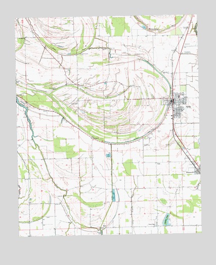
Shelby, MS USGS Topographic Map
Click on map above to begin viewing in our Map Viewer.

This topographic map contains these locations and features:
Feature Name Type Latitude Longitude GNIS ID View Map
Allendales Lake DamDamN33.9918°W90.7818°682431View Map
Bellamy ChapelChurchN33.8793°W90.8168°666787View Map
Broad Street High SchoolSchoolN33.9484°W90.7620°710118View Map
Brown TempleChurchN33.9593°W90.8490°667632View Map
California Brake (historical)SwampN33.8996°W90.7534°687967View Map
Christmas AirportAirportN33.9295°W90.7883°680414View Map
City of ShelbyCivilN33.9508°W90.7653°2405453View Map
Ditch Number FiveCanalN33.9087°W90.7704°688040View Map
Ditch Number FourCanalN33.9090°W90.7898°688045View Map
Ditch Number OneCanalN33.9287°W90.7698°688051View Map
Ditch Number SixCanalN33.9196°W90.7795°688062View Map
Ditch Number ThreeCanalN33.8762°W90.8065°688069View Map
Hall CemeteryCemeteryN33.8759°W90.7976°670838View Map
Holmes LakeLakeN33.9301°W90.7912°671356View Map
Holmes Lake Cut-OffCanalN33.9034°W90.8109°671357View Map
Macedonia ChurchChurchN33.9671°W90.7743°673021View Map
Manocknut Plantation (historical)LocaleN33.9529°W90.7765°710131View Map
Mound Bayou Recreation Lake DamDamN33.8868°W90.7701°682387View Map
Mount Olive ChurchChurchN33.8937°W90.8465°674156View Map
New Hope ChurchChurchN33.9884°W90.8684°674731View Map
New Mount Zion ChurchChurchN33.9779°W90.7948°674792View Map
New Prospect ChurchChurchN33.9554°W90.8748°674813View Map
Old Mount Olive ChurchChurchN33.8979°W90.8443°675210View Map
Peters Rock CemeteryCemeteryN33.9815°W90.8126°675652View Map
Pleasant Green ChurchChurchN33.8796°W90.7820°675976View Map
Porter LakeLakeN33.9490°W90.8692°676257View Map
Raineys LakeLakeN33.8825°W90.7740°676459View Map
Saint James ChurchChurchN33.9307°W90.8232°677044View Map
ShelbyPopulated PlaceN33.9509°W90.7679°677634View Map
Shelby Air ServiceAirportN33.9670°W90.7671°2676391View Map
Shelby CemeteryCemeteryN33.9338°W90.7801°677635View Map
Shelby City Police DepartmentBuildingN33.9499°W90.7676°2754062View Map
Shelby Community HospitalHospitalN33.9521°W90.7676°710146View Map
Shelby Elementary SchoolSchoolN33.9529°W90.7637°710147View Map
Shelby Post OfficePost OfficeN33.9508°W90.7670°2768818View Map
Shelby Volunteer Fire Department Station 7BuildingN33.9498°W90.7674°2666047View Map
Sunnyside ChurchChurchN33.9812°W90.8176°678429View Map
Town of WinstonvilleCivilN33.9123°W90.7529°2406904View Map
Turkey Pen BayouGutN33.9546°W90.8223°678957View Map
Turners ChapelChurchN33.9504°W90.8337°678977View Map
Turners Chapel CemeteryCemeteryN33.9793°W90.8315°678978View Map
Union Hill ChurchChurchN33.9598°W90.7982°679098View Map
Upper BogueStreamN33.9921°W90.8698°679144View Map
Watson TempleChurchN33.9159°W90.7807°679382View Map
WinstonvillePopulated PlaceN33.9101°W90.7515°679791View Map
Winstonville Volunteer Fire DepartmentBuildingN33.9110°W90.7528°2665918View Map

Note: Coordinates in the location and feature list above are referenced to NAD83 datum.


Copyright (C) 2008-2025 Ryan Niemi / Sunset Dynamics ... All Rights Reserved