TopoQuest Logo
Do you find TopoQuest useful?
Help keep TopoQuest running and adding new maps/features by donating!
Bitcoin:  19c7KJd3qBynnjoSw5npx9KScwjBe4ifkT
Litecoin:  LXs6TkuXGGXo1vDsWCkWVdjQX94eUKd6ui
Home View Maps Find Maps Find Places Resources & Links


Ruther Glen, Virginia Topographic Map

USGS Map Title: Ruther Glen, VA
USGS Map MRC: 37077H4
DRG (GeoTIFF) Download: o37077h4.tif


Neighboring USGS Topographic Map Quads:


  Ladysmith, VA  
38077A5
 

  Woodford, VA  
38077A4
 

  Bowling Green, VA  
38077A3
 

  Hewlett, VA  
37077H5
 

  Ruther Glen, VA  
37077H4
 

  Penola, VA  
37077H3
 

  Hanover Academy, VA  
37077G5
 

  Ashland, VA  
37077G4
 

  Hanover, VA  
37077G3


Map MRC Location:

N38°
W78°
N38°
W77°
H8 H7 H6 H5 H4 H3 H2 H1
G8 G7 G6 G5 G4 G3 G2 G1
F8 F7 F6 F5 F4 F3 F2 F1
E8 E7 E6 E5 E4 E3 E2 E1
D8 D7 D6 D5 D4 D3 D2 D1
C8 C7 C6 C5 C4 C3 C2 C1
B8 B7 B6 B5 B4 B3 B2 B1
A8 A7 A6 A5 A4 A3 A2 A1
N37°
W78°
N37°
W77°

Ruther Glen, VA USGS 1:24K Topographic Map Preview:
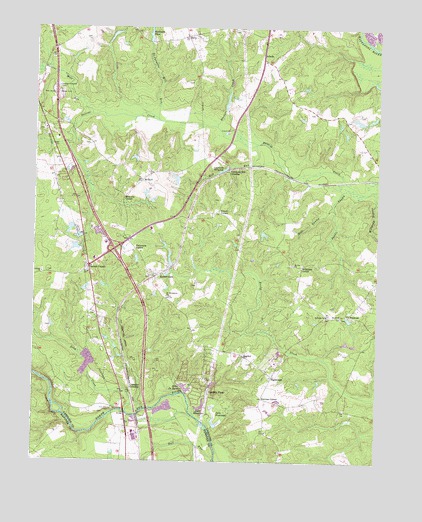
Ruther Glen, VA USGS Topographic Map
Click on map above to begin viewing in our Map Viewer.

This topographic map contains these locations and features:
Feature Name Type Latitude Longitude GNIS ID View Map
AthensPopulated PlaceN37.9926°W77.4172°1477084View Map
BagdadPopulated PlaceN37.9054°W77.4233°1499073View Map
BaltyPopulated PlaceN37.9976°W77.4450°1477091View Map
Boulware PondReservoirN37.9996°W77.4581°1463698View Map
Boulwares Millpond DamDamN37.9960°W77.4589°1489388View Map
Bull RunStreamN37.8751°W77.4333°1464072View Map
Burruss CornerPopulated PlaceN37.8932°W77.4161°1477161View Map
Carmel CemeteryCemeteryN37.9301°W77.4808°1739332View Map
Carmel ChurchLocaleN37.9307°W77.4803°1464447View Map
Carmel Church QuarryMineN37.9036°W77.4792°2629376View Map
Carmel Methodist ChurchChurchN37.9293°W77.4803°1739333View Map
Caroline PinesPopulated PlaceN37.8963°W77.4358°1499217View Map
Caroline Pines DamDamN37.8901°W77.4414°1489364View Map
Caroline Pines LakeReservoirN37.8903°W77.4390°1489365View Map
Cassra School (historical)SchoolN37.9399°W77.4672°1739336View Map
Chandler CrossingPopulated PlaceN37.8960°W77.4641°1499238View Map
Coburn DamDamN37.9418°W77.4797°1489391View Map
Colemans Mill CrossingPopulated PlaceN37.9590°W77.4294°1477216View Map
Colemans MillpondReservoirN37.9592°W77.4315°1465094View Map
DeJarnette Mill RunStreamN37.9729°W77.4547°1465669View Map
Fox BridgeBridgeN37.8893°W77.4661°1466823View Map
Hackett CreekStreamN37.9715°W77.4341°1467625View Map
Interchange 104CrossingN37.9362°W77.4708°1739354View Map
Jericho ChurchChurchN37.9293°W77.4969°1468689View Map
Lake De JarnetteReservoirN37.8964°W77.4444°1465670View Map
Lake De Jarnette DamDamN37.8946°W77.4436°1489392View Map
Lake PinewoodReservoirN37.8854°W77.4333°1502096View Map
Lake Pinewood DamDamN37.8849°W77.4336°1489394View Map
Lake ShannonReservoirN37.8901°W77.4405°1474222View Map
Long CreekStreamN37.8890°W77.4655°1469809View Map
Mattaponi DistrictCivilN37.9797°W77.4074°1927395View Map
McBryant CornerPopulated PlaceN37.9315°W77.4022°1499719View Map
McDuffPopulated PlaceN37.9557°W77.4608°1499721View Map
Mill RunStreamN37.9660°W77.4197°1470537View Map
Millpond SwampStreamN37.9532°W77.3769°1470580View Map
Moncure CornerPopulated PlaceN37.9507°W77.4675°1499755View Map
Mount Oni ChurchChurchN37.9315°W77.4053°1471012View Map
Patersons CornerPopulated PlaceN37.9360°W77.4633°1499845View Map
PeatrossPopulated PlaceN37.9174°W77.3850°1477614View Map
R Collins DamDamN37.9735°W77.3780°1489390View Map
Rafe SwampStreamN37.9485°W77.3916°1472930View Map
Reedy ChurchChurchN37.9168°W77.3880°1473111View Map
Reedy Church DistrictCivilN37.8878°W77.4216°1927459View Map
Reedy SwampStreamN37.9737°W77.4555°1473125View Map
Ruther GlenPopulated PlaceN37.9287°W77.4558°1500007View Map
Ruther Glen ChurchChurchN37.9182°W77.4789°1739385View Map
Ruther Glen Post OfficePost OfficeN37.9348°W77.4750°2767259View Map
Ruther Glen School (historical)SchoolN37.9082°W77.4344°1739386View Map
Saddle SwampStreamN37.9524°W77.3789°1473682View Map
Saint Margarets CemeteryCemeteryN37.9226°W77.4514°1739389View Map
Saint Margarets ChurchChurchN37.9224°W77.4516°1473813View Map
Saint Pauls CemeteryCemeteryN37.9168°W77.3936°1739390View Map
Saint Pauls ChurchChurchN37.9168°W77.3933°1473886View Map
Second Baptist ChurchChurchN37.9026°W77.4175°1739395View Map
SignboardPopulated PlaceN37.8996°W77.4125°1477750View Map
Stevens Mill RunStreamN37.9749°W77.4794°1475124View Map
Swans CornerPopulated PlaceN37.9468°W77.4328°1477796View Map
The Carmel SchoolSchoolN37.9267°W77.4941°2464862View Map

Note: Coordinates in the location and feature list above are referenced to NAD83 datum.


Copyright (C) 2008-2025 Ryan Niemi / Sunset Dynamics ... All Rights Reserved