TopoQuest Logo
Do you find TopoQuest useful?
Help keep TopoQuest running and adding new maps/features by donating!
Bitcoin:  19c7KJd3qBynnjoSw5npx9KScwjBe4ifkT
Litecoin:  LXs6TkuXGGXo1vDsWCkWVdjQX94eUKd6ui
Home View Maps Find Maps Find Places Resources & Links


Saddle Mountain, Utah Topographic Map

USGS Map Title: Saddle Mountain, UT
USGS Map MRC: 37113C5
DRG (GeoTIFF) Download: o37113c5.tif


Neighboring USGS Topographic Map Quads:


  Central West, UT  
37113D6
 

  Central East, UT  
37113D5
 

  Grass Valley, UT  
37113D4
 

  Veyo, UT  
37113C6
 

  Saddle Mountain, UT  
37113C5
 

  Signal Peak, UT  
37113C4
 

  Santa Clara, UT  
37113B6
 

  Washington, UT  
37113B5
 

  Harrisburg Junction, UT  
37113B4


Map MRC Location:

N38°
W114°
N38°
W113°
H8 H7 H6 H5 H4 H3 H2 H1
G8 G7 G6 G5 G4 G3 G2 G1
F8 F7 F6 F5 F4 F3 F2 F1
E8 E7 E6 E5 E4 E3 E2 E1
D8 D7 D6 D5 D4 D3 D2 D1
C8 C7 C6 C5 C4 C3 C2 C1
B8 B7 B6 B5 B4 B3 B2 B1
A8 A7 A6 A5 A4 A3 A2 A1
N37°
W114°
N37°
W113°

Saddle Mountain, UT USGS 1:24K Topographic Map Preview:
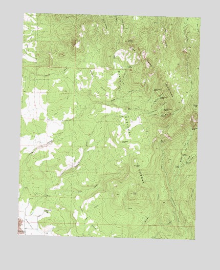
Saddle Mountain, UT USGS Topographic Map
Click on map above to begin viewing in our Map Viewer.

This topographic map contains these locations and features:
Feature Name Type Latitude Longitude GNIS ID View Map
Alger GulchValleyN37.2722°W113.6063°1438151View Map
Big Pine SpringSpringN37.3197°W113.5255°1438714View Map
Burger PeakSummitN37.3255°W113.5013°1439335View Map
Carter CanyonValleyN37.3255°W113.5655°1439492View Map
Carter Canyon SpringSpringN37.3336°W113.5322°1439493View Map
Cedar KnollSummitN37.2741°W113.5597°1451207View Map
Cedar KnollSummitN37.2750°W113.5452°1439575View Map
Cottonwood SpringSpringN37.3124°W113.5052°1440036View Map
Cougar SpringSpringN37.2908°W113.5133°1440058View Map
Diamond ValleyBasinN37.2536°W113.6208°1440452View Map
Diamond Valley RanchLocaleN37.2639°W113.6069°1440453View Map
Diamond Valley Volunteer Fire DepartmentBuildingN37.2582°W113.6138°2627210View Map
East Fork Cottonwood CreekStreamN37.2778°W113.5180°1440798View Map
East Fork SpringSpringN37.2939°W113.5083°1440821View Map
Goat CanyonValleyN37.3297°W113.5583°1441340View Map
Goat SpringSpringN37.3463°W113.5508°1441342View Map
Goat Spring TrailTrailN37.3458°W113.5552°1449985View Map
Grass KnollSummitN37.2908°W113.5436°1441426View Map
Indian Hollow Spring TrailTrailN37.3739°W113.5633°1450045View Map
Lone Pine CanyonValleyN37.3214°W113.5363°1442872View Map
Lower SpringSpringN37.2972°W113.5108°1443026View Map
Mahogany KnollSummitN37.3039°W113.5541°1443089View Map
Maudsley SpringSpringN37.3697°W113.6025°1455693View Map
Middle Fork Cottonwood CreekStreamN37.2836°W113.5158°1443343View Map
Mud SpringSpringN37.3147°W113.5313°1451304View Map
Quaking Aspen SpringSpringN37.3228°W113.5252°1444689View Map
Red KnollSummitN37.3225°W113.5508°1444804View Map
Reservoir CanyonValleyN37.3228°W113.5430°1444867View Map
Rock CanyonValleyN37.3739°W113.5027°1445041View Map
Rock Hollow WashValleyN37.2575°W113.6161°1445076View Map
Saddle MountainSummitN37.3605°W113.5519°1445225View Map
Slide CanyonValleyN37.3275°W113.5355°1445678View Map
Slide Canyon SpringSpringN37.3292°W113.5279°1445683View Map
Summit TrailTrailN37.3486°W113.5591°1446246View Map
Truman BenchBenchN37.3414°W113.5627°1446746View Map
Washington CountyCivilN37.2804°W113.5047°1448040View Map
West Fork Cottonwood CreekStreamN37.2778°W113.5180°1447137View Map
West Fork SpringSpringN37.3047°W113.5269°1447154View Map

Note: Coordinates in the location and feature list above are referenced to NAD83 datum.


Copyright (C) 2008-2025 Ryan Niemi / Sunset Dynamics ... All Rights Reserved